
Wroxham Road
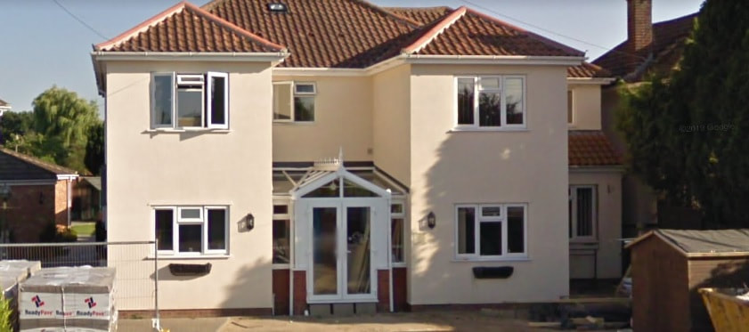
1A Wroxham Road - Desira
Used to be Pointer Motors and a Texaco petrol station and Norvic Car Center in 1987.
Used to be Pointer Motors and a Texaco petrol station and Norvic Car Center in 1987.
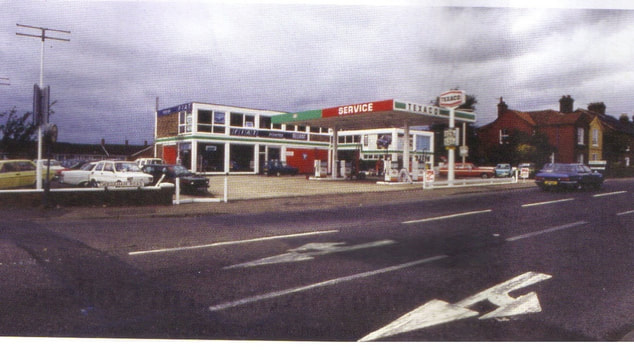
Picture: Sprowston Heritage
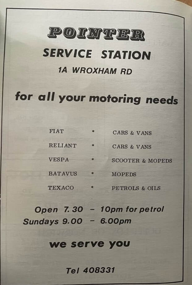
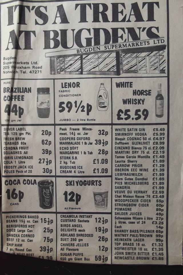
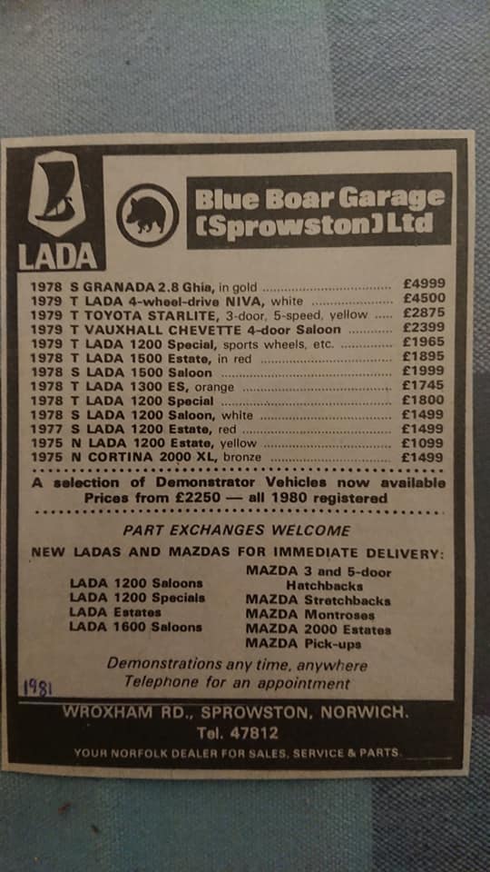
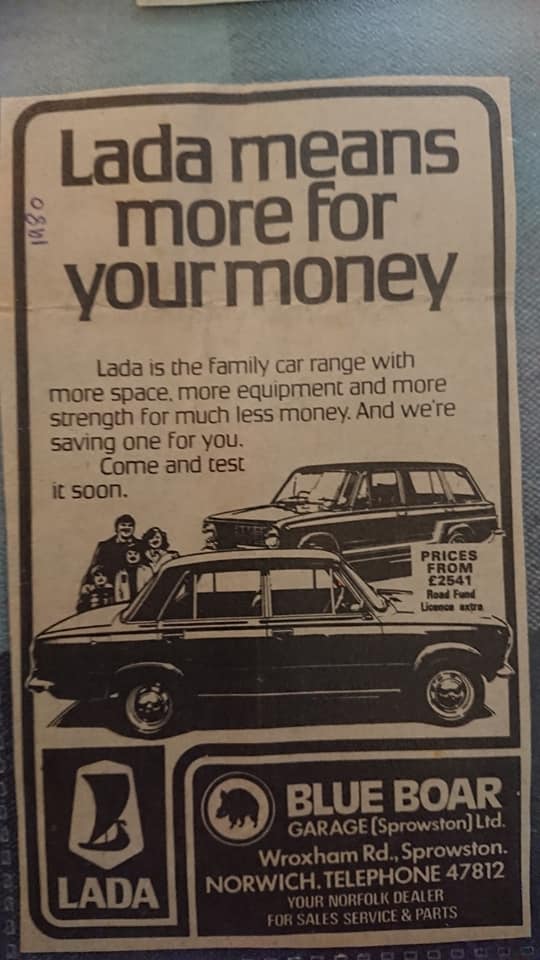
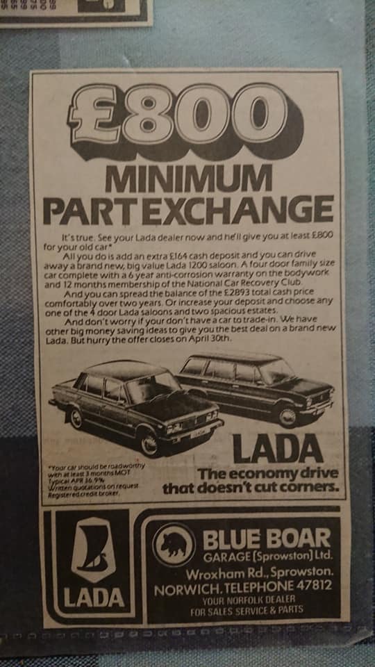
1977 advert
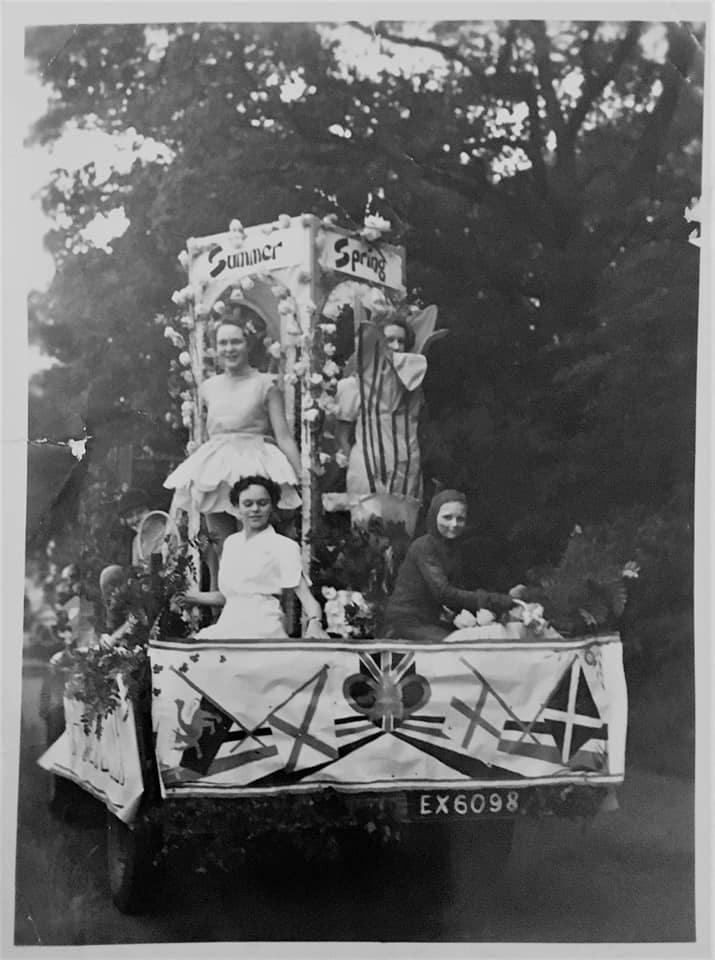
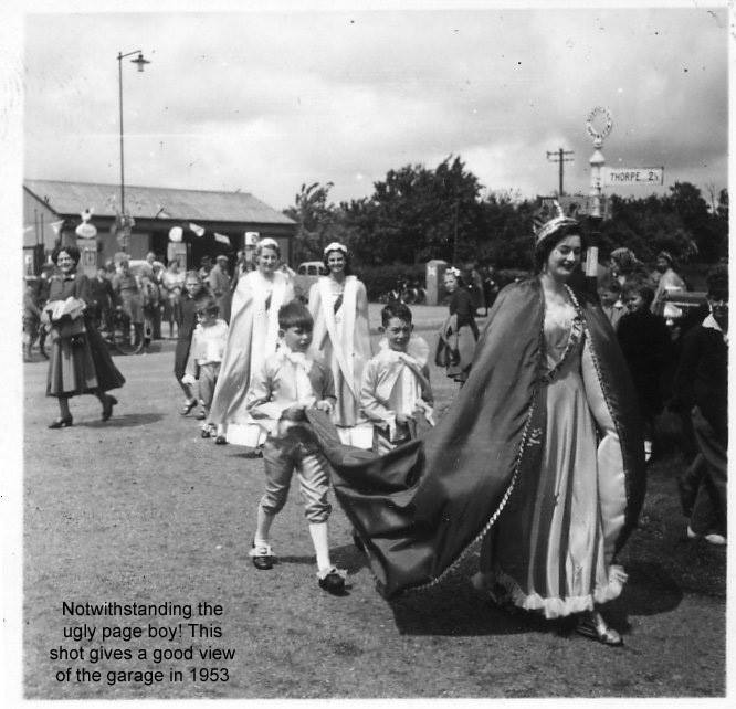
The procession float picture below is the Sprowston Girl Guides float which won first prize in the Coronation celebration parade on Wroxham road on 2nd June 1953. The procession went the length of Wroxham road from the Brickmakers end, (there was no roundabout at that time), to the Blue Boar end. Thanks to Stu for the photo and info.
St. Cuthbert's Church
Opened in 1885 as a chapel of ease. The Vicarage next door was built around the same time.
Opened in 1885 as a chapel of ease. The Vicarage next door was built around the same time.
59 Wroxham Road - Old Doctors Surgery
This used to be a doctors surgery before the new one was added next door. Liz Campbells tells us "I remember it as Dr Millar’s House. As I recall, there were two Dr Millars (husband and wife, both GPs). The original surgery was effectively in one of their front rooms, but a proper surgery, with a separate entrance, was built as an extension on the side during the early 1970s." Angie Edgar adds "Waiting room was the front room to the left of the door and surgery was to the right I believe. Prior to Doctor Millar it was doctor Allibone, he was lovely, always got a sweet after an injection!"
This used to be a doctors surgery before the new one was added next door. Liz Campbells tells us "I remember it as Dr Millar’s House. As I recall, there were two Dr Millars (husband and wife, both GPs). The original surgery was effectively in one of their front rooms, but a proper surgery, with a separate entrance, was built as an extension on the side during the early 1970s." Angie Edgar adds "Waiting room was the front room to the left of the door and surgery was to the right I believe. Prior to Doctor Millar it was doctor Allibone, he was lovely, always got a sweet after an injection!"
70 Wroxham Road, Sprowston
This house used to be called Gresham in 1945.
This house used to be called Gresham in 1945.
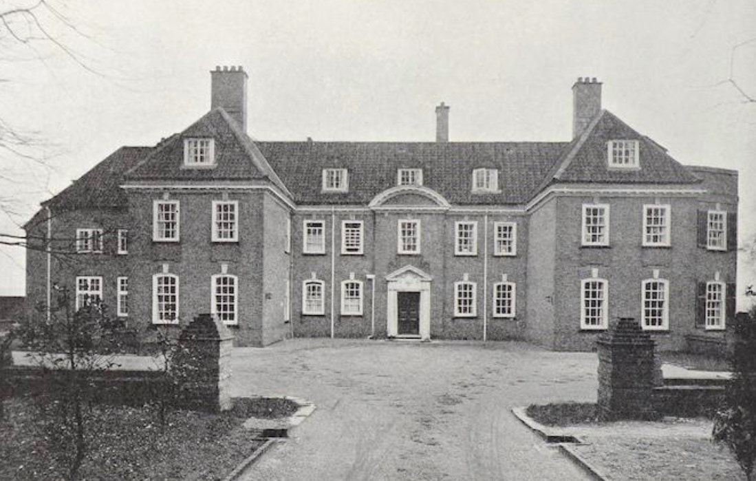
88, 90, 92 Wroxham Road - Sprowston Court
In 1930 Sprowston Court the Georgian residence off Wroxham Road was for sale. It included 2 cottages, pleasure ground and paddocks. It had a total of 18 acres back then. It was built in 1914 by Oswald P Milne for Mr Hartcup
https://historicengland.org.uk/listing/the-list/list-entry/1050878?section=official-list-entry
157A Wroxham Road - The Warren Care Home
Used to be a single bungalow and in 1996 The Ross Day Center was built.
Used to be a single bungalow and in 1996 The Ross Day Center was built.
170 Wroxham Road, Once Upon A Time
This nursery was added to No 170 Wroxham Road and opened in 2007. This house used to be Wood Farm.
This nursery was added to No 170 Wroxham Road and opened in 2007. This house used to be Wood Farm.
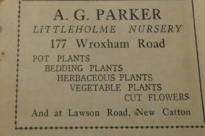
177 Wroxham Road
A. G. Parker Littleholme Nursery was there in 1940.
A. G. Parker Littleholme Nursery was there in 1940.
181 Wroxham Road, Sprowston
This house used to be called Eastways.
This house used to be called Eastways.
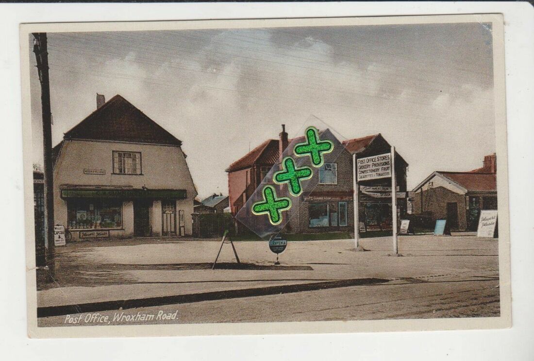
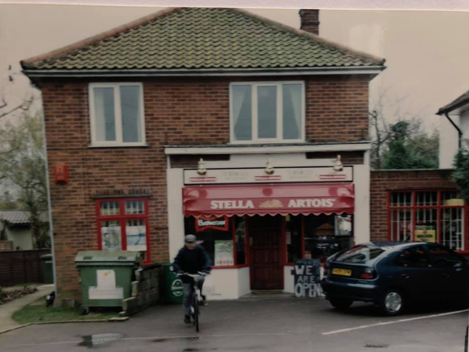
195 Wroxham Road - Age UK
This was once a post office run by Mr and Mrs Cunningham as seen in the picture below. Later it was Dye's Pharmacy and then moved to North Walsham Road and was run by Bob. It is now a charity shop called Age UK.
This was once a post office run by Mr and Mrs Cunningham as seen in the picture below. Later it was Dye's Pharmacy and then moved to North Walsham Road and was run by Bob. It is now a charity shop called Age UK.
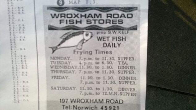
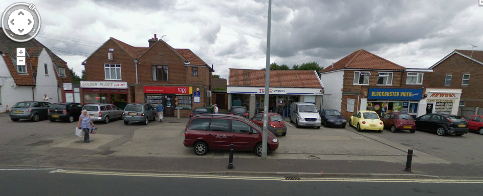
197 Wroxham Road - Golden Plaice Fish Bar
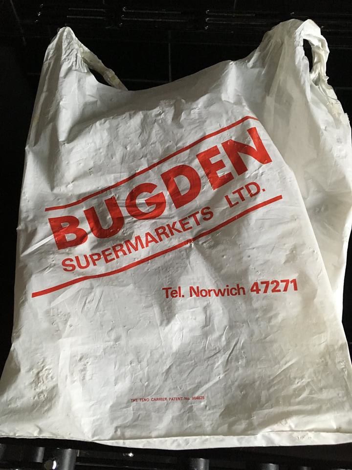
This used to be Wroxham Road Fish Stores. In the 1970's and 1980's it was also known as Steves. In 1982 the chip shop was owned by Bugden's until there was a fire then it closed.
This used to be Wroxham Road Fish Stores. In the 1970's and 1980's it was also known as Steves. In 1982 the chip shop was owned by Bugden's until there was a fire then it closed.
199 Wroxham Road - Batemans Carpets
This used to be Tops Estate Agent, AM News, Dillions and paper and sweet shop who also owned the shell garage next door to the right.
This used to be Tops Estate Agent, AM News, Dillions and paper and sweet shop who also owned the shell garage next door to the right.
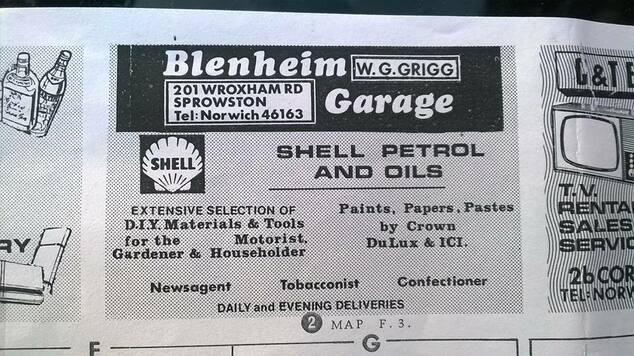
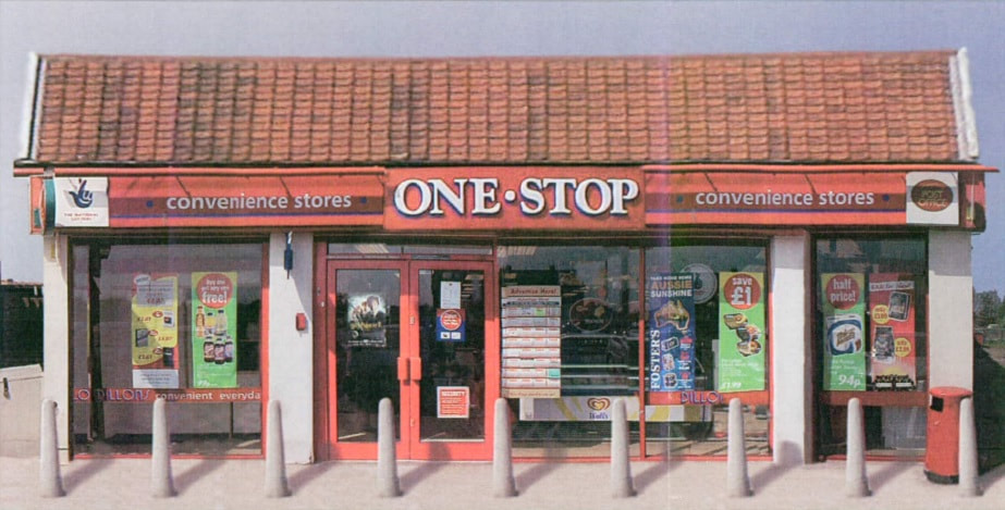
201 Wroxham Road - Tesco Express
This used to be a Shell petrol staton called Blenhiem Garage owned by W.G Grigg. It was later Phoenix petroleum. It closed in 1998 and then turned into Dillons then One Stop shop and then Tesco Express. Wroxham Road
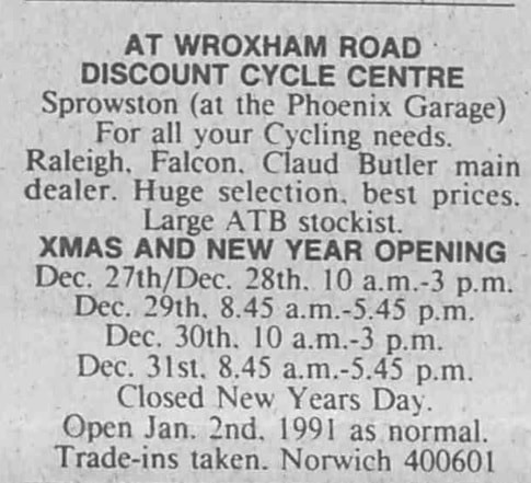
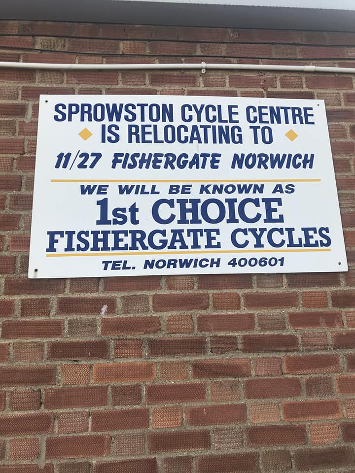
Wroxham Road Cycle Centre
Round the back of the petrol station was Wroxham Road Cycle Centre. The shop was renamed Sprowston Cycle Centre and in 1998 it moved premises to Fishergate then ceased trading around 2003.
This used to be a Shell petrol staton called Blenhiem Garage owned by W.G Grigg. It was later Phoenix petroleum. It closed in 1998 and then turned into Dillons then One Stop shop and then Tesco Express. Wroxham Road
Wroxham Road Cycle Centre
Round the back of the petrol station was Wroxham Road Cycle Centre. The shop was renamed Sprowston Cycle Centre and in 1998 it moved premises to Fishergate then ceased trading around 2003.
Thanks to Nick Oakley
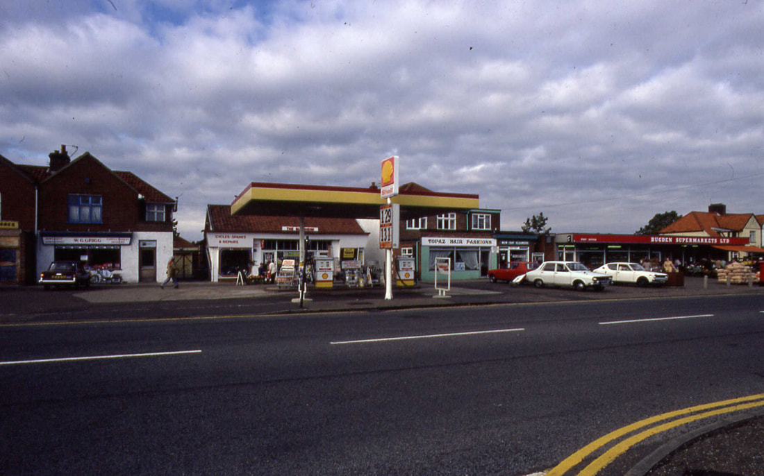
The Shell Petrol Station, Topaz Hair Fasions and Bugdens Supermarket.
2003
And now
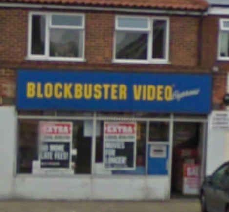
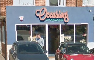
203 Wroxham Road - Occasions Of Sprowston
Used to be Blockbuster video shop, Topaz Hair Fashions and once a Grocers shop called F.C. Andrews, and Cornells Butchers run by a mother and son.
Used to be Blockbuster video shop, Topaz Hair Fashions and once a Grocers shop called F.C. Andrews, and Cornells Butchers run by a mother and son.
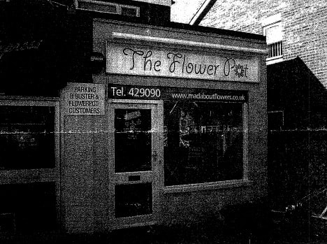
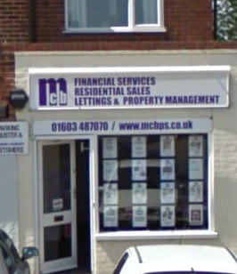
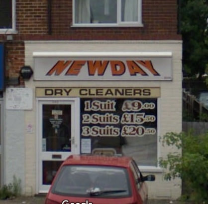
203A Wroxham Road - MCH
This used to be The Flower Pot, Newday Dry Cleaners, MCB Estate Agents and Pymm & Co. Anyone know what it was before that?
This used to be The Flower Pot, Newday Dry Cleaners, MCB Estate Agents and Pymm & Co. Anyone know what it was before that?
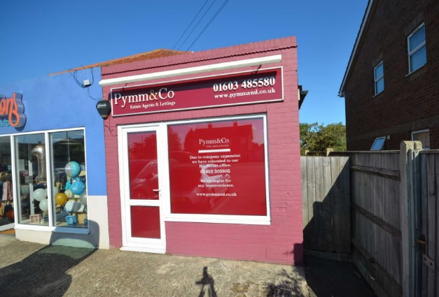
2018
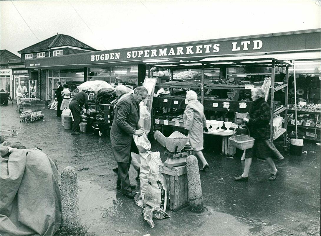
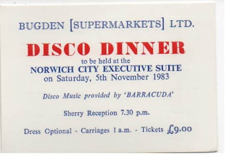
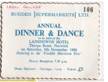
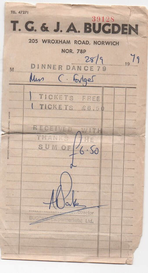
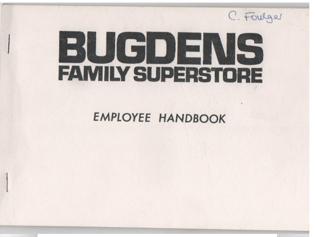
205 - 205c Wroxham Road
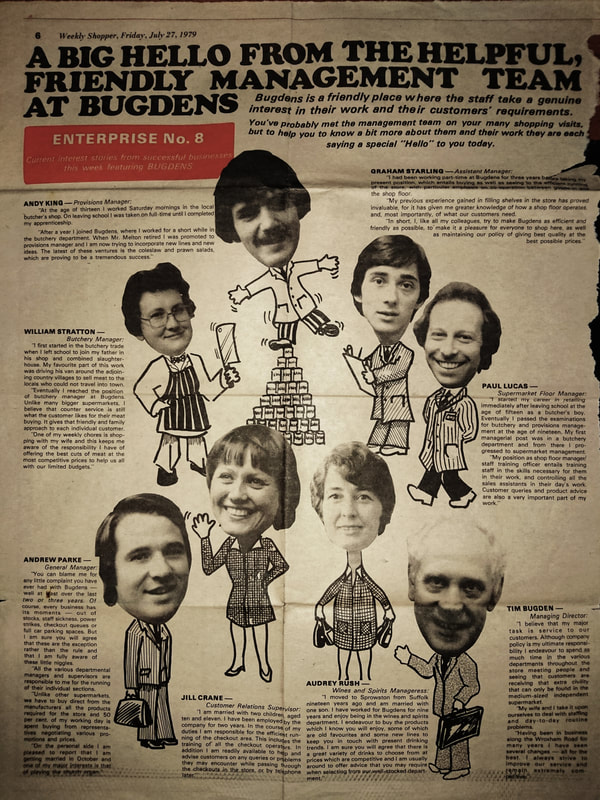
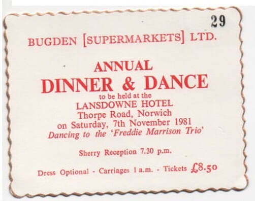
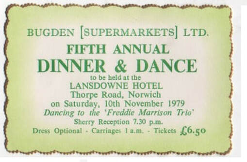
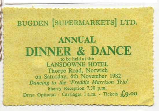
These flats were built on the site of the old Bugden supermarket which opened in 1974 when it was converted from a small shop into a supermarket. Tim Bugden live in the big house next to the end of the parade. Bugdens was demolished in 1987 and moved to where Tesco is on Blue Boar Lane.
These flats were built on the site of the old Bugden supermarket which opened in 1974 when it was converted from a small shop into a supermarket. Tim Bugden live in the big house next to the end of the parade. Bugdens was demolished in 1987 and moved to where Tesco is on Blue Boar Lane.
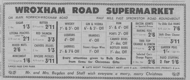
Tuesday 21 Dec 1965
Copyright Archant & https://www.localrecall.co.uk/
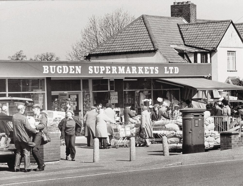
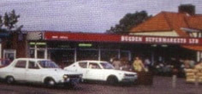
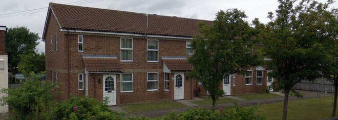
Site where Bugdens Supermarket used to stand.
Thanks to Kevin Bishop for these and all the other bits below
Thanks to Steve Speck who emailed this in.
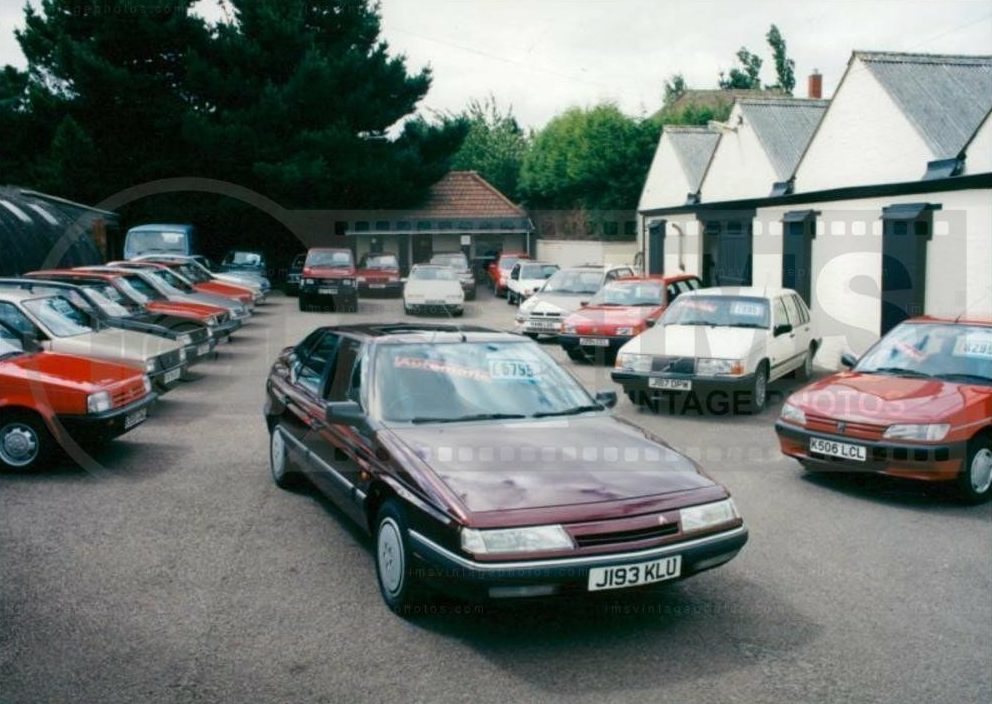
Desira Motors
This used to be Texaco Petrol Station & Pointers Motors
This used to be Texaco Petrol Station & Pointers Motors
Gravers Blacksmith Shop
I have read that there used to be a Blacksmiths close the junction of Church Lane and Wroxham Road on the oppsite side of the road as the pub. Anyone know anything more?
I have read that there used to be a Blacksmiths close the junction of Church Lane and Wroxham Road on the oppsite side of the road as the pub. Anyone know anything more?
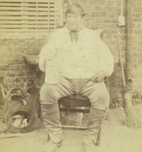
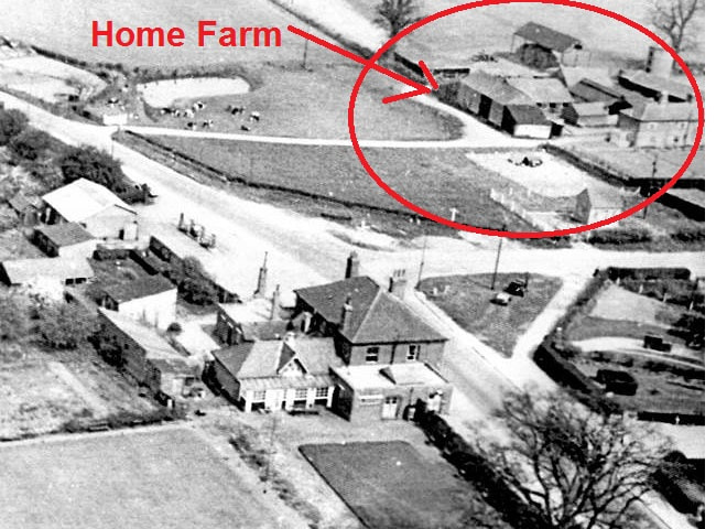
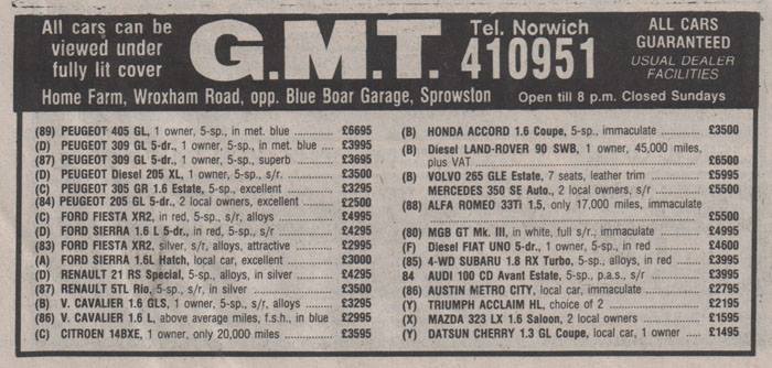
Home Farm
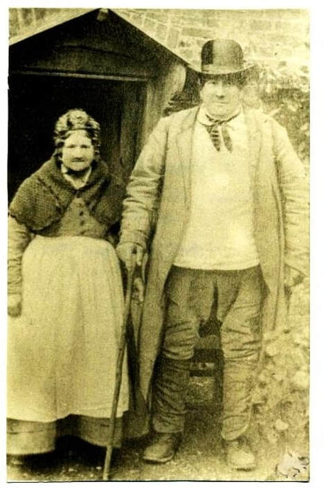
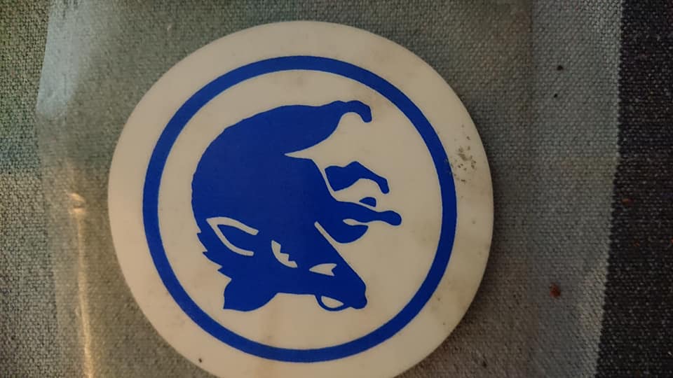
This was a pig farm opposite the Blue Boar Garage next door to The Blue Boar pub on Wroxham Road. Henry Yellop is pictured below and born 1820 and died 1896 & his wife Mary Ann Yellop (nee Winter) 1819 - 1896. They died within a fortnight of each other, both about 76 , after 53 years of marriage. Thanks to Andy May for the info. The farm was in between Wroxham Road and Blue Boar Lane. Lots of it is now Chopyngs Dole Close. Later it became GMT Car Sales.
This was a pig farm opposite the Blue Boar Garage next door to The Blue Boar pub on Wroxham Road. Henry Yellop is pictured below and born 1820 and died 1896 & his wife Mary Ann Yellop (nee Winter) 1819 - 1896. They died within a fortnight of each other, both about 76 , after 53 years of marriage. Thanks to Andy May for the info. The farm was in between Wroxham Road and Blue Boar Lane. Lots of it is now Chopyngs Dole Close. Later it became GMT Car Sales.
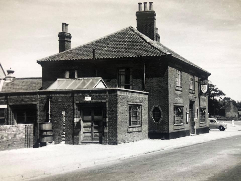
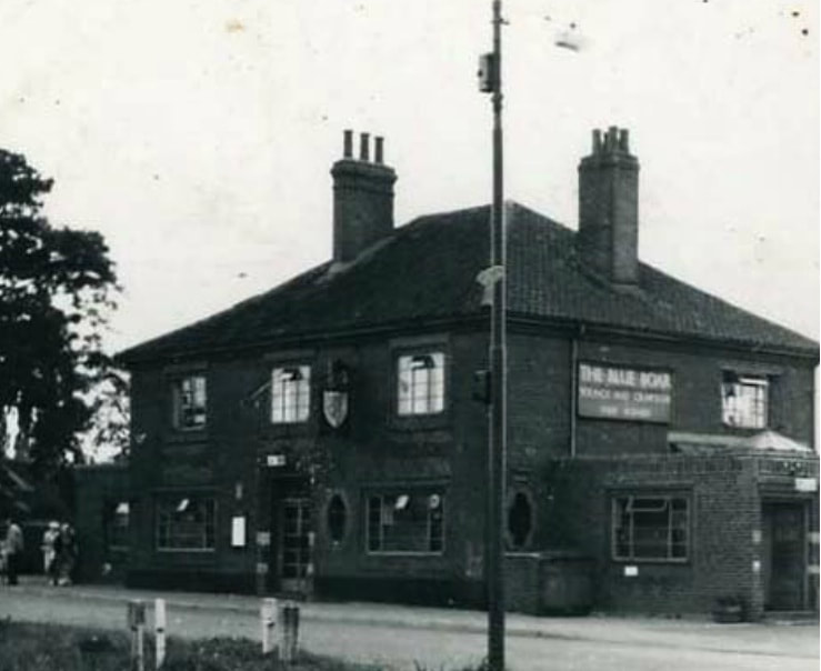
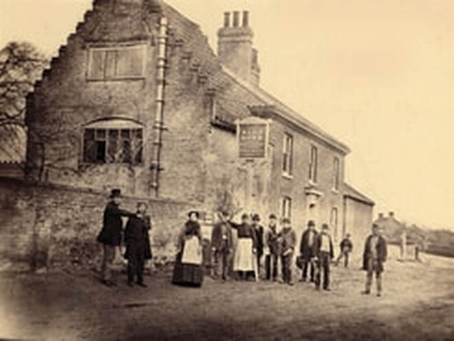
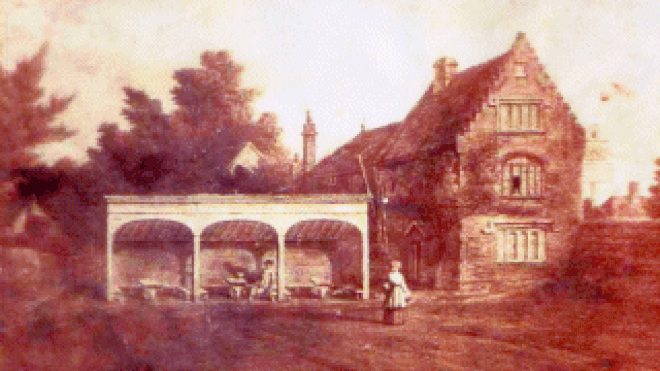
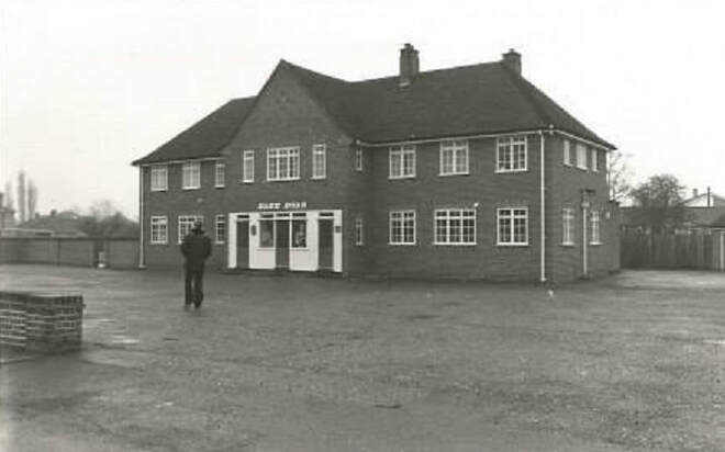
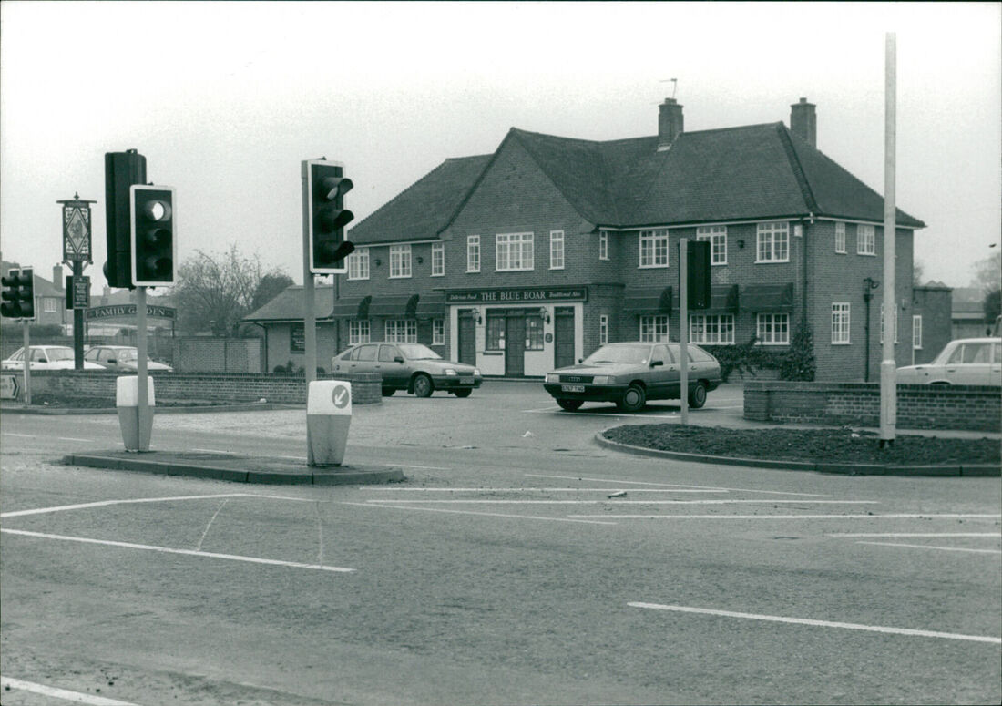
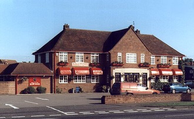
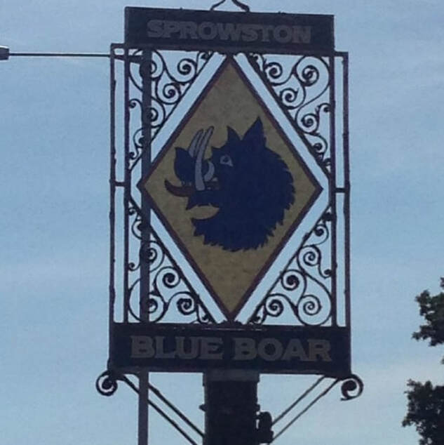
259 Wroxham Road - The Blue Boar
There has been a public house on this site since around 1750. The original building was demolished in 1953 to widen Wroxham Road and the current Blue Boar was built further back from the road. David Turnbull took over in 1979. On 20th March 2009 he celebrated 30 years as owner at the pub. The pub was then currently undergoing a £25,000 makeover. David retired on Sunday 25th June 2017. Steve and Carla then took over and are the currents landlords.
This was one of very few pubs to once have it's own set of traffic lights coming out of the car park! The pub used to have an off licence in the middle as you go into the pub. David tells us on our Facebook page "we took out The Off License from Blue Boar around about 1982. I bought The Gun Room and opened Turnbull’s Off Licence. We did well until Bugdens in Blue Boar Lane turned into Tesco !"
There is a couple of websites that say there was a pub on Wroxham Road called The Unicorn but it was an error it was actually The Boars Head that later became The Blue Boar.
https://nrocatalogue.norfolk.gov.uk/index.php/william-pearces-deposit-note-for-gbp50-with-interest-at-4-p-a-relating-to-the-boars-head-public-house-situate-in-sprowston
Taken from here - https://web.archive.org/web/20040630141455/http://www.blueboarnorwich.co.uk/history.html

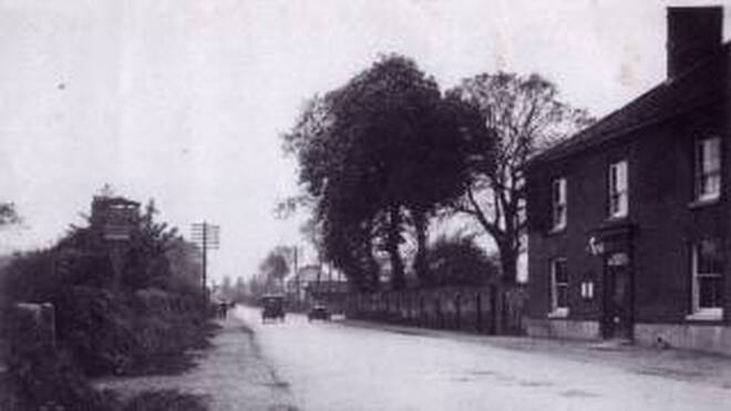
Wroxham Road - 1836
The sign for the Blue Boar public house stands on the left, but the pub itself is on the right-hand side. Notice the postman standing under the signpost and the old style telegraph posts. The road to the right is Church Lane. Today the Blue Boar public house has been rebuilt and stands back from the road. Photographed looking towards the city centre.
Taken from the old Blue Boar website now gone
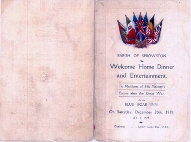
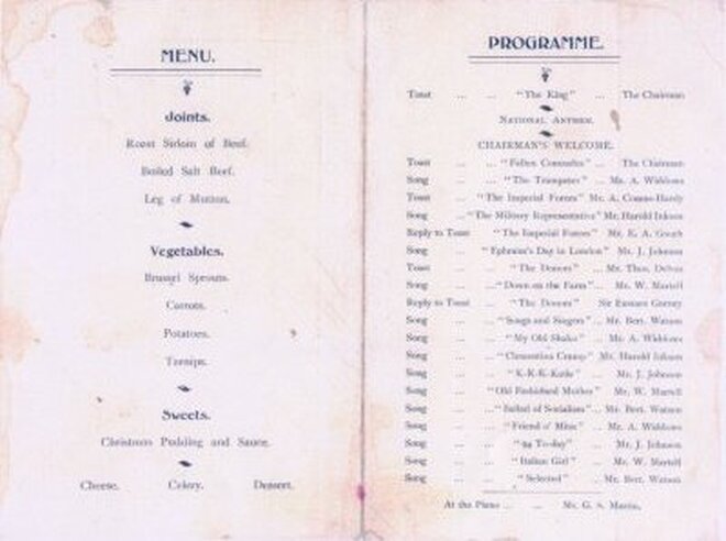
The Blue Boar has always been a focal point of the local community as well as an excellent venue for events. Below is a menu from a 'Welcome Home Dinner' in 1919 for the soldiers returning from 'The Great War'.
1978 - thanks to Gilbert Plummer
1981
2013
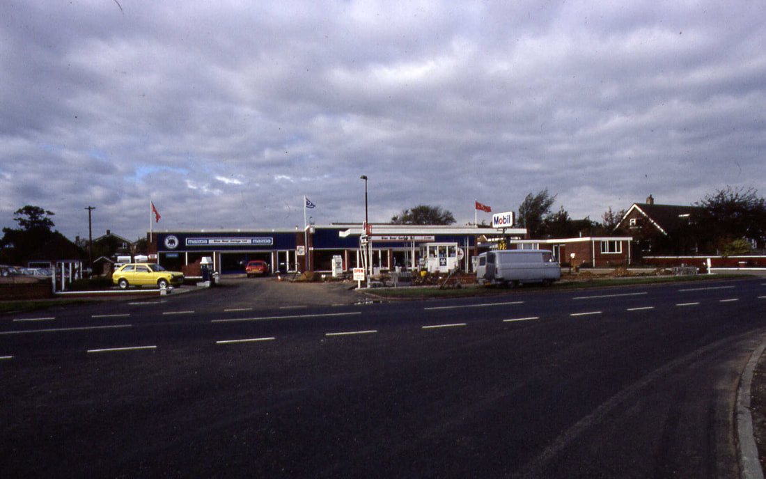
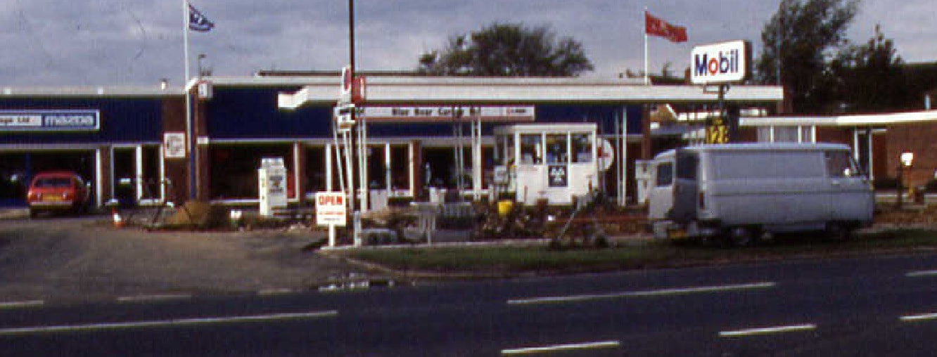
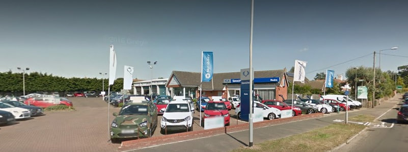
261 Wroxham Road - Desira SsangYongn
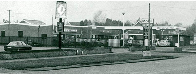
This used to be Blue Boar garage which was founded in 1970. In 1996 Grant Long became General Manager (see picture below) then it became Mobil and around 1996 became a BP petrol station before it was demolished to make way for the car sales showroom you see today.
Janet Knights My Dad started working at the Blue Boar garage, my grandfather used to take his car there and that is how he met my Mum.....they married in 54. He lived in Cozen's Hardy Rd and she lived in Blenheim Rd.
Credit: Archant & https://www.localrecall.co.uk/
This is an even earlier picture showing Blue Boar Garage, run at that time by my father Cliff Blyth.
This was taken at the 1953 Coronation Celebrations. The other page boy on the right hand side of me was (I think) Robert Bradley.
Anyone know the names of the others? David Blyth
236 Wroxham Road - Klair House
It started out life as a sweet shop called Walters and later a gun shop called The Gun Room. After that it was Turnbull's Off Licence. I remember it being very handy as when Tesco's used to close at 8pm (remember them days) you had to buy your beers from the off licence as it was open later. The shop was owned by David Turnbull who used to run The Blue Boar opposite.
234 The Gun Room 1977
The old shop was converted into the current care home and opened in 2010. I have also heard that there was once a swimming pool in the garden of Klair House but it was filled in when it was converted.
Turnbull's Off Licence - Thanks to Robert Arneil
As it looks today as Klair House
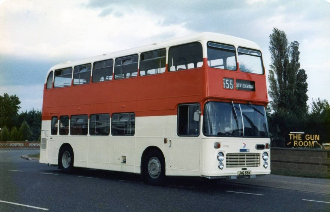
Bus outside The Gun Room opposite The Blue Boar Pub. Credit: Not know yet
The Hidden Part Of Wroxham Road
When the new roundabouts on Wroxham Road / Blue Boar Lane were built an original part of Wroxham Road was replaced inbetween Chenery Drive and close to the Park n Ride. The picture below shows the original part of Wroxham Road which like the old part of Blue Boar Lane has now become a lovely quiet cul-de-sac. You cannot see it from the main road you have to turn ino the cul-de-sac. I bet the people's houses that live on this bit of road have noticed their houses go up in priee! It is now amazing to think how busy this road used to actually be now.
When the new roundabouts on Wroxham Road / Blue Boar Lane were built an original part of Wroxham Road was replaced inbetween Chenery Drive and close to the Park n Ride. The picture below shows the original part of Wroxham Road which like the old part of Blue Boar Lane has now become a lovely quiet cul-de-sac. You cannot see it from the main road you have to turn ino the cul-de-sac. I bet the people's houses that live on this bit of road have noticed their houses go up in priee! It is now amazing to think how busy this road used to actually be now.
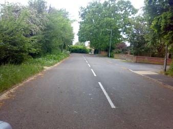
Looking down the old Wroxham Road
309 Wroxham Road
The big end bungalow next to the park and ride sold at auction for £20.700 to Mr Sewell.
The big end bungalow next to the park and ride sold at auction for £20.700 to Mr Sewell.
