Sprowston Road
Sidney's Row was off Sprowston Road next to Roys Car Sales. Now gone.
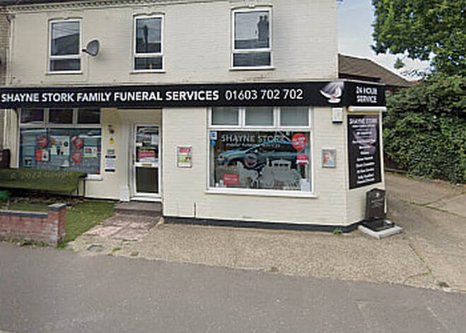
2 Sprowston Road - Collins Care
Used to be Stuarts Quality Used Car Centre in 1981, Range Motorcycles run by Roy Burgoyne, Kings Motorcycles and Dennis Henson cars in From 1975 till 1980.
Used to be Stuarts Quality Used Car Centre in 1981, Range Motorcycles run by Roy Burgoyne, Kings Motorcycles and Dennis Henson cars in From 1975 till 1980.
10 Sprowston Road
Used to be a tobacconist shop run by Nicholls Martin in 1908 and a bike shop in 1970 run by Mr Frost.
Used to be a tobacconist shop run by Nicholls Martin in 1908 and a bike shop in 1970 run by Mr Frost.
12 Sprowston Road
Used to be a grocers shop in 1908.
Used to be a grocers shop in 1908.
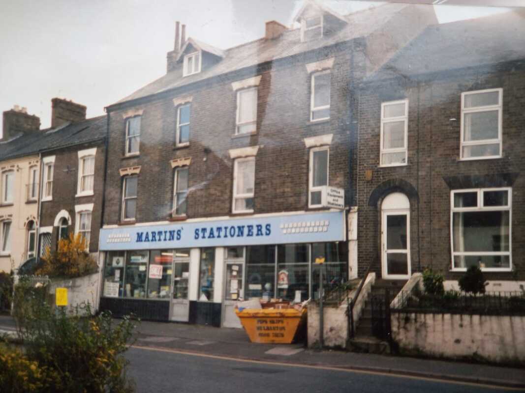
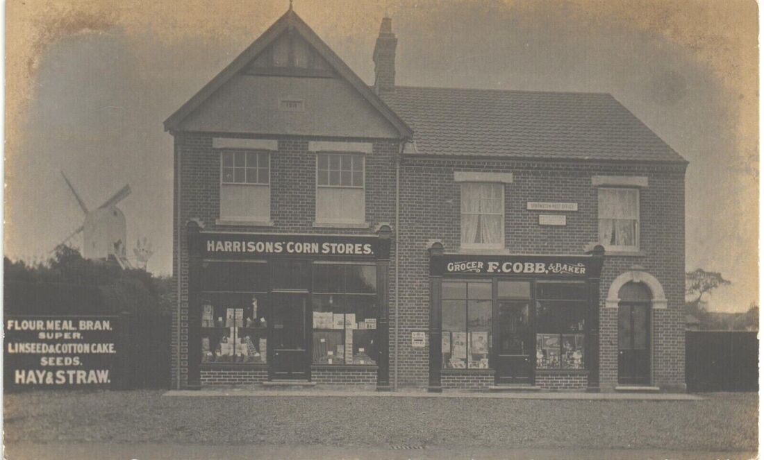
43 Sprowston Road
Used to be a bakery in 1908. In 1970 Martins Stationers opened until 1977 when they moved to Corbet Avenue. 43 had been a bakers, Freemans then Knights, then an office for Blanchflower heating engineers. 45a was the Stamford Mutual Insurance Company.
Used to be a bakery in 1908. In 1970 Martins Stationers opened until 1977 when they moved to Corbet Avenue. 43 had been a bakers, Freemans then Knights, then an office for Blanchflower heating engineers. 45a was the Stamford Mutual Insurance Company.
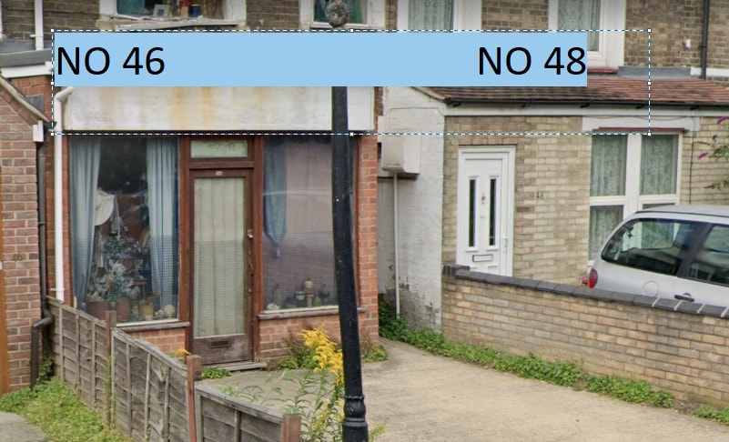
46 Sprowston Road
This was an antiques/bric-a-brac shop called ‘Maybe Antiques’ or similar. This would have been in the late 70s/early 80s
48 Sprowston Road
Thus used to be a shop and was trading in 1935. We think this may have been a dress hire shop at some point and a shop that sold satellite TV equipment.
This was an antiques/bric-a-brac shop called ‘Maybe Antiques’ or similar. This would have been in the late 70s/early 80s
48 Sprowston Road
Thus used to be a shop and was trading in 1935. We think this may have been a dress hire shop at some point and a shop that sold satellite TV equipment.
70 Sprowston Road
In 1897 this up for rent for £10 a month.
In 1897 this up for rent for £10 a month.
104 Sprowston Road
Used to be a grocers shop in 1908, Aspen Windows and Handyman's stores in 1970 and Bradfields Dairy run by George Bradfield. There was another branch at Vauxhall Street run by Charlie Bradfield.
Used to be a grocers shop in 1908, Aspen Windows and Handyman's stores in 1970 and Bradfields Dairy run by George Bradfield. There was another branch at Vauxhall Street run by Charlie Bradfield.

Jack Bradfield out the dairy
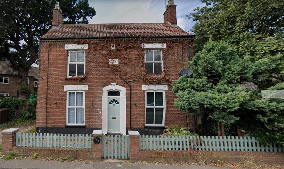
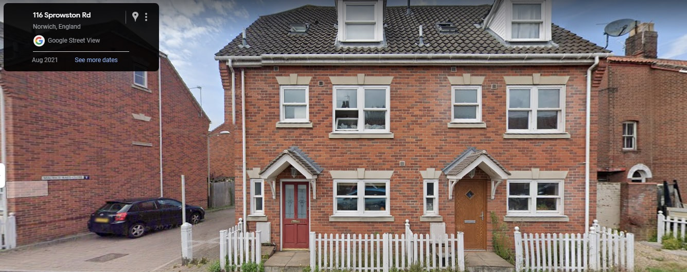
108 Sprowston Road
This house used to be called Hawthorn Cottage and was built in 1896.
This house used to be called Hawthorn Cottage and was built in 1896.
118 Sprowston Road
Before these new houses were put up there was a butchers shop and slaughter houses with cart lodge here. Barwell & Sons wine merchant was there in 1970.
Before these new houses were put up there was a butchers shop and slaughter houses with cart lodge here. Barwell & Sons wine merchant was there in 1970.

Credit: Padraic O'Riordan
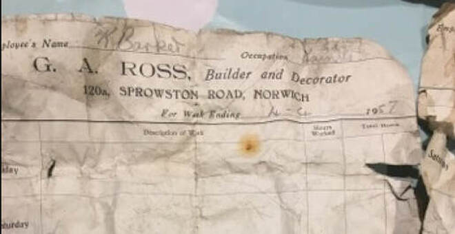
120a Sprowston Road G.A. Ross Builder and decorator
Anyone know more about these. Thanks to Sarah Alderton for the picture of this paperwork she found in some cracks in her ceiling
Anyone know more about these. Thanks to Sarah Alderton for the picture of this paperwork she found in some cracks in her ceiling
141 Sprowston Road
Used to be Smithson Grocers.
Used to be Smithson Grocers.
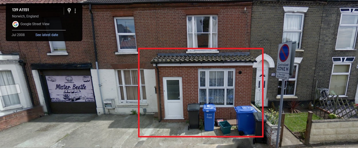
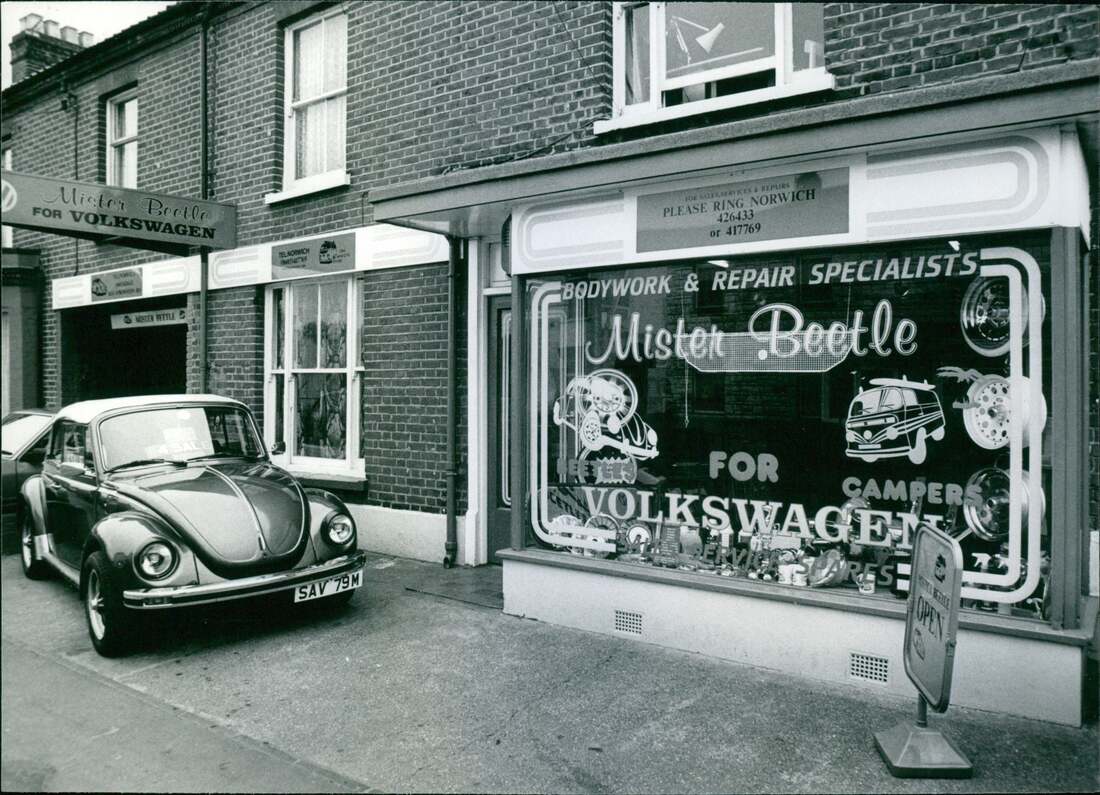
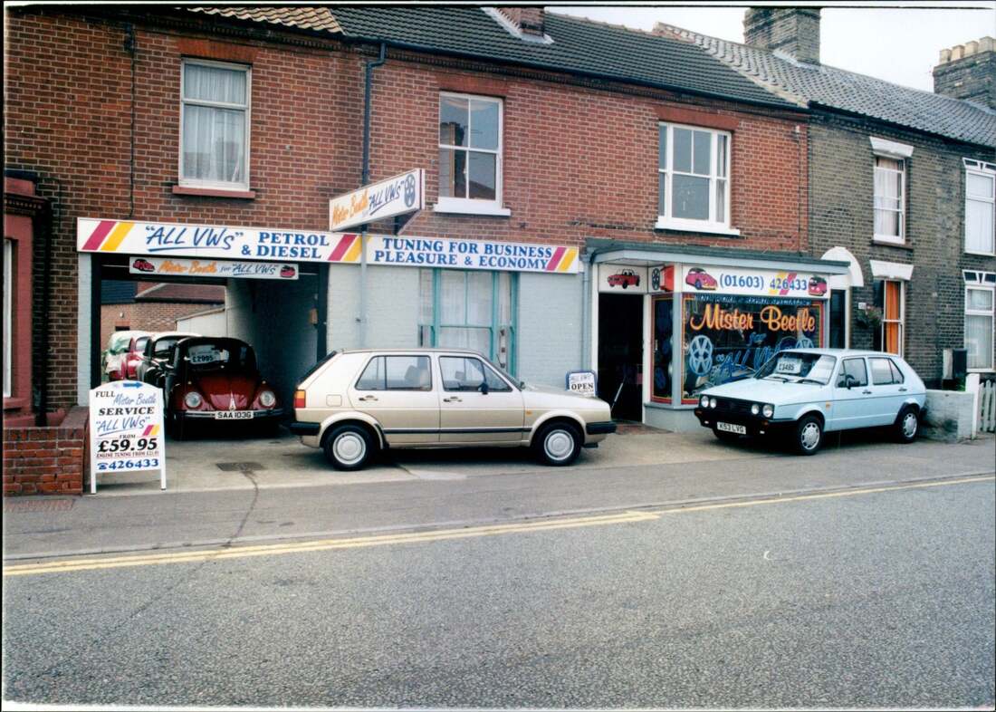
143 Sprowston Road - Mister Beetle
Now gone. Used to be a builders yard in 1912.
Now gone. Used to be a builders yard in 1912.
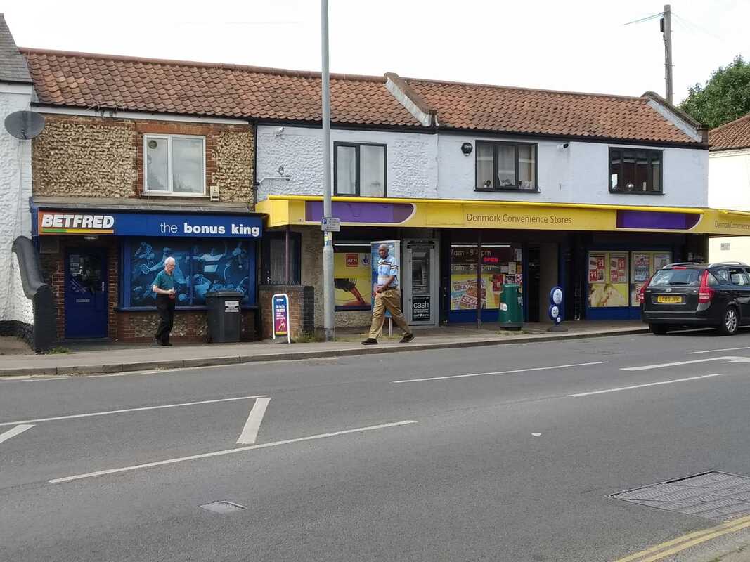
154 Sprowston Road - Betfred
The shop on the left was a barber shop in the early 1900's & to the right was newsagents. Thanks to Steph Tyler.
The shop on the left was a barber shop in the early 1900's & to the right was newsagents. Thanks to Steph Tyler.
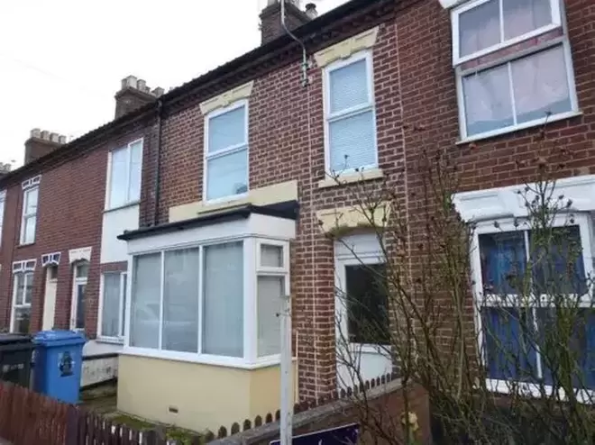
175 Sprowston Road
Used to be a Chemist in 1912.
Used to be a Chemist in 1912.
193 Sprowston Road
Used to be Arnold Christopher fish and chip shop in 1908 and Hales fish shop in 1970.
Used to be Arnold Christopher fish and chip shop in 1908 and Hales fish shop in 1970.
193a Sprowston Road
Used to be R. G. Taylor Plumbers in 1975.
Used to be R. G. Taylor Plumbers in 1975.
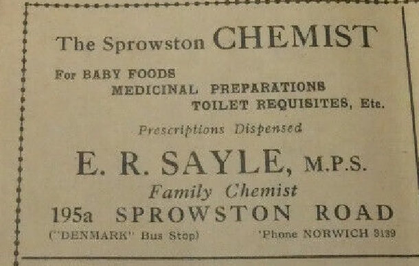
195A Sprowston Road
Now Co-Op this was The Sprowston Chemist in 1940. It was where the Co-Op is now.
Now Co-Op this was The Sprowston Chemist in 1940. It was where the Co-Op is now.
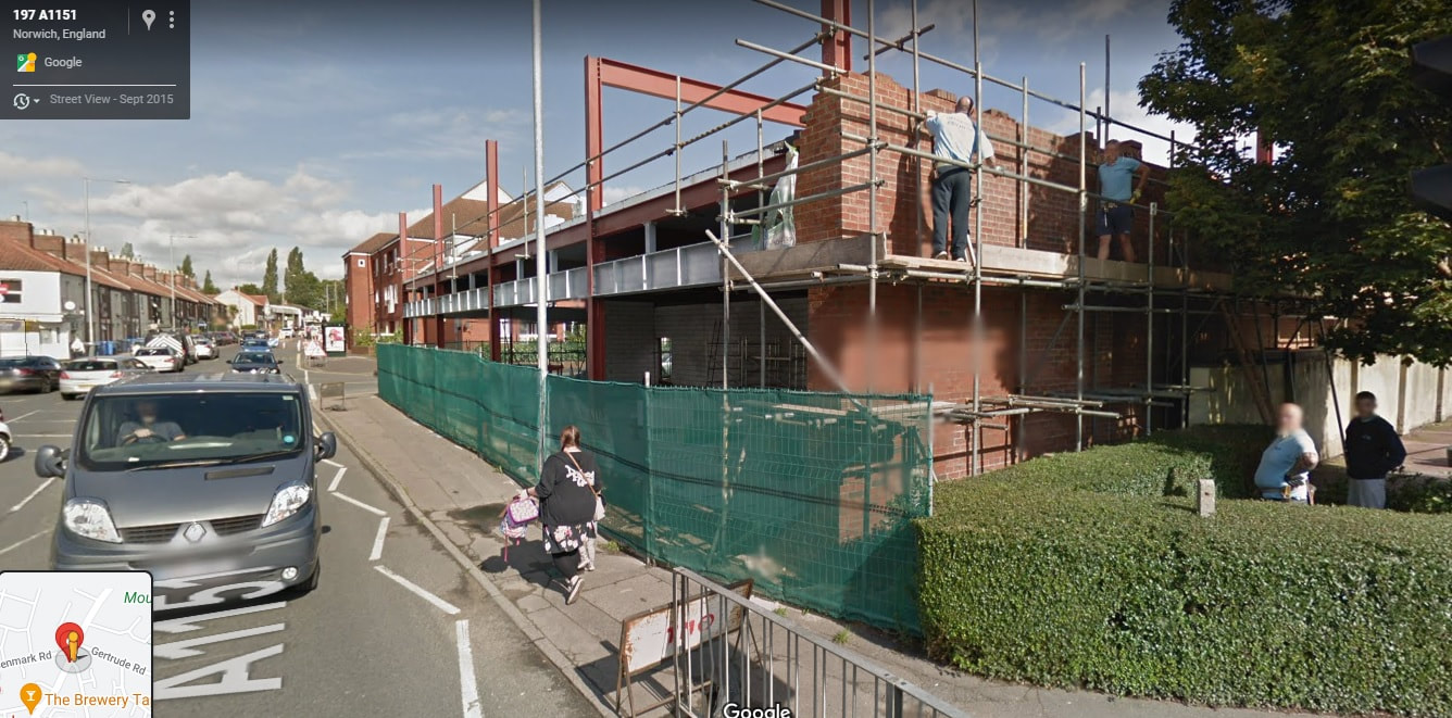
195-197 Sprowston Road - Co-Op
In 1920 it was a freehold general shop and a jam and sweet factory. In 1970 it was a greengrocers run by Mr Clark. Later it was Rush Lighting. They moved out in Febuary 2015. The building and the old factory at the back was demolished around 2014 and then rebuilt as the Co Op
In 1920 it was a freehold general shop and a jam and sweet factory. In 1970 it was a greengrocers run by Mr Clark. Later it was Rush Lighting. They moved out in Febuary 2015. The building and the old factory at the back was demolished around 2014 and then rebuilt as the Co Op
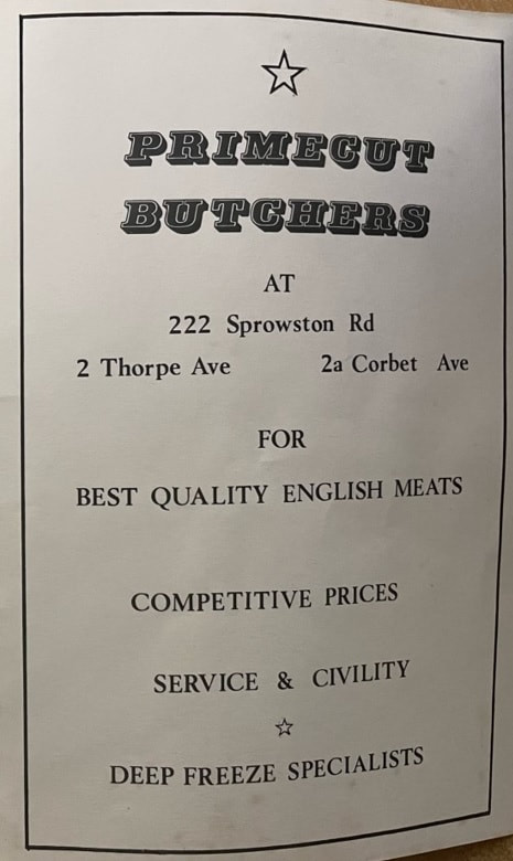
222 Sprowston Road - Dragon City Chinese Takeaway.
Used to be Primecut Butchers in 1977.
Used to be Primecut Butchers in 1977.
224 Sprowston Road - Golden Chicken And Fish Bar
Was called visors in the 50's in the 49's it was called Bailey's
Was called visors in the 50's in the 49's it was called Bailey's
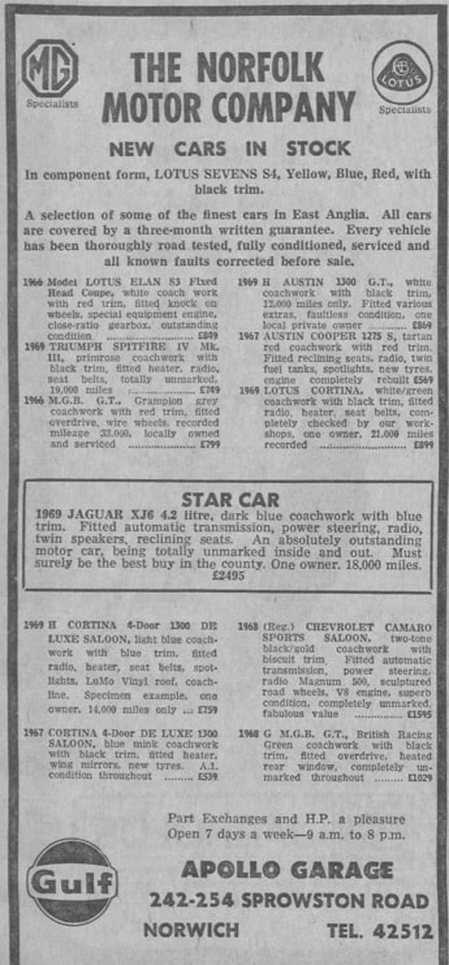
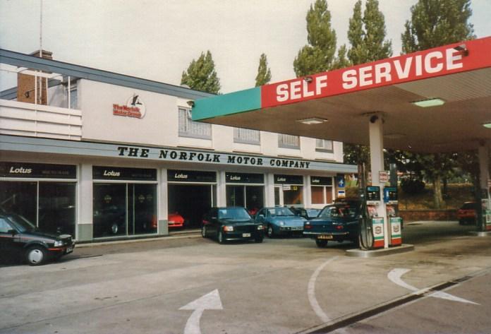
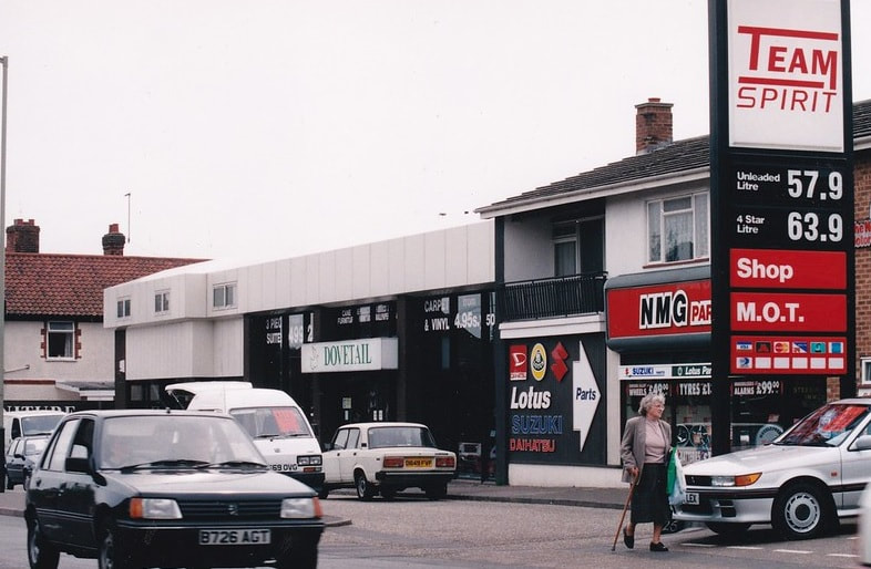
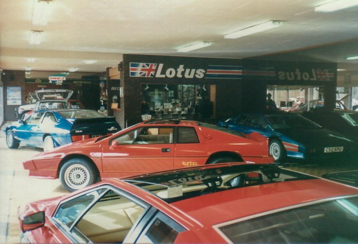
226-236 Sprowston Road - Dovetail
Used to be Reynold's Motor Sales in 1972 and later it was a Lotus car showroom.
Used to be Reynold's Motor Sales in 1972 and later it was a Lotus car showroom.
272 Sprowston Road
Used to be Whiting Stores which was a Spar shop in 1960.
Used to be Whiting Stores which was a Spar shop in 1960.
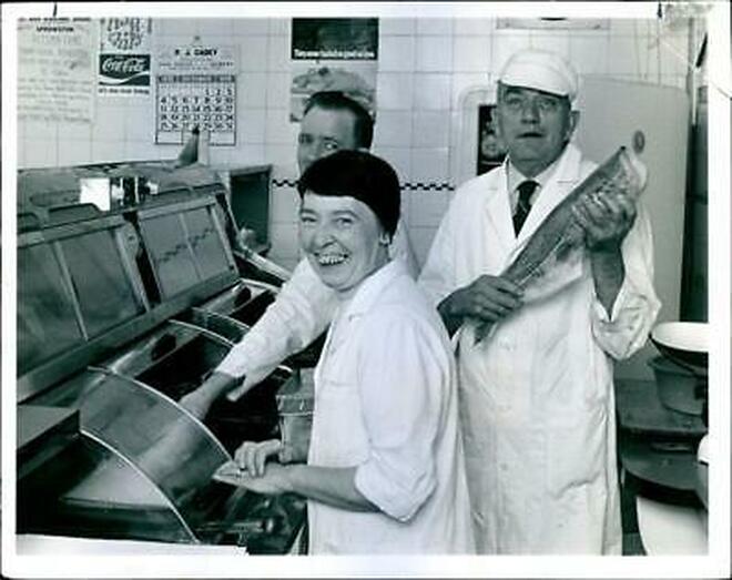
1970 . George Elsegood and his wife Elsie owners of the fish and chip shop on Sprowston Road .( Fryer at the back unknown )
284 Sprowston Road - Norfolk And Norwich Arms Public House
Opened 1830 - 1958
Opened 1830 - 1958
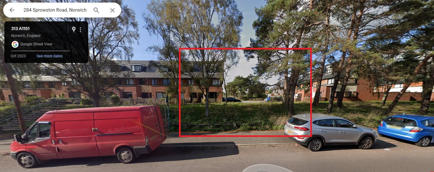
Pub was about here
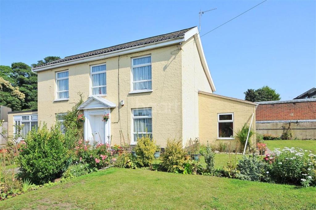
312 Sprowston Road - Monkswell House
Used to be a GP surgery.
Used to be a GP surgery.
314 - 316 Sprowston Road
Used to be Plunkett Brothers tyres in 1971
Used to be Plunkett Brothers tyres in 1971
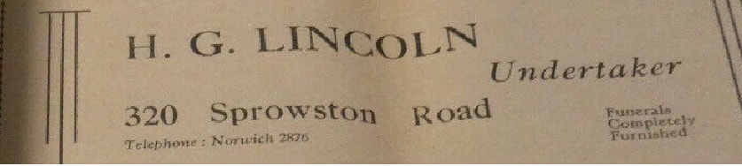
320 Sprowston Road
In 1940 the local Undertaker H. G. Lincoln lived there.
In 1940 the local Undertaker H. G. Lincoln lived there.
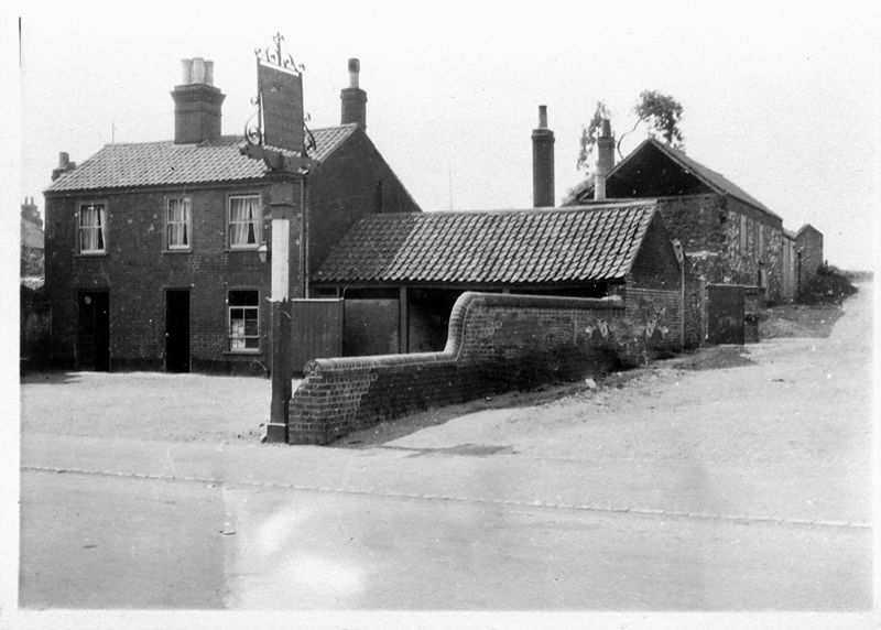
407 Sprowston Road - Black Horse Pub
The Black Horse was situated at 407 Sprowston Road. This pub closed in 1970 and has now been demolished and is now flats opposite the wall road junction.
The Black Horse was situated at 407 Sprowston Road. This pub closed in 1970 and has now been demolished and is now flats opposite the wall road junction.
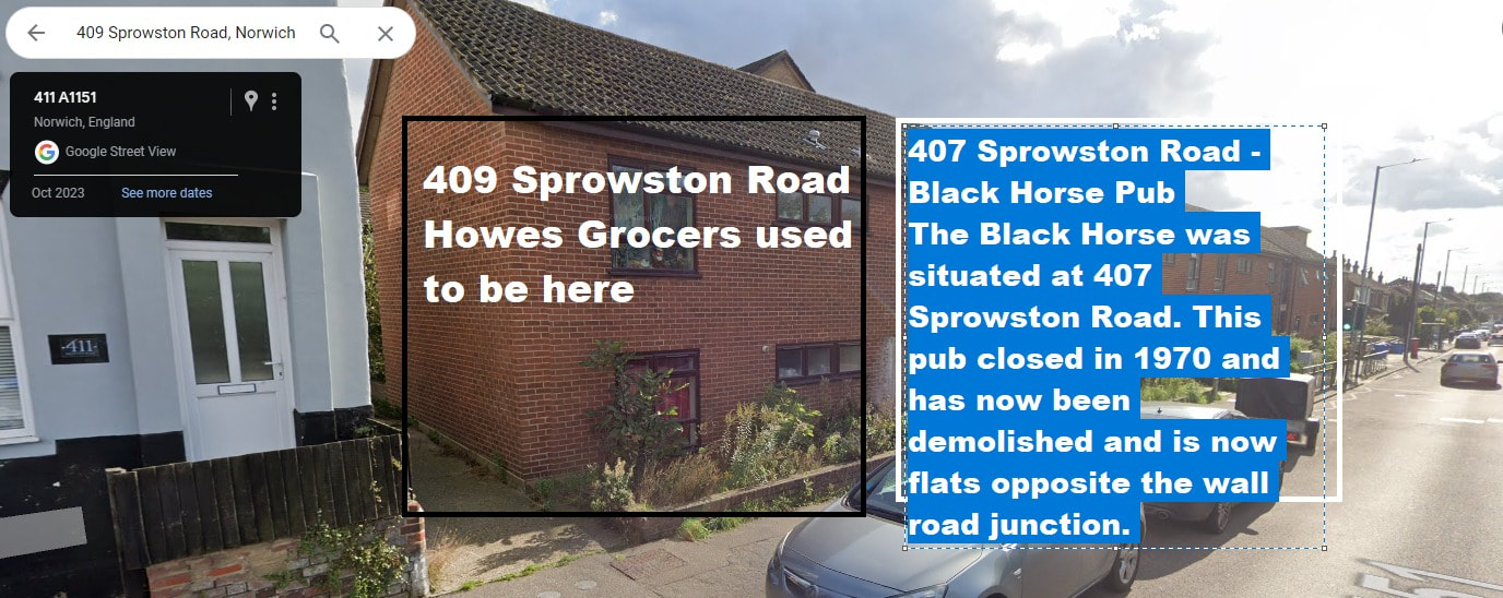
409 Sprowston Road
Now demolished this was Howes Grocers in 1970 next to the Black Horse pub also now gone.
Now demolished this was Howes Grocers in 1970 next to the Black Horse pub also now gone.

424 Sprowston Road
Beryl's snack bar was at 424 Sprowston Road but all now part of Shipfield so it was somewhere around that area in 1970.
Beryl's snack bar was at 424 Sprowston Road but all now part of Shipfield so it was somewhere around that area in 1970.
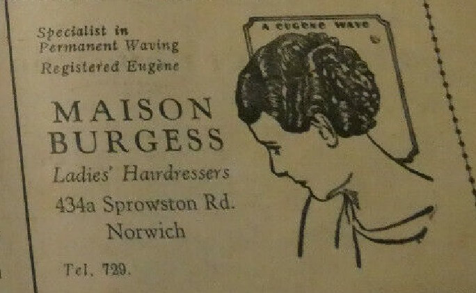
434a Sprowston Road
At a guess I would say this was round about where the entrance to Shipfield now is as this haidressers is long gone. 1940.
At a guess I would say this was round about where the entrance to Shipfield now is as this haidressers is long gone. 1940.
421 Sprowston Road
Used to be known as West View in 1927.
Used to be known as West View in 1927.
461 Sprowston Road (rear of)
Used to be a builders yard at the back of No 461 in 1969.
Used to be a builders yard at the back of No 461 in 1969.
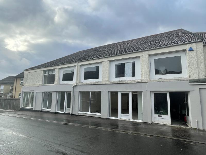
463 Sprowston Road - Aldi
Where the Aldi car park is now this used to be Sprowston Post Mill. More to come
Where the Aldi car park is now this used to be Sprowston Post Mill. More to come
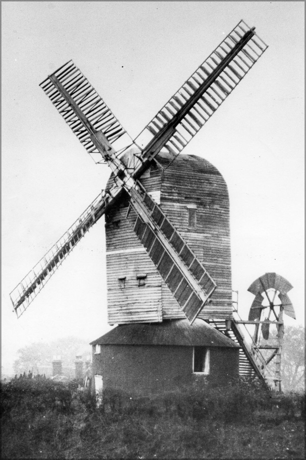
Picture credit unknown at present
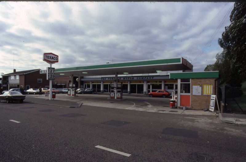
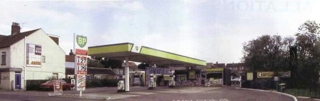
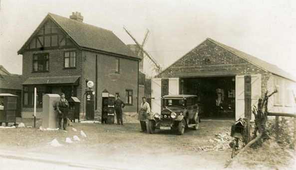
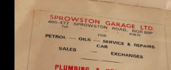
465 - 477 Sprowston Road - Aldi
This is where Sprowston Garage, Millers Garage run by John Miller was and later become a BP. Behind it was Sprowston Sales in 1980.
This is where Sprowston Garage, Millers Garage run by John Miller was and later become a BP. Behind it was Sprowston Sales in 1980.
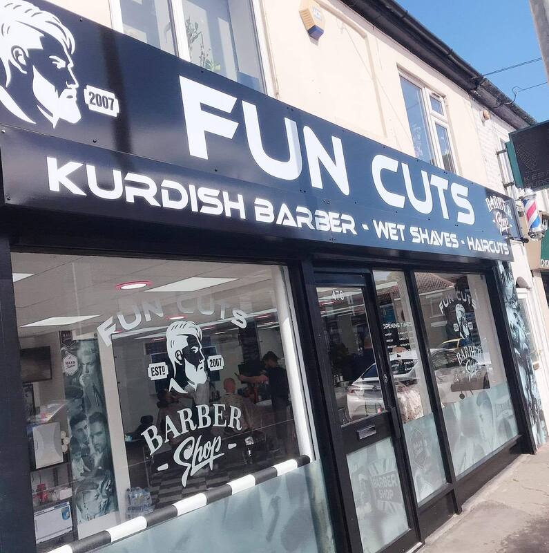
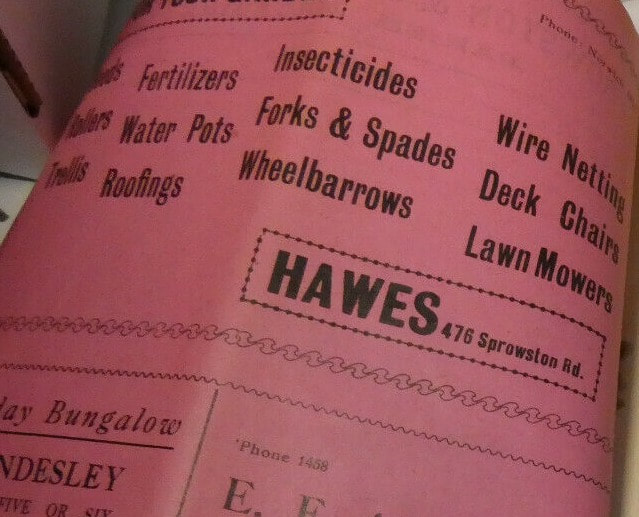
476 Sprowston Road - Fun Cuts
Used to be Hawes garden shop in 1940 and Sexton's hardware stores in 1970.
Used to be Hawes garden shop in 1940 and Sexton's hardware stores in 1970.
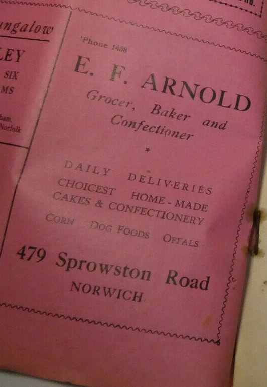
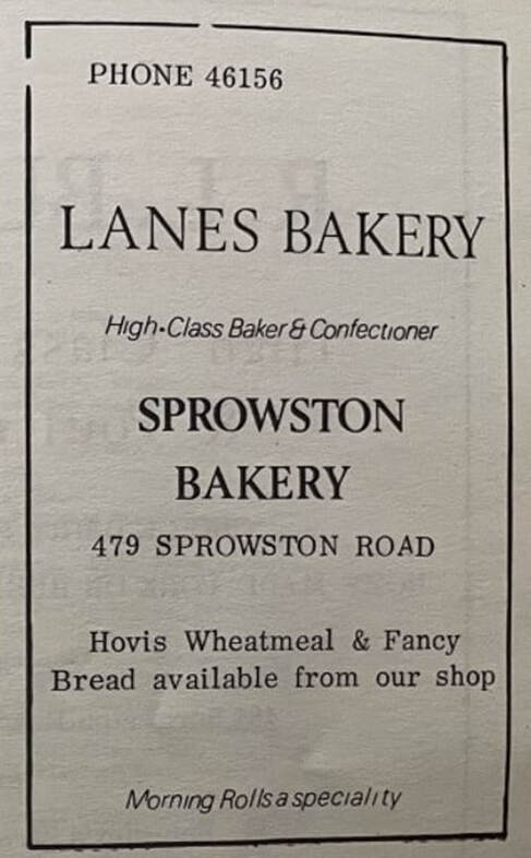
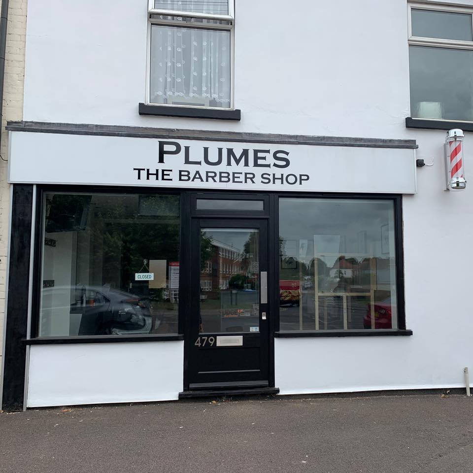
479 Sprowston Road - Plumes Barber Shop
Used to be E. F. Arnold Bakery in 1940 and later Lanes Bakery in 1977.
Used to be E. F. Arnold Bakery in 1940 and later Lanes Bakery in 1977.
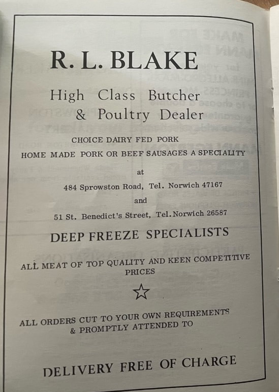
484 Sprowston Road
Used to be Blakes Butchers in 1977.
Used to be Blakes Butchers in 1977.
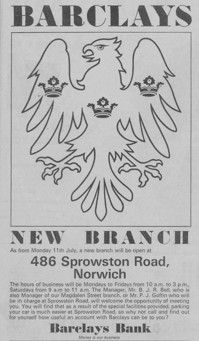
486 Sprowston Road
The Sprowston Road branch of Barclays Bank opened on 11th July 1966 and closed in 2017.
The Sprowston Road branch of Barclays Bank opened on 11th July 1966 and closed in 2017.
Copyright Archant & https://www.localrecall.co.uk/
2019
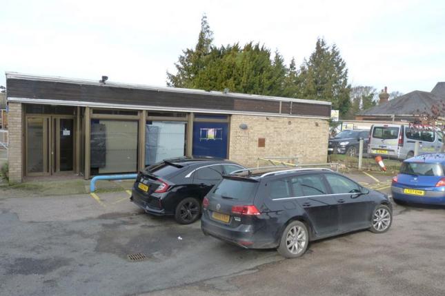
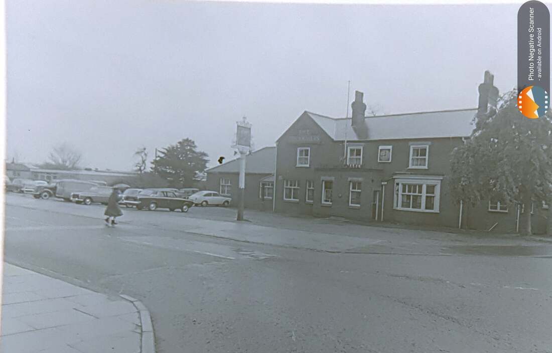
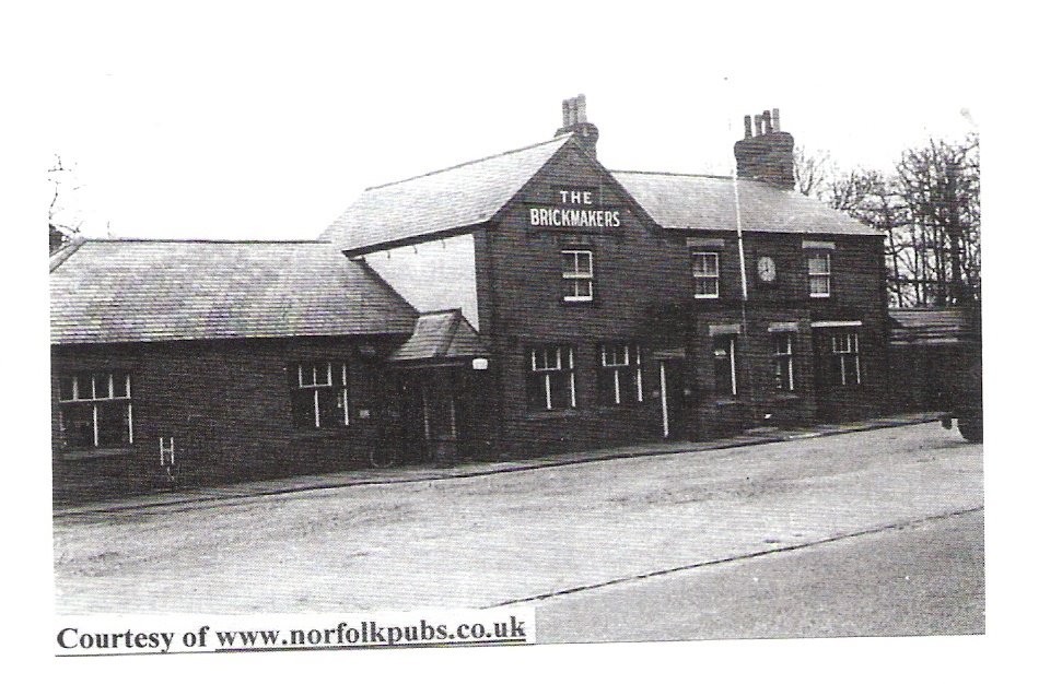
496 Sprowston Road - The Brickmakers
Thanks to Charlie from The Brickmakers who tells us some of the history of the pub after I asked her if the building today is the original pub..
"It’s the original building yes. The single storey bit on the left was added in 1939. The original pub was built in the very late 1800s. I have some very old plans somewhere, will find them and upload them for you to have a look at some point. The mock Tudor wood was added sometime before the 90s, not sure when.
Lots of great bands and artists have played at the pub including Ed Sheeran who performed here in 2008 as part of the Next Big Thing semi finals.
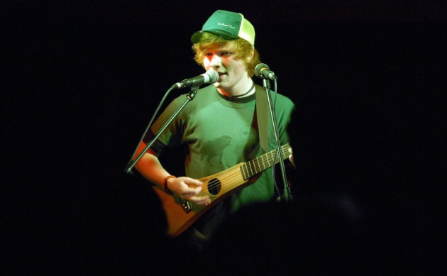
Ed Sheeran on stage at The Brickmakers
547 Sprowston Road
Used to be a shop
Used to be a shop
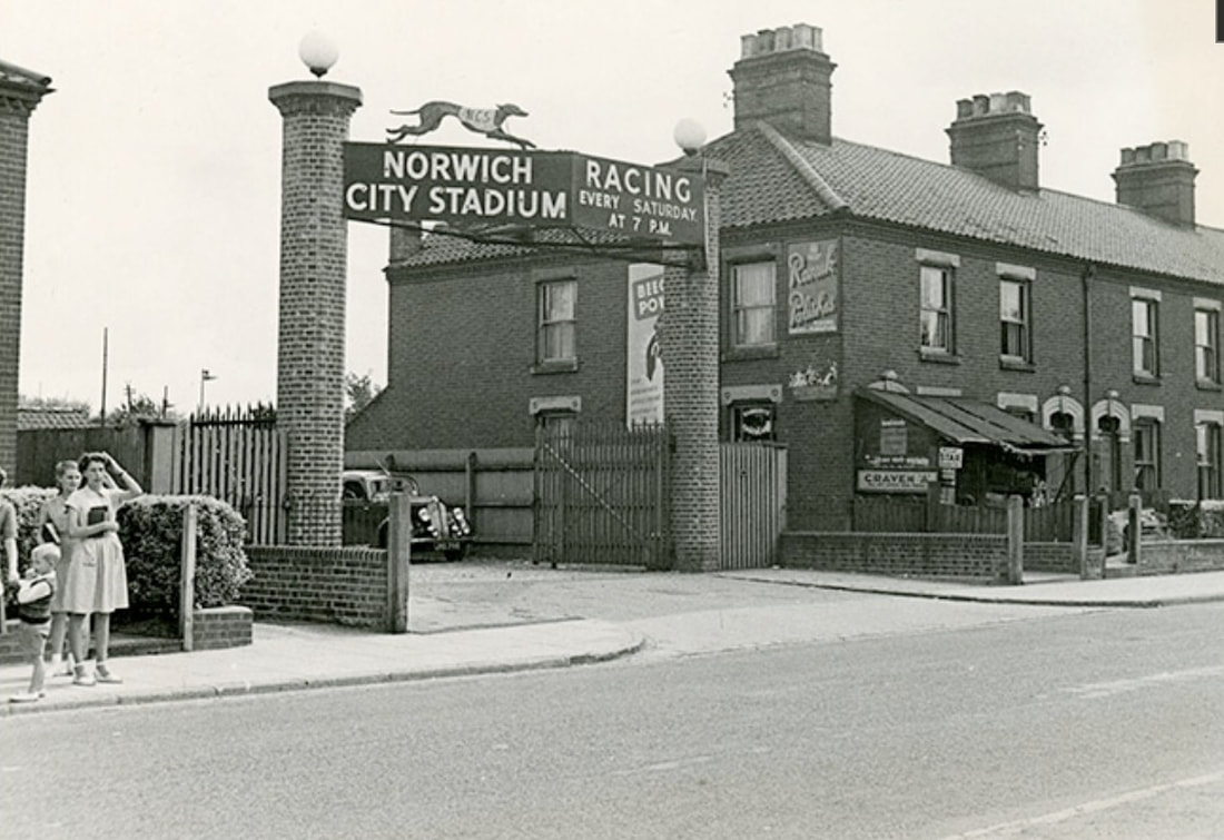
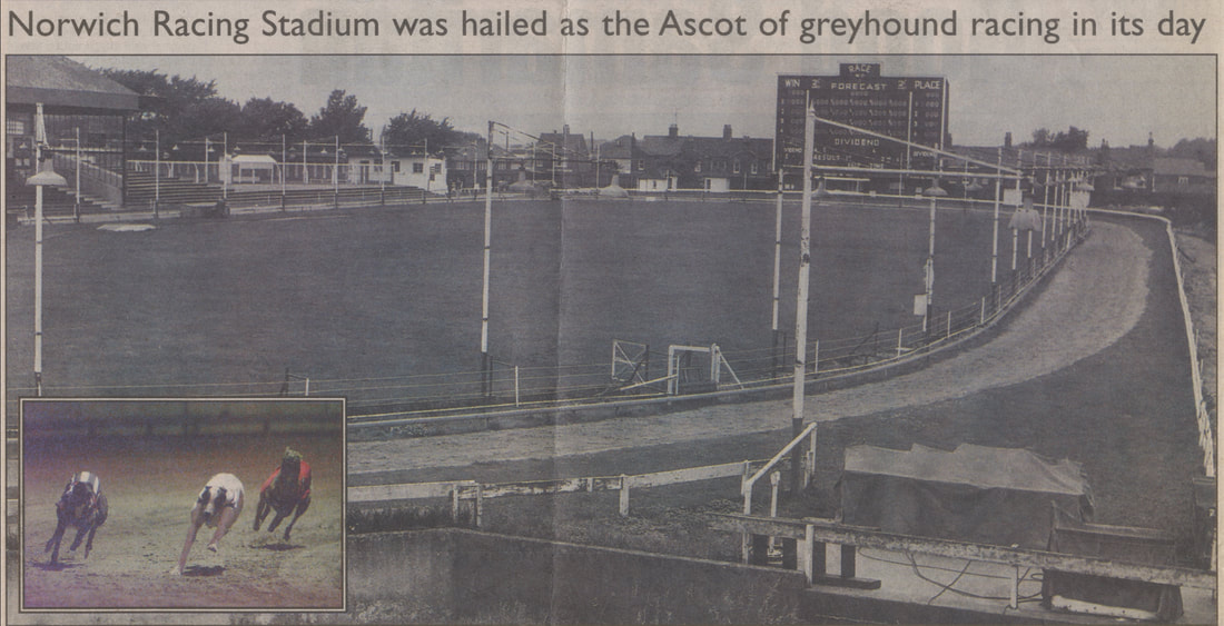
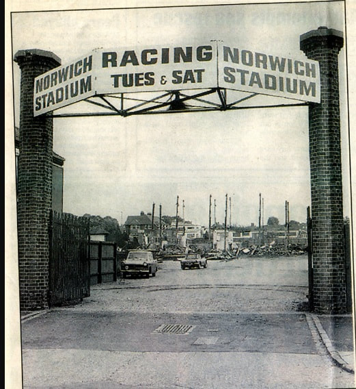
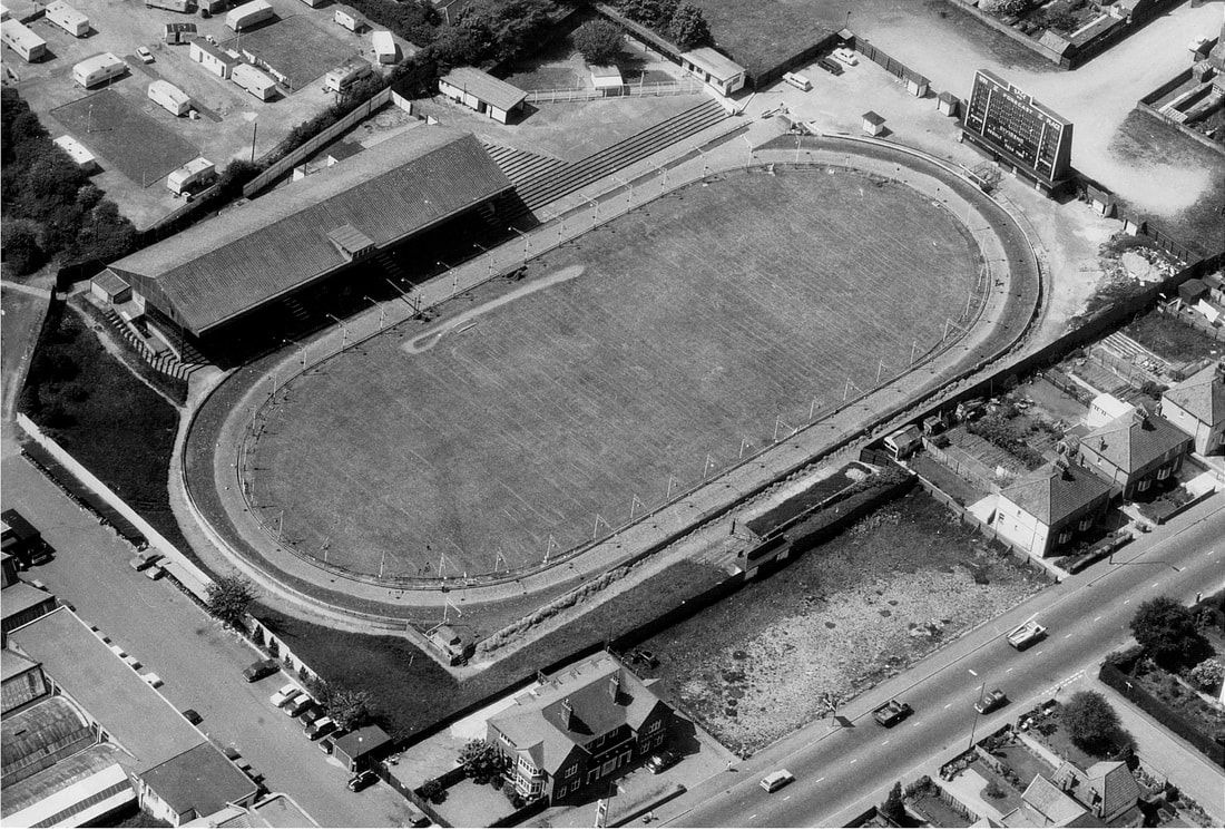
549-553 Sprowston Road
Norwich City Stadium a greyhound racing track was here in 1970.
Norwich City Stadium a greyhound racing track was here in 1970.
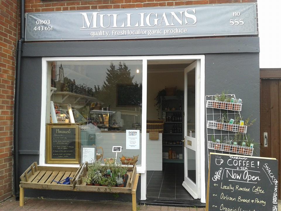
555 Sprowston Road
Used to be Mr. Horward general groceries store.
In 2014 it was Mulligans. In 2022 it is Bakaway
Used to be Mr. Horward general groceries store.
In 2014 it was Mulligans. In 2022 it is Bakaway
557 Sprowston Road - Newscene
Used to be Kandy Kabin
Used to be Kandy Kabin
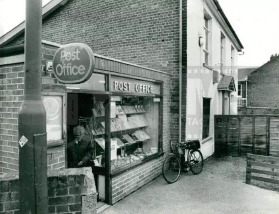
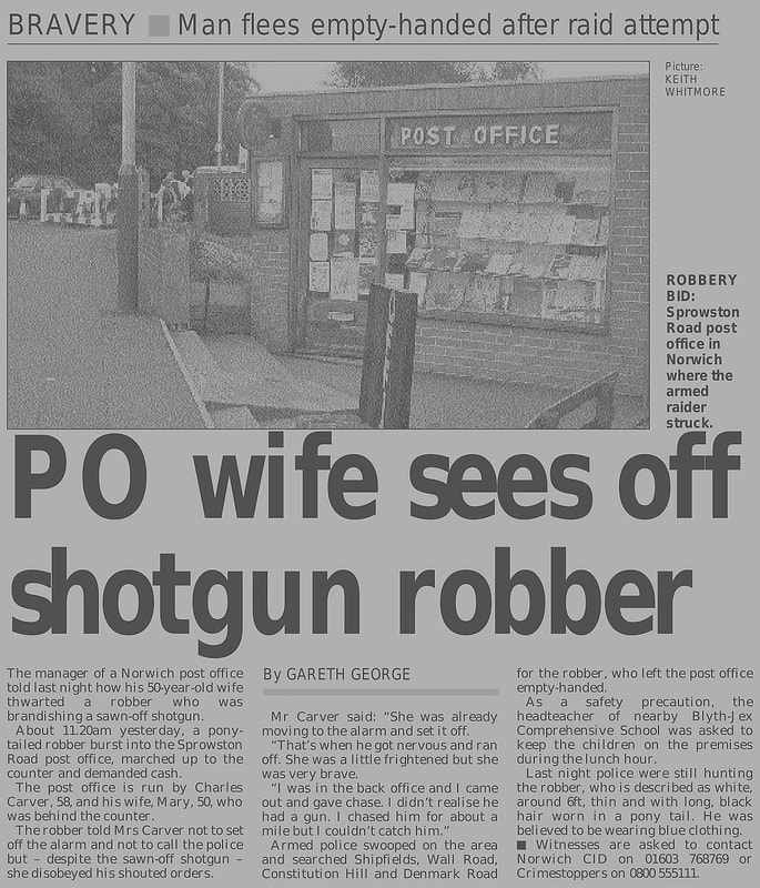
569 Sprowston Road
Used to be a Post Office.
Used to be a Post Office.
Copyright Archant 1998