
Thorpe Road, Norwich
Station Approach, Thorpe Road
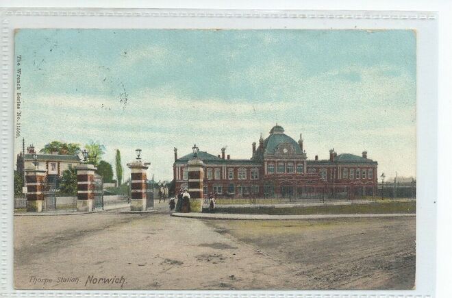
Thorpe Station.
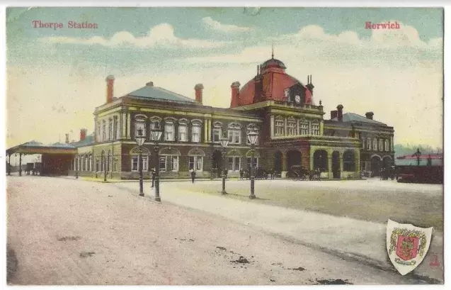
Thorpe Station.
1 Thorpe Road
Used to be Readicrete
Used to be Readicrete
43 Thorpe Road
In 1904 this house was called Iford House.
In 1904 this house was called Iford House.
45 Thorpe Road
This house used to be know as Durlstone.
This house used to be know as Durlstone.
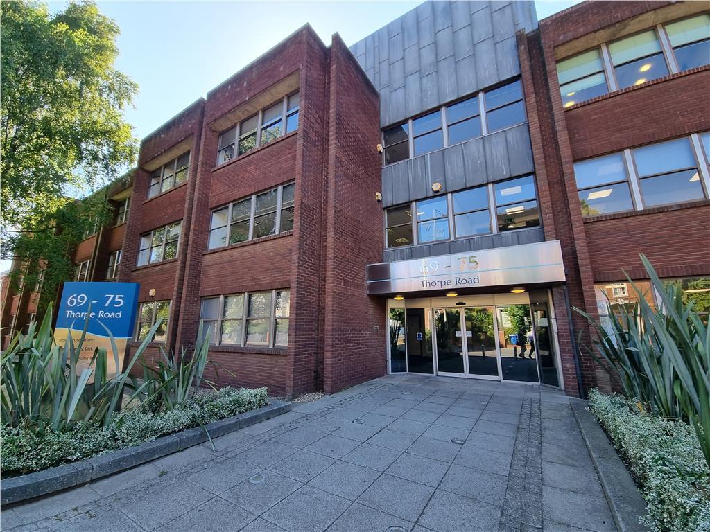
69 Thorpe Road
Used to be Norfolk Constabulary in 1962
Used to be Norfolk Constabulary in 1962
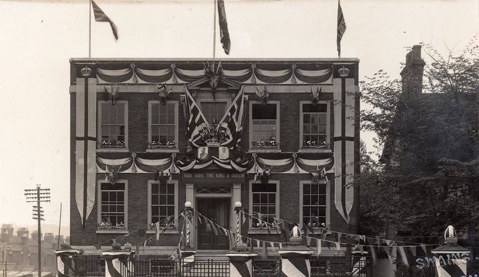
79 Thorpe Road bedecked for a state occasion: Probably the 1936 Coronation of George VI and Elizabeth.
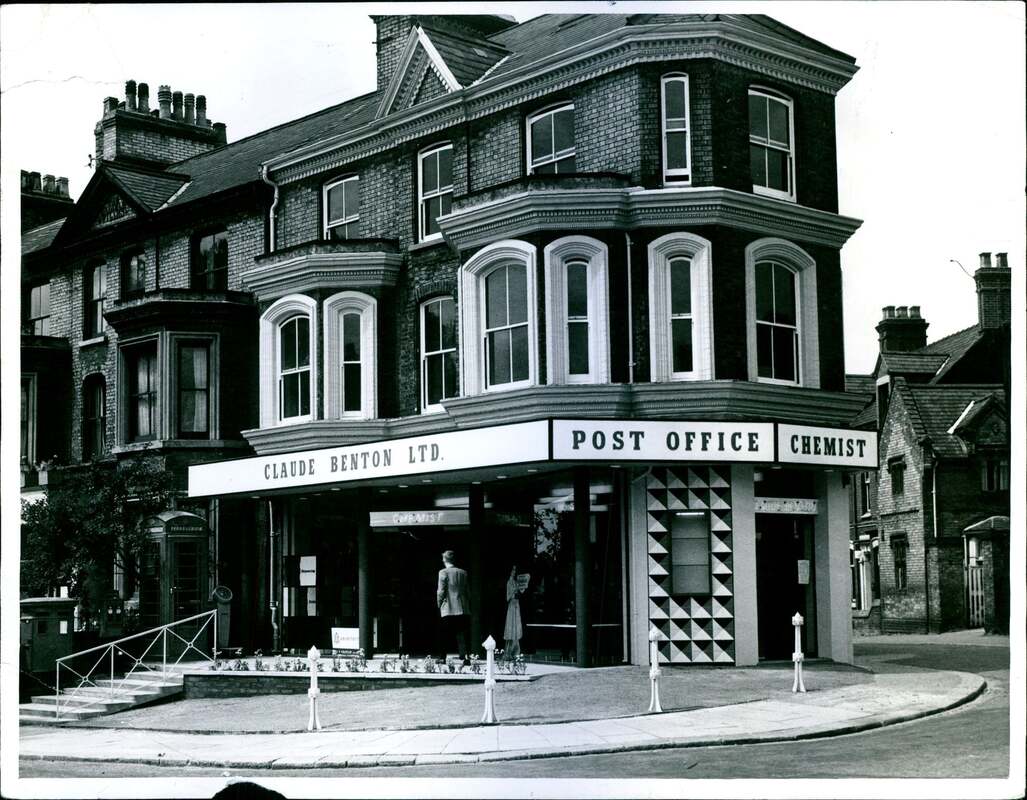
102 Thorpe Road - Tiffins
Used to be a post office and chemist called Claude Benton.
Used to be a post office and chemist called Claude Benton.
113 Thorpe Road
Used to be a sweet shop in 1912.
Used to be a sweet shop in 1912.
121 Thorpe Road
Used to be Rural Estates Building Company in 1968 and Thorpe House Estate Agents and later is was Designers hair and nail studio
Used to be Rural Estates Building Company in 1968 and Thorpe House Estate Agents and later is was Designers hair and nail studio
131 Thorpe Road
Used to be Eastern Truck Sales in 1967 and in 1975 it was Norwich Motor Services Ltd.
City Heights
Used to be Cumberland Hotel
The Denes
This used to be a ESSO petrol station and Thorpe Road Service Station. The Cumberland Hotel was opposite.
Used to be Eastern Truck Sales in 1967 and in 1975 it was Norwich Motor Services Ltd.
City Heights
Used to be Cumberland Hotel
The Denes
This used to be a ESSO petrol station and Thorpe Road Service Station. The Cumberland Hotel was opposite.
212 - 216 Thorpe Road
Cumberland Car Sales was at 216 Thorpe Road
Used to be Cumberland Hotel until 2007 then demolished. The hotel dates back to the 1960s and had 19 bedrooms it shut before Christmas 2007.
Old information about the hotel
https://www.edp24.co.uk/edp-property/norwich-eyesore-to-be-demolished-1-882447
Heritage Developments want to build 19 flats on the site of the run down former Cumberland Hotel, at 212 - 216 Thorpe Road, by spring next year.
They are currently waiting for planning permission before demolition and building work begins.
“I have had a lot of telephone calls in the last three or four months from people desperate for us to get going so that the eyesore goes and the antisocial behaviour stops”, said Matt Bartram, managing director of Heritage Developments.
“They will be a mixture of one to three bed flats”, he said.
He said the building was plagued by antisocial behaviour, graffiti and squatters and other issues associated with derelict buildings.
“As soon as we get permission to demolish we will have the building down immediately”, he said.
The developers already had a site on Yarmouth Road but wanted to work on building more flats.
“We wanted to develop another site along Yarmouth Road. It had been on the market for a while and I was reasonably confident I would get permission that was workable. The market in the area is ready for some flats.”
He said that they would be of a high quality, but they would be affordable as well.
Heritage Developments bought the site last November when it had outline planning permission.
The hotel dates back to the 1960s and had 19 bedrooms it shut before Christmas 2007.
There have been attempts to transform the hotels into flats since 2006 and permission was finally given for it to be demolished and outline permission for a development was given in 2008.
In 2009 the hotel was damaged by a series of fires and at the time neighbours said the Thorpe Road hotel had been beset by squatters and graffiti artists
A police spokesman said they were aware of the problems and they had been called to incidents at the site.
Mr Bartram said he hoped that the planning permission would be signed off in the next few days.
The reserved matters application to finalise planning permission details was sent to Norwich City Council on January 26 this year.
https://www.flickr.com/photos/manof2worlds/albums/72157622921200706/with/4153731598/
Independantly owned hotel situated a short distance from the city centre and the Riverside complex We offer a good quality service with friendly staff at reasonable prices Situated only 1/2 mile from the railway station with quick and easy access to the city centre, Castle, cathedral and Norwich City Football ground. Ideally located to visit the Norfolk Broads and surrounding villages. Restaurant and bar facilities, free car parking on site. Conference facilites available.
