
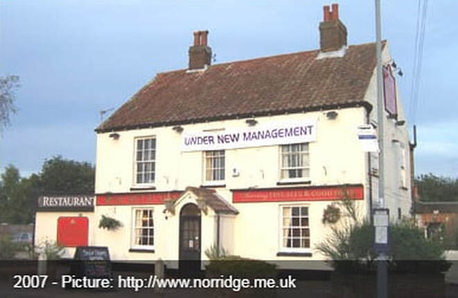
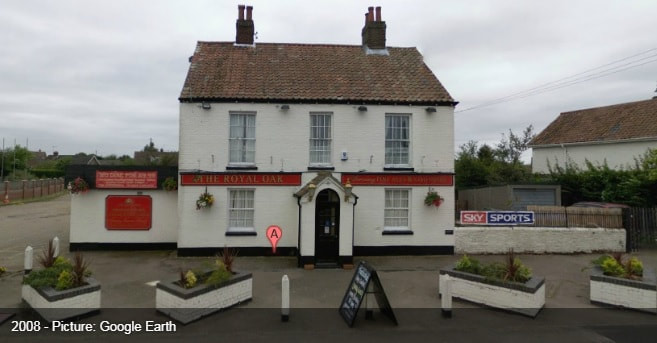
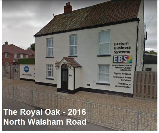
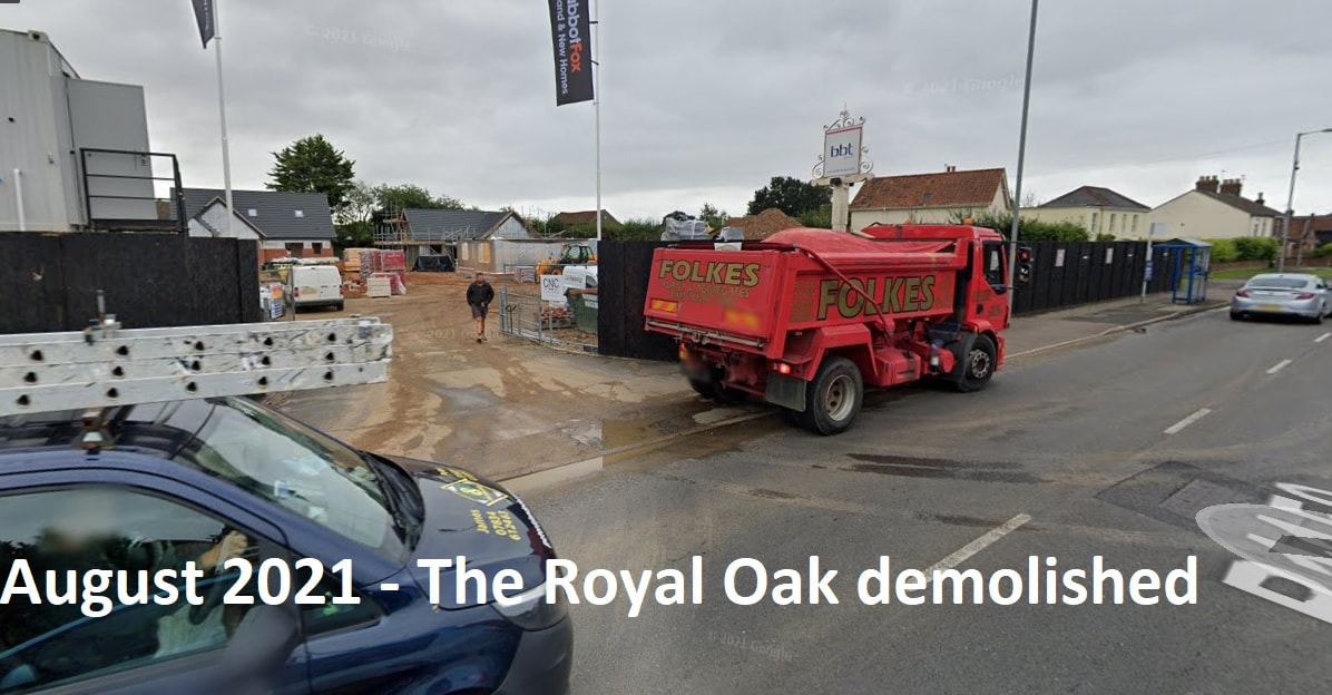
North Walsham Road
12 North Walsham Road
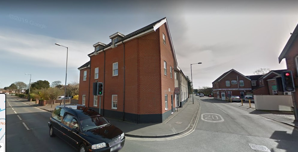
Now called Woodman Court but I think this is now on School Lane but the original building and address was 2-4 North Walsham Road. It has been many different shops through the years. Here are some of the old shop names. If you know more get in touch.
Bob Clarkes Grocery Store was here who also doubled up as a chimney sweep.
Simcock's which at some point was run by George Simcock (pictured below). Deborah J Slattery tells us "George Simcock always added up the items in your basket in his head. He was so quick you never got a chance to work out whether it was right. He was a huge character and the shop was always busy."
George's son David Simcock worked at the store for many years before taking it over. David became a Conservative Agent for North-West Norfolk in 1981.
It has also been a bakery at some point if anyone knows when
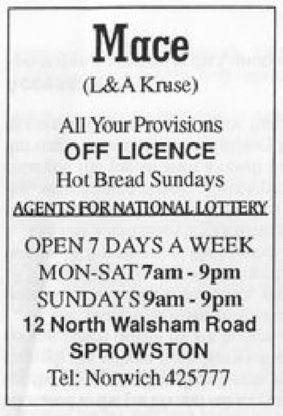
Lastly it became a Mace Shop and then Linda and David's run by Linda and David Kruse. There was a car crash and a fire in about 2006 The rebuilding started soon after but then it was left unfinished for several years. The flats were finally finished about 2012.
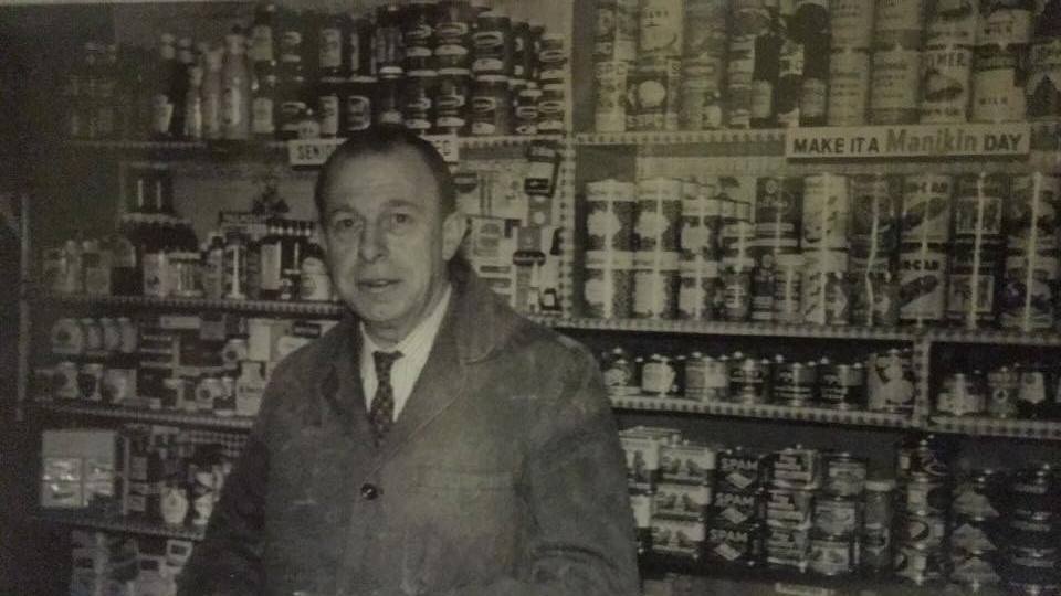
George Simcock who ran the shop Simcocks. Credit: Ron Sheldon
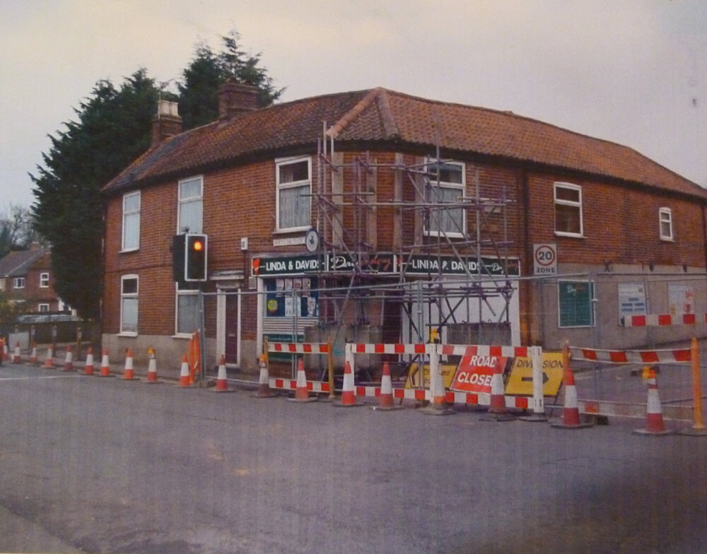
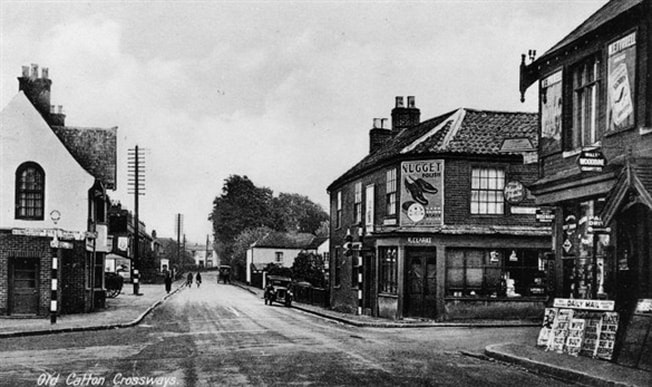
IMAGE COURTESY OF NORFOLK COUNTY COUNCIL LIBRARY AND INFORMATION SERVICE - ENJOY THOUSANDS OF IMAGES OF NORFOLK'S UNIQUE HISTORY AT www.picture.norfolk.gov.uk
As it is today
11 North Walsham Road - The Woodman Public House
To the left of The Woodman used to be two cottages. One of these was a butchers run by Mr Webb. When the road was widened the cottages were demolishd and he moved to where The Corner Shop is now on the corner of George Hill and North Walsham Road at 127 Constitution Hill.
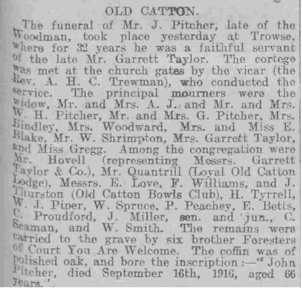
The funeral of John Pitcher the landlord from 1911-1916 took place at Trowse. He died on September 16th 1916 aged 66.
To the left of The Woodman used to be two cottages. One of these was a butchers run by Mr Webb. When the road was widened the cottages were demolishd and he moved to where The Corner Shop is now on the corner of George Hill and North Walsham Road at 127 Constitution Hill.
The funeral of John Pitcher the landlord from 1911-1916 took place at Trowse. He died on September 16th 1916 aged 66.
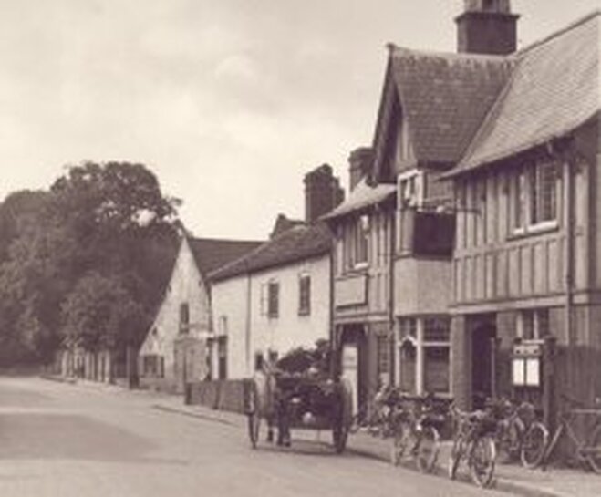
1935 - norfolkpubs.co.uk
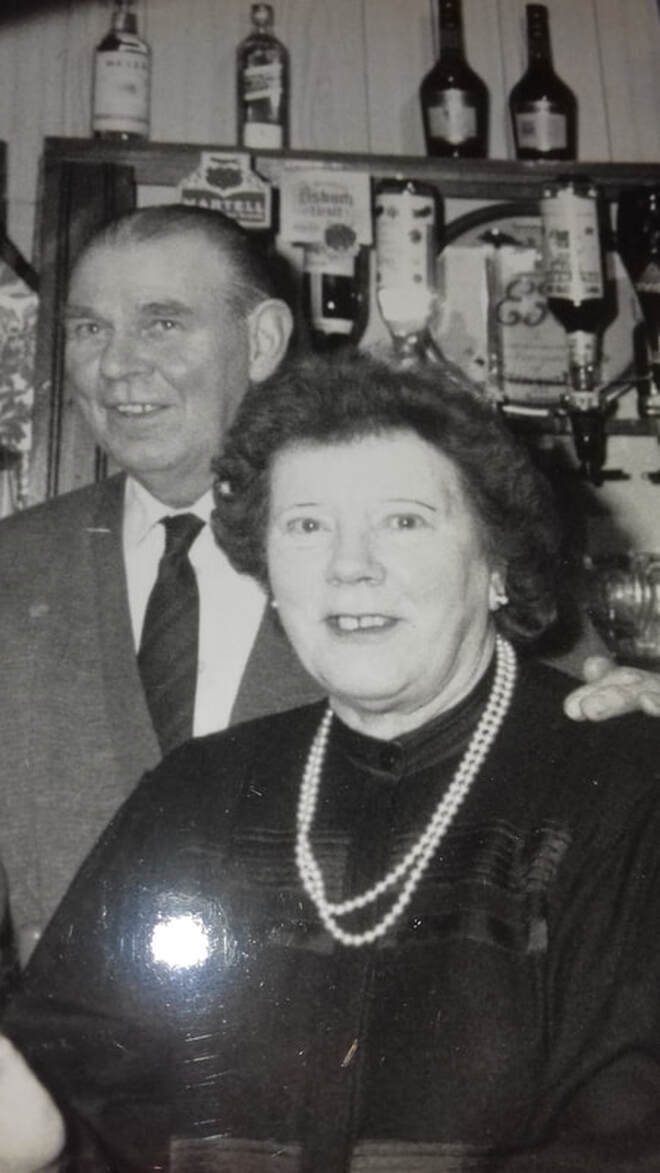
Ken and Kathy Spinks at The Woodman
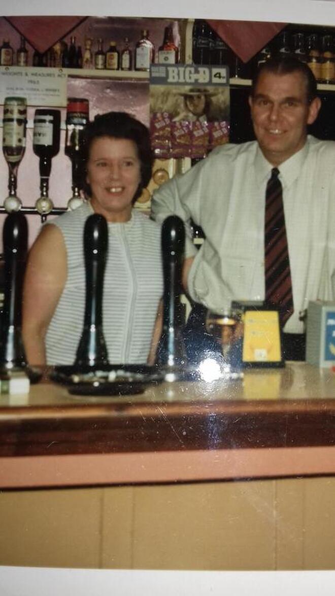
Ken and Kathy Spinks at The Woodman
25 North Walsham Road - The Old Post Office
There was a Post Office at No 25 North Walsham Road. The house is still there. It was run by Alice Osborn in 1944. The original Post Office was where the express shop is now on the corner of George Hill and Constitution Hill.
There was a Post Office at No 25 North Walsham Road. The house is still there. It was run by Alice Osborn in 1944. The original Post Office was where the express shop is now on the corner of George Hill and Constitution Hill.
1944
38 North Walsham Road
Local district Nurse Hurst lived here in 1940.
Local district Nurse Hurst lived here in 1940.
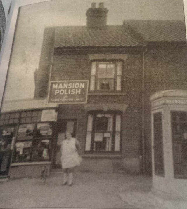
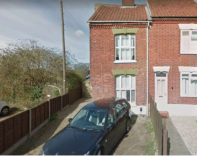
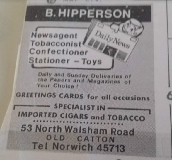
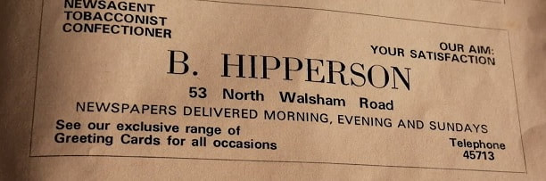
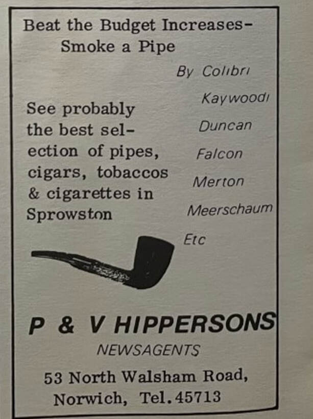
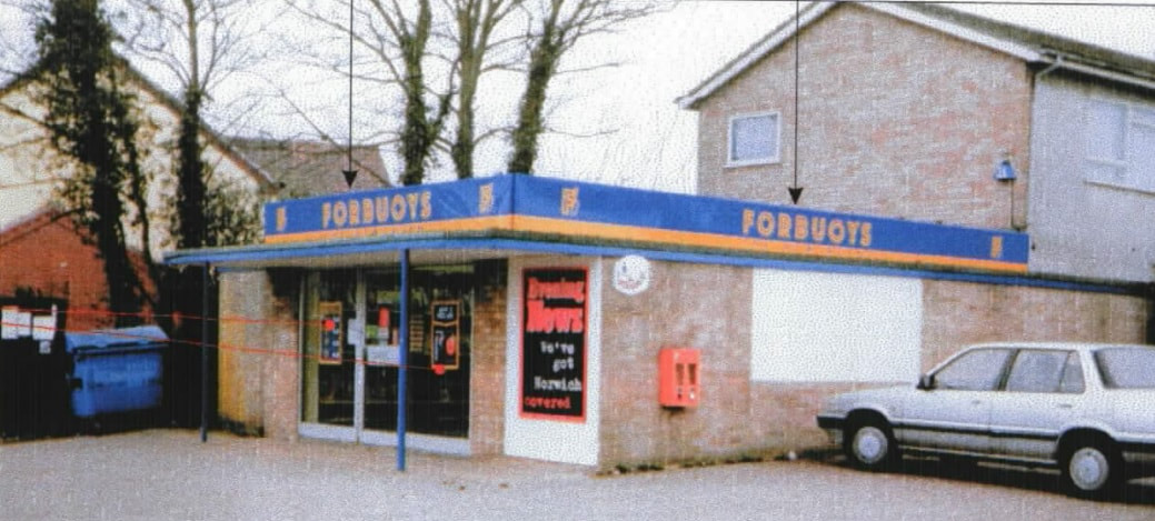
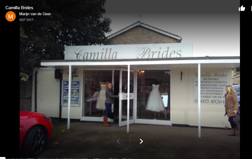
53 North Walsham Road - Camilla Brides
This shop was built around 1969 and started out life as a shop called Hippersons. Brian and Valerie Hipperson kept it from the start. Mike Smith got in touch to say that he was a papeboy there from 1969 - 1973. Later it became Martins Newsagents. It was also Forbuoys that Clive and Shirley ran and that closed in 2000. Later it became Spencer Ward Residentials. Anyone know what else it was? It is now Camilla Brides and the bride shop has been running for over 30 years but not always at this location.
Richard Birchenall tells us
I am sure Brian Hippersons original shop was on the corner of School Lane and Constitution Hill which he took over in 1959 when I think he was only 19 years old which is some achievement at that age. Later this shop was owned by a Mr Etchel and after that it was a flower shop for a long time and is now an estate agents. Brian and Valerie Hipperson sold there Newsagents business to Forbuoys Ltd in April 1980 after running it for 21 years . Don and Lin Ruth managed the business until June 1985 when they moved back to there native Isle of Wight. Looking at the house to the rear of the shop at number 53 North Walsham Road there is evidence that it was once originally a bungalow as there is a distinct difference in the brickwork from where the roofline of the original bungalow would have been. I did a paper round for Brian from 1978 until he sold the shop and then for Don when Forbuoys took it over. Hope this information brings back some happy memories.
1977
1998
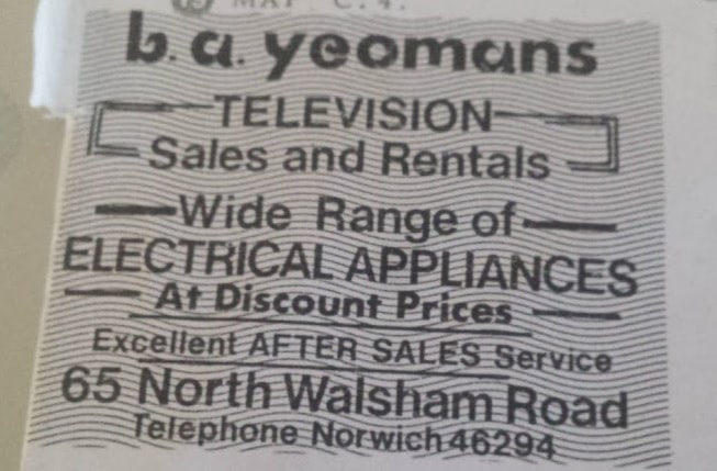
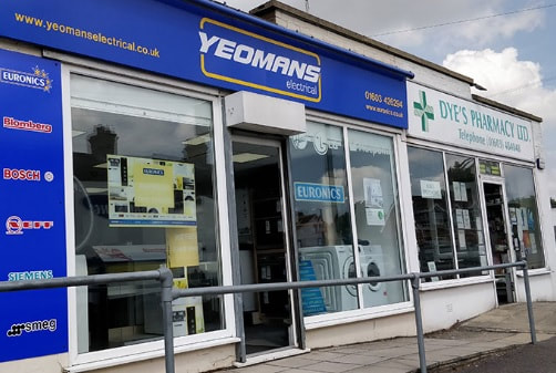
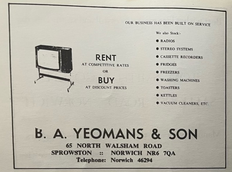
65 North Walsham Road - Yeomans
Established in 1963 by Bernard & Joan Yeomans. Used to be on Ber St.
Established in 1963 by Bernard & Joan Yeomans. Used to be on Ber St.
1973
1977
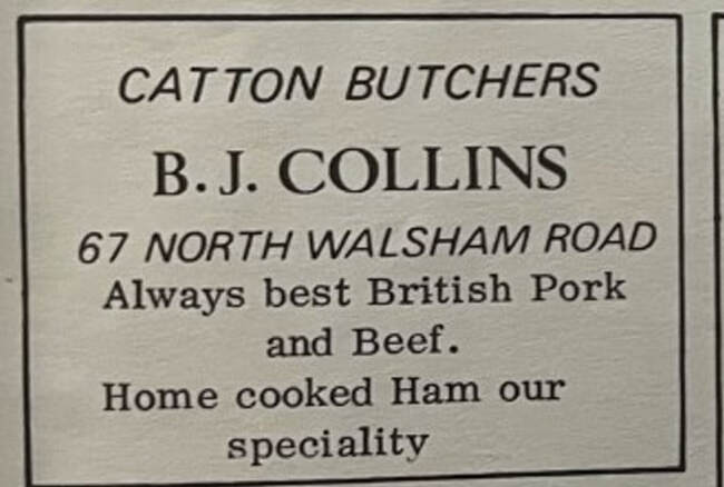
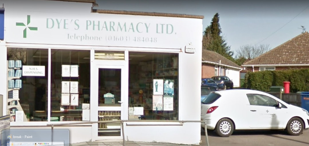
67 North Walsham Road - Dye's Pharmacy
Used to be Catton Butchers shop in 1977.
Used to be Catton Butchers shop in 1977.
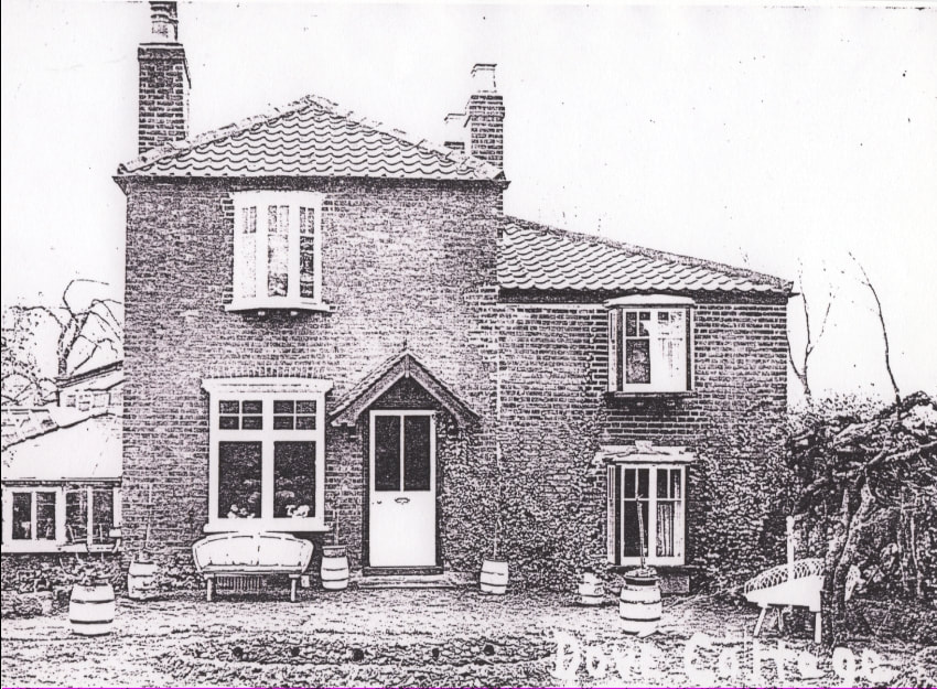
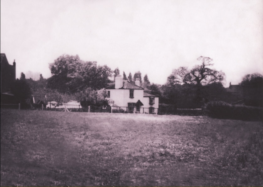
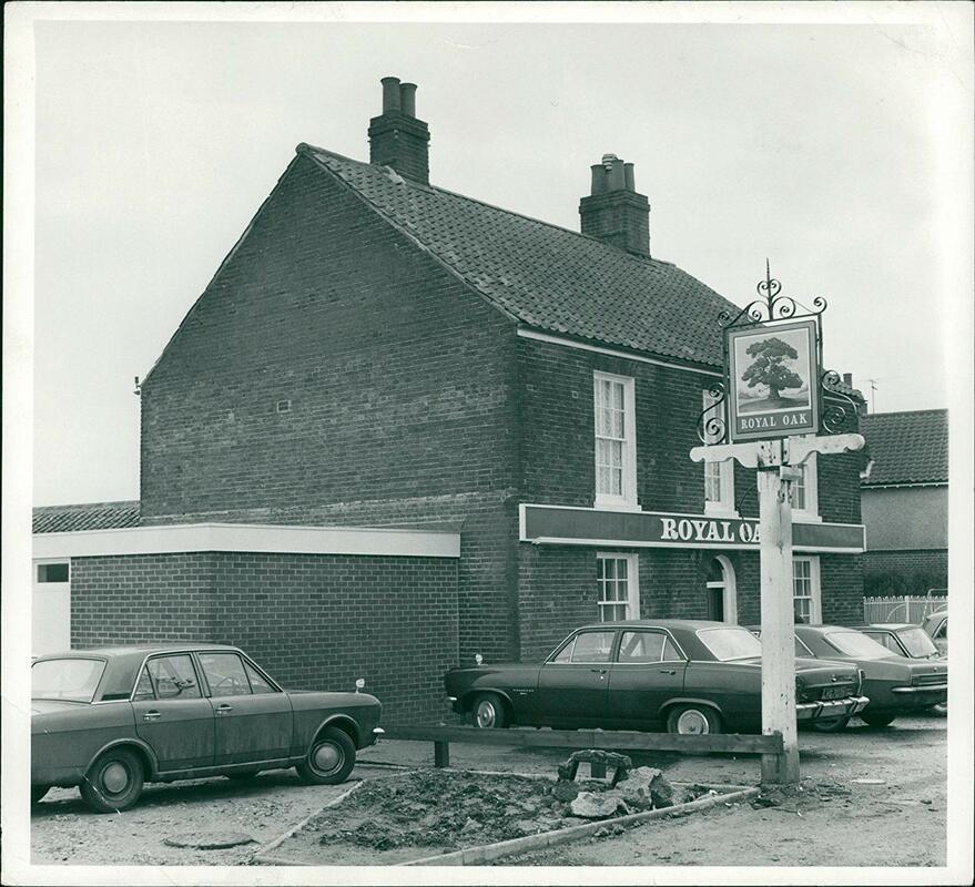
78 North Walsham Road - The Dove
The house below is shown as being a public house called The Dove in this old map from 1842-1952. Dovedales was named after it. It closed on 21st June 1909.
The house below is shown as being a public house called The Dove in this old map from 1842-1952. Dovedales was named after it. It closed on 21st June 1909.
Michael Copland
5 mins · Edited
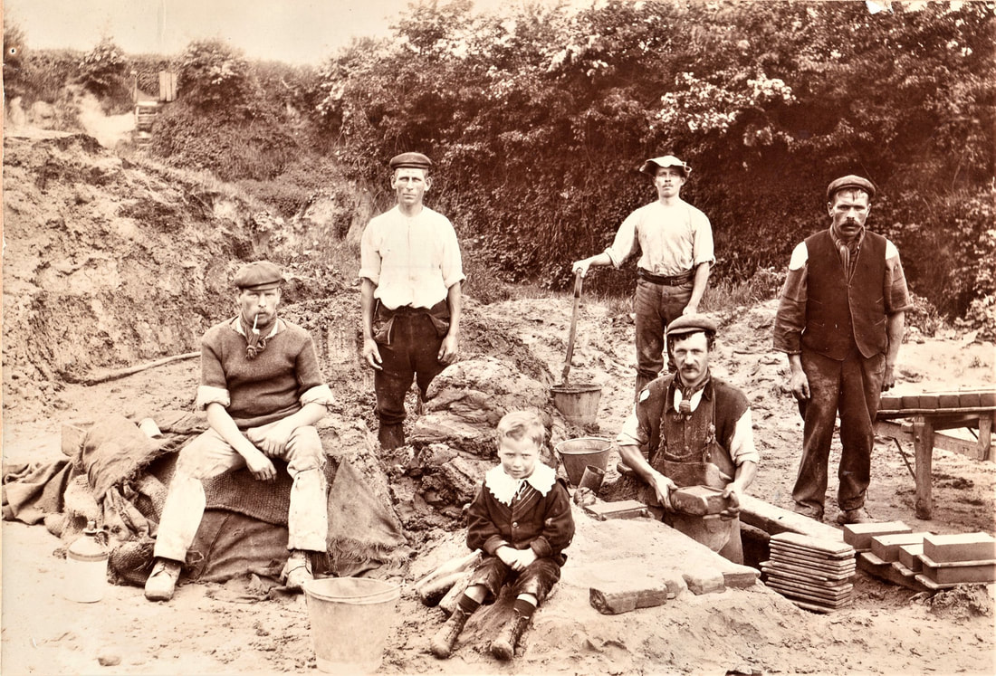
Many, Many thanks for this, my Great Grandfather Daniel Shorten was Licensee of the Dove from 1879-1883 & also a Brickmaker, my Grandmother was born there, this is a pic of him sitting, smoking pipe making Bricks & somewhere on Sprowston Road.
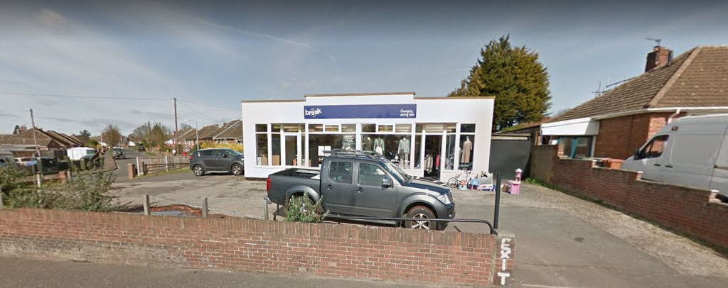
83 North Walsham Road - Break Charity Shop
This is now a charity shop. It used to be a hardware store for many years and before that a Co-Op and a video shop. In 1965 when it was a Co-Op Daphne Cooper used to work behind the tills.
This is now a charity shop. It used to be a hardware store for many years and before that a Co-Op and a video shop. In 1965 when it was a Co-Op Daphne Cooper used to work behind the tills.
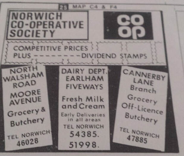
Advert from 1973
88 North Walsham Road
This was a Post Office around 1969 run by Mr and Mrs Carver.
This was a Post Office around 1969 run by Mr and Mrs Carver.
98, 98a & 98b North Walsham Road
This row of houses facing the opposite way to the others we think may have been workers to the brick yard where Dovedales is now or old farm houses.
This row of houses facing the opposite way to the others we think may have been workers to the brick yard where Dovedales is now or old farm houses.
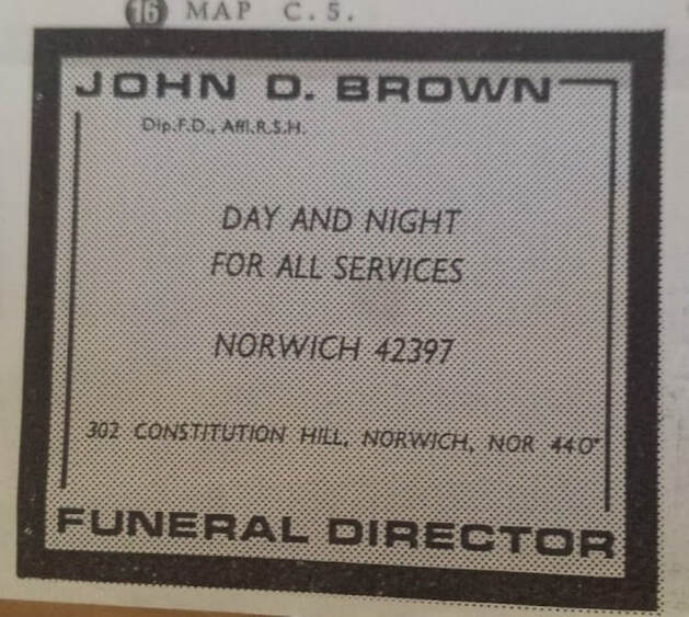
102 North Walsham Road - John Brown Funeral Services
This used to be the site of the Old Catton Methodist Church. There was also a Sunday school here run by Ethel Futter and her Dad in the 1950's. In the 1970's a Milkman used to house his horse and cart in the gardens of the school buildings. The church was taken down and in its place the current building was built. The company was established in 1970 and originally on 302 Constitution Hill before moving to North Walsham Road.
This used to be the site of the Old Catton Methodist Church. There was also a Sunday school here run by Ethel Futter and her Dad in the 1950's. In the 1970's a Milkman used to house his horse and cart in the gardens of the school buildings. The church was taken down and in its place the current building was built. The company was established in 1970 and originally on 302 Constitution Hill before moving to North Walsham Road.
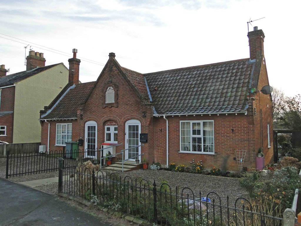
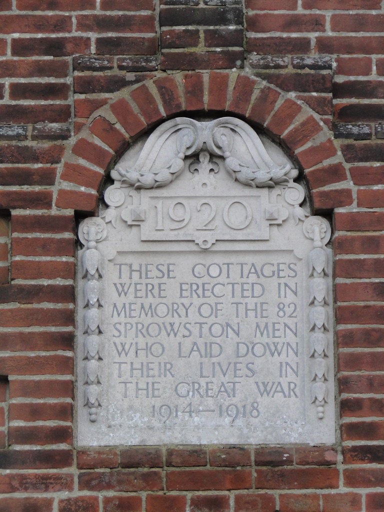
104-106 North Walsham Road - War Memorial Cottages
These were built to commemorate those men of the parish who did not return home from World War I in 1918.
These were built to commemorate those men of the parish who did not return home from World War I in 1918.
112 - 114 North Walsham Road
This used to be Foxes Grocery Shop run by Mrs Fox and her husband ran a carpentry business. it was later kept by Maurice and Pauline Lince, then it passed hands several times before closing. If anyone has pictures of the shop I would love to add them here.
This used to be Foxes Grocery Shop run by Mrs Fox and her husband ran a carpentry business. it was later kept by Maurice and Pauline Lince, then it passed hands several times before closing. If anyone has pictures of the shop I would love to add them here.
118 North Walsham Road
Used to be a guest house in 1983. This was built in the 1860's.
Used to be a guest house in 1983. This was built in the 1860's.
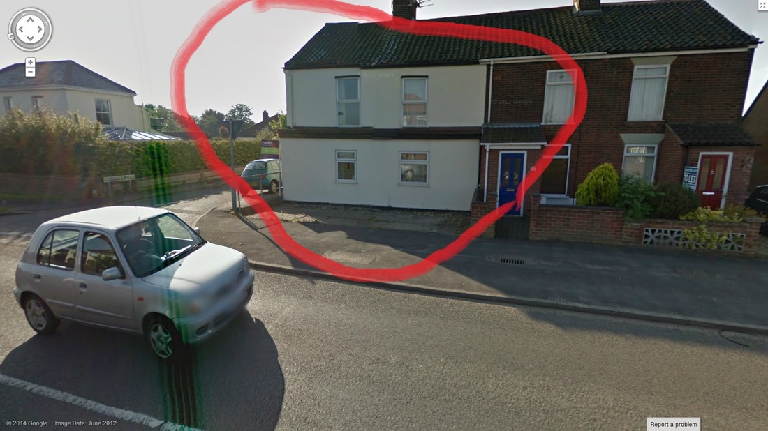
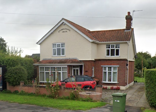
120 North Walsham Road
House is called Stubblegate and was built in 1924
House is called Stubblegate and was built in 1924
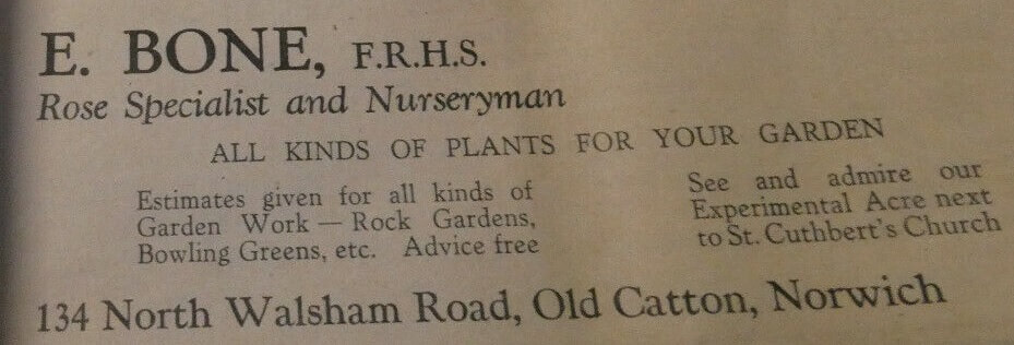
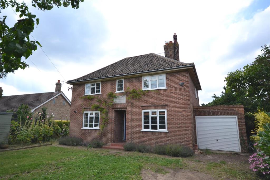
134 North Walsham Road
This was the home of Mr E. Bone who was a rose specialist and nurseryman in 1940.
This was the home of Mr E. Bone who was a rose specialist and nurseryman in 1940.
137 North Walsham Road
Used to be a Police House.
Used to be a Police House.
169 North Walsham Road
The boundary between Sprowston and Old Catton runs through this shop.
The boundary between Sprowston and Old Catton runs through this shop.
171 North Walsham Road - Progress Fuels
Used to be Gold Seal Garage in 1992/ and Texaco
Used to be Gold Seal Garage in 1992/ and Texaco
