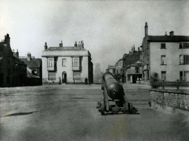
Marine Parade, Great Yarmouth
Atlantis Tower Complex
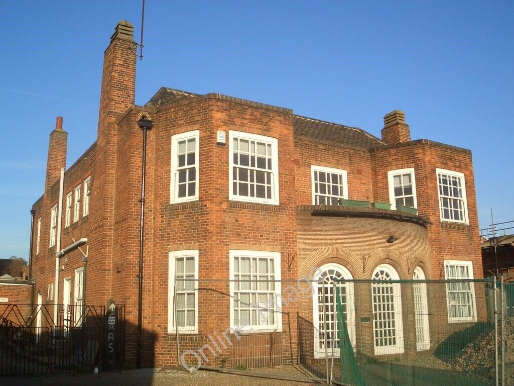
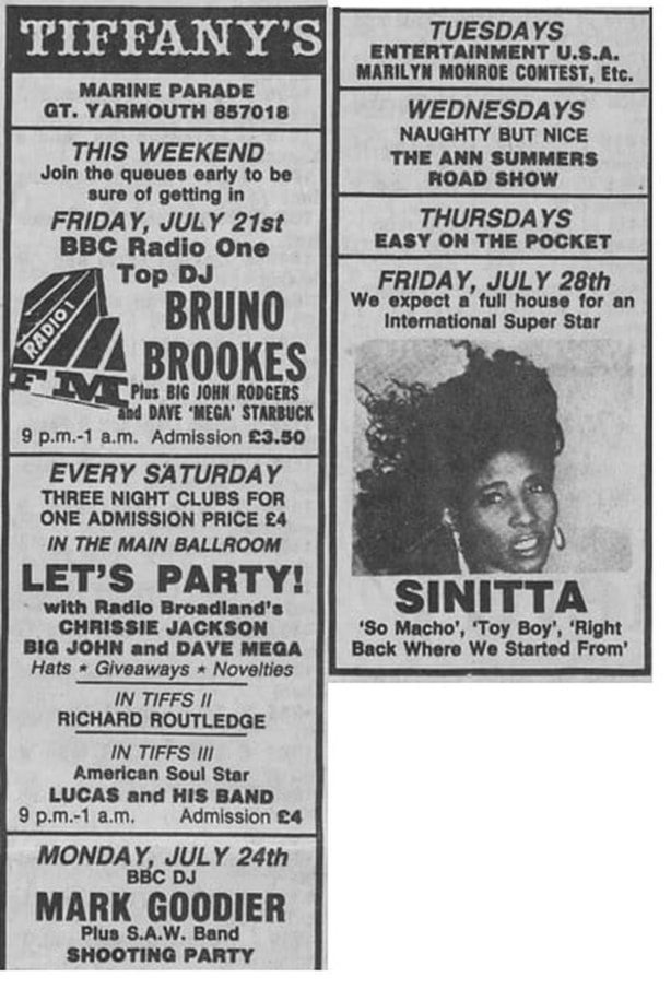
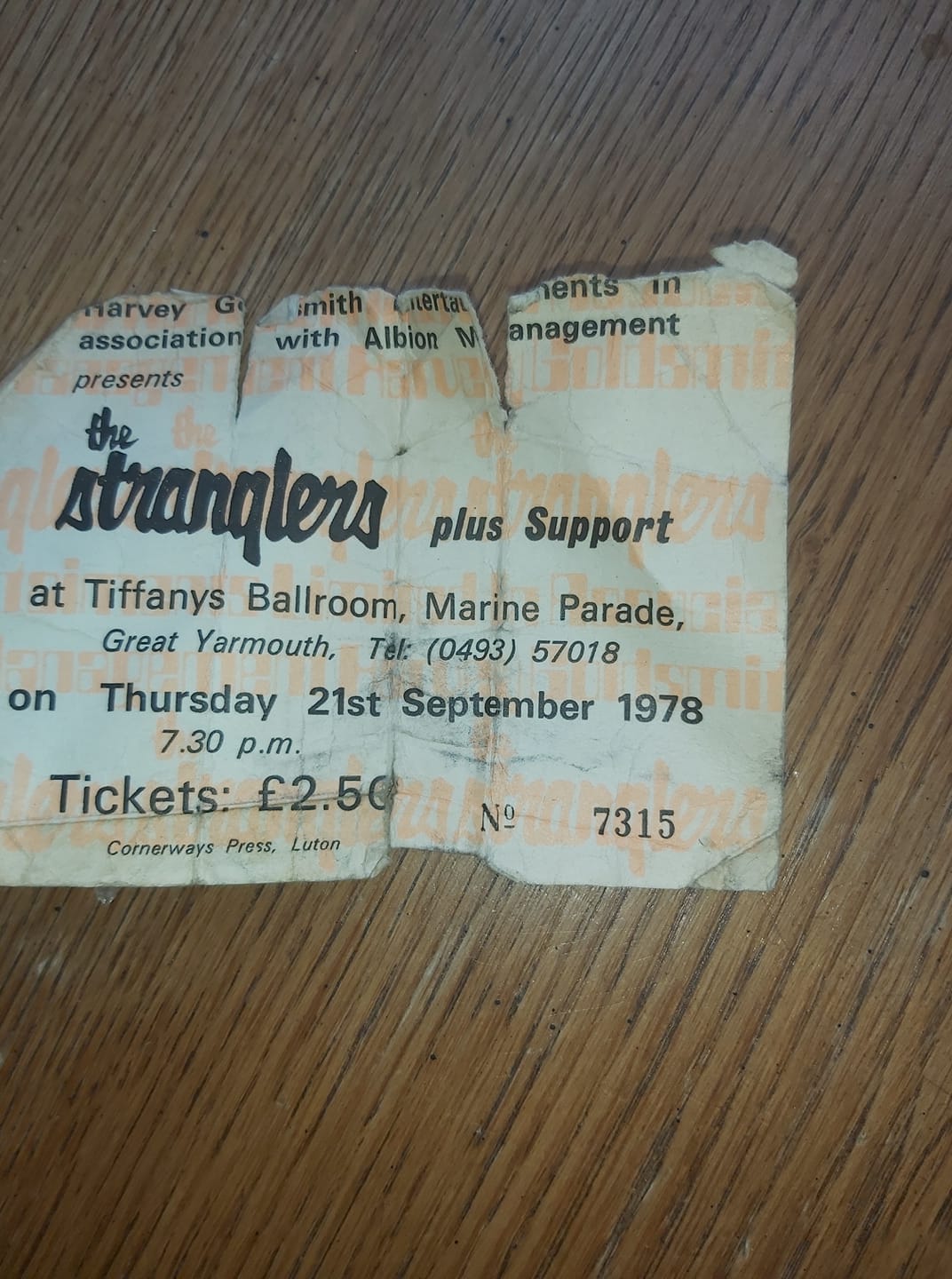
Used to be Tiffanys Ballroom. Chrissie Jackson who used to be on Radio Broadland and BBC Radio Norfolk used to be one of the resident DJ's.
Used to be Tiffanys Ballroom. Chrissie Jackson who used to be on Radio Broadland and BBC Radio Norfolk used to be one of the resident DJ's.
Central Beach
The BBC Radio 1 Roadshows used to here most years. It was the highlight of the year and the beach was always packed out. Vibe FM and T4 also did similar shows in the same spot.
In 1994 Mark Tonderai presented acts including The Farm, Sub Sub, Two Cowboys, Charlene Smith and Ronnie Simon.
The BBC Radio 1 Roadshows used to here most years. It was the highlight of the year and the beach was always packed out. Vibe FM and T4 also did similar shows in the same spot.
In 1994 Mark Tonderai presented acts including The Farm, Sub Sub, Two Cowboys, Charlene Smith and Ronnie Simon.
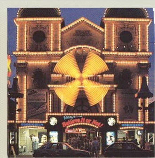
9-10 Marine Parade, Great Yarmouth - Windmill Adventure Golf
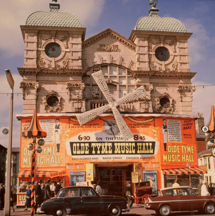
Used to be The Gem Theatre and the Windmill Theatre.
https://www.windmilladventuregolf.co.uk/
Taken from the Windmill Adventure Golf website. Full credit for the text and amazing history of the building below.
The Windmill Adventure Golf is not just a round of crazy golf. It is a unique experience that can be shared by all the family, young and old. The incredible themed settings throughout the course are packed with cinema history and theatre memorabilia, and to give you an idea why so much heritage can be found in this unique building we have to go back to the beginning.
The building started life as The Gem Theatre. Designed by architect Arthur S. Hewitt. Initially intended to be a menagerie for displaying wild animals, however opinion from locals swayed it to become one of the country’s first electric picture houses instead. The Gem opened on Saturday July 4th 1908, for the ‘Electric Vaudeville’; a continuous flow of films. Today it is now one of Britain’s earliest surviving Cine Variety buildings.
It had a magnificent display of electric light bulbs attached to the front of the building which gave it the nick-name ‘Palace of a Thousand Lights’. Inside a seating provision for over 1000 would be often full to witness engrossing moving pictures. One of the original conditions of the cinema license, like the local bathhouses, men and women weren’t allowed to mix and had to sit on opposite sides of the auditorium.
Prices when the cinema opened were; 2d, 4d and up to 6d if you sat in a plush seat at the front. In today’s money it cost just under 2p for a front seat!
Theatre owner and before becoming London leading West End producer C.B. ‘Cockie’ Cochran used to stand outside the theatre barking and enticing people in, which was soon banned by the local council.
In 1948, local impresario Jack Jay took over ‘The Gem’ and transformed into a theatre, The Windmill Theatre. Before re-opening Jack Jay fitted a set of sails to the front of building, which was partly influenced by the string of windmills which used to line the Great Yarmouth seafront, and to pay homage to the world famous music hall ‘The Moulin Rouge’ in Paris. They are still there today.
Stars who have appeared there include many legendary variety and pop superstars, from Billy Fury, Marty Wilde, Norman Wisdom, Max Bygraves, Sid James, Tommy Trinder and many others show casing popular TV stars; Love their Neighbour, On the Buses, and Crossroads, all huge hits at the time.
For a number of summer seasons The Windmill was home to the wonderful Lancashire Comedian, George Formby. The 1959 Summer Season was sadly George’s last season here before his death, however never forgotten there is a memorial inside the course, which pays tribute to the star.
See More Historical Windmill Photos
Summer Shows were packed with artistes The Billy Fury Show, Karl Denver, Chic Murray and the 1962 starred Tommy Steele, Frankie Howerd, and was the first season for local band Peter Jay and the Jaywalkers. Freddie Starr fronted the final Summer Show season in the early eighties.
The Windmill theatre built an illustrious history of famous performances and talent right through until it’s unfortunate decline in the early 1980’s, where the boom of home television was impacting local cinema and theatre. With the Windmill being one of five theatres and cinemas along the seafront, it was again forced to adapt to the times.
Whether you remember watching an iconic film, experiencing a Summer Show performance, darting around ‘Wally Windmills’, visiting ‘Ripley’s Believe It or Not’ Odditorium, or the Waxworks, you can reminisce throughout the uniquely themed crazy golf course.
The Windmill has had probably the most varied uses in a British theatre history in the country, and now Britain’s first most spectacularly themed indoor golf adventure right here in Great Yarmouth.
9-10 Marine Parade,
Great Yarmouth,
Norfolk.
NR30 3AD
01493 844172


11 - 12 Marine Parade, Great Yarmouth - Harry Ramsden's
Used to be Steam Packet pub
Used to be Steam Packet pub
16 Marine Parade, Great Yarmouth - Barking Smack
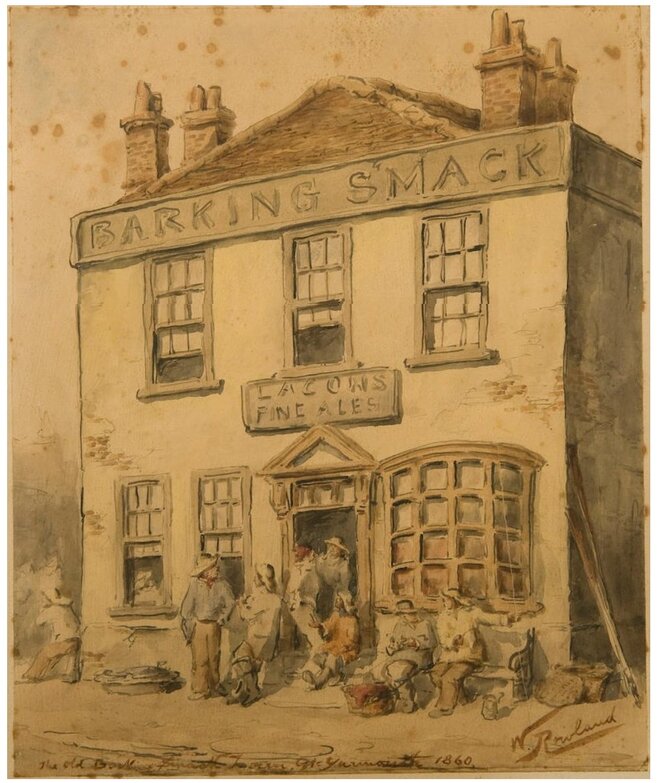
1860 - Credit not known
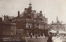
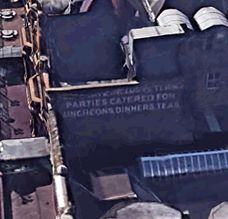
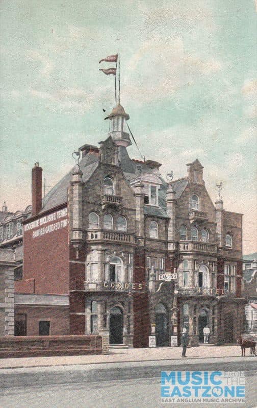
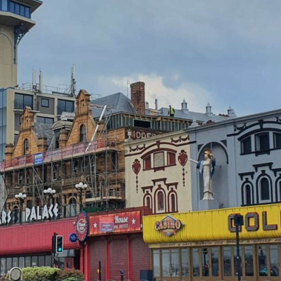
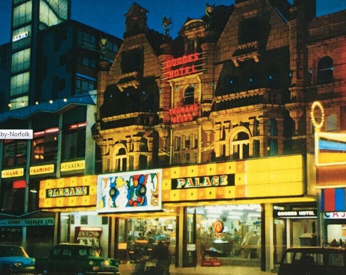
33 Marine Parade, Great Yarmouth - Caesars Palace
Used to be Goodes Hotel above the arcade.
Used to be Goodes Hotel above the arcade.

42 - 44 Marine Parade, Great Yarmouth - Leisureland
Used to be Stagecoach (arcade?)
Used to be Stagecoach (arcade?)
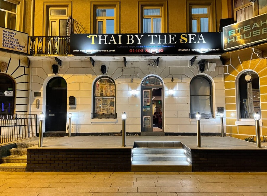
62 Marine Parade, Great Yarmouth - Thai By The Sea
Used to be Marlborough Boarding House in 1911.
Used to be Marlborough Boarding House in 1911.
Pleasure Beach
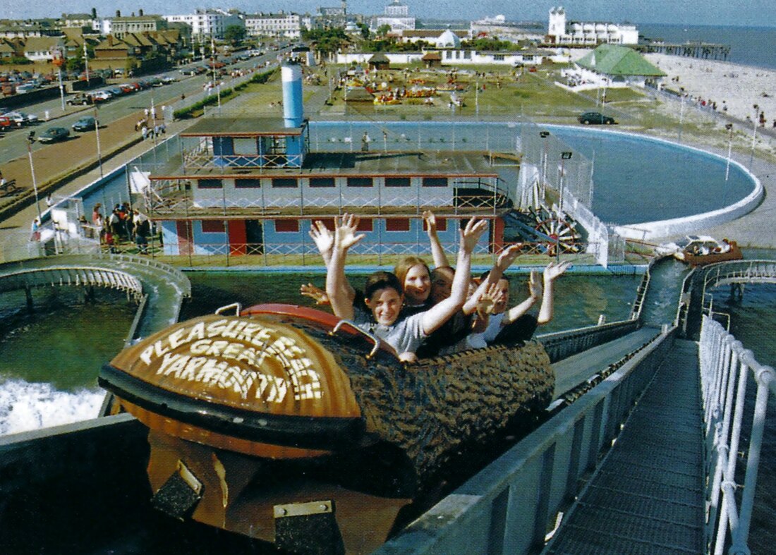
The Log Flume opened on Sunday 18 June 1981. Its first passengers were two local MP’s, Michael Carttiss and David Porter, who both officially opened the ride, together with Norwich Town Crier, David Bullock, and Albert Jones. The ride was installed at the south boating lake, which had long been a source of wrangling between Botton Brothers and the local council as to how best to utilise the space as holiday-maker expectations changed over time. The ride has operated ever since and generally follows only the Scenic Railway in popularity and income for the park.
It is generally criticised for its heavy industry look. It was always the intention to clad the ride and theme it accordingly. However, council planning never allowed this for concern it would block views of the beach and sea from Marine Parade, which had been one of the concerns in the aforementioned wrangling.
The ride consists of a large station loading area, meandering water course and three drops of heights 8 metres, 5 metres and 11 metres (in order). Conveyor belts carry the logs to the top of each drop and gravity brings them back down with a splash. The flow of water in the course carries the logs around to the next drop before bringing them back to the station loading area. This image show the view from to top of the highest point of the ride.
This ride is unusual among water rides as it uses salt water from the nearby sea, rather than fresh water. There are a number of mechanically similar rides operating at parks in Europe, for example at Fårup Sommerland, Denmark.
Sealife Center
Used to be a manual go kart track.
Used to be a manual go kart track.
The Arc Cinema
Used to be The Royalty Cinema and aquarium. Amazing video with behind the scenes stuff with Walk With Me Tim here
Used to be The Royalty Cinema and aquarium. Amazing video with behind the scenes stuff with Walk With Me Tim here
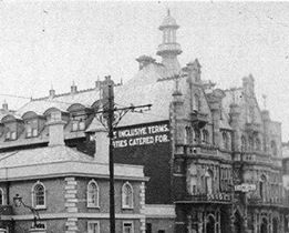
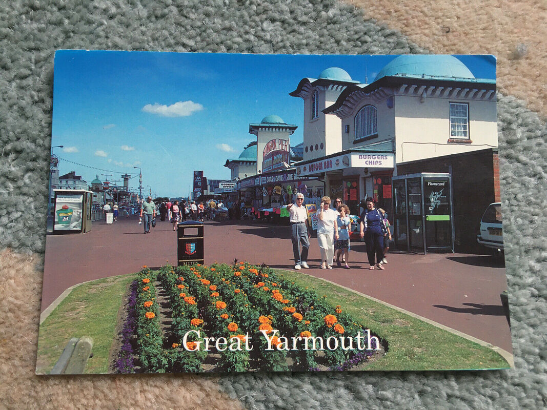
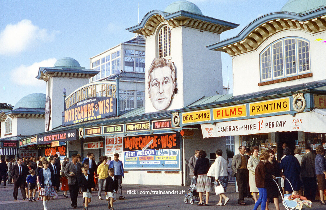
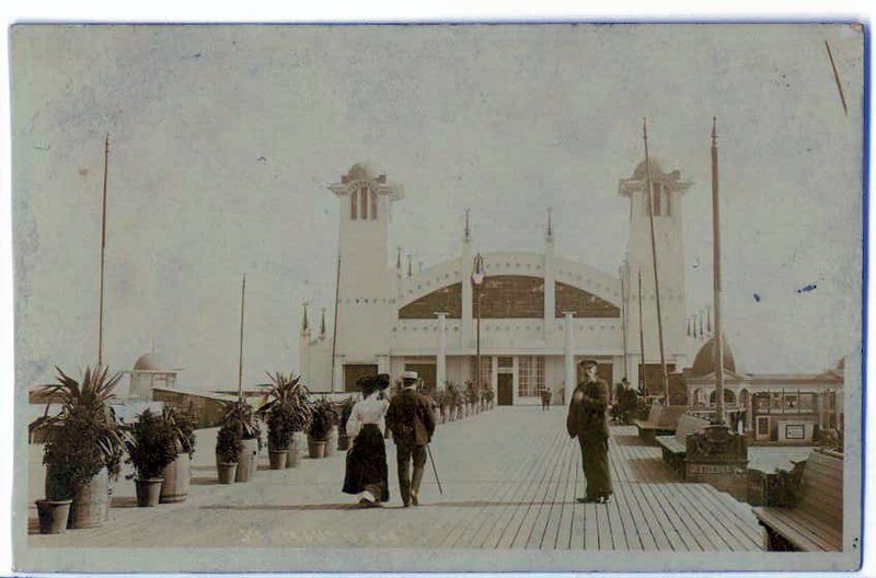
Wellington Pier
The Wellington Pier, a 700ft wooden structure, was designed by P. Ashcroft and opened on October 31st, 1853 having cost £6,776 to build.
The Pier made an impressive £581 profit in its first year, but a second pier was built nearby just 5 years later which had very harsh financial effects on the Pier.
The Great Yarmouth Corporation bought the pier in 1899 for £1,250 with new entertainment plans.On July 13th, 1903 the new Pavillion opened.
The Winter gardens was purchased from a failed project in Torquay, for £2,400, and was incorporated into the Pier complex.
Major steelwork renovations were carried out in the early 70's costing £30,00
The Wellington Pier began its construction work in June 2003 for an impressive and speedy face-lift.
On 3rd April 2004 The Wellington Pier re-opened for the 2004 Season.
Ice Cream Parlour
Used to be the Wellington Theatre booking office to the right and ice cream parlour similar to today to the left.
Wellington Bowl
Used tot be Wellington Theatre.
Ice Cream Parlour - used to be the booking office for the piers shows.
Gift shop used to be a burger bar.

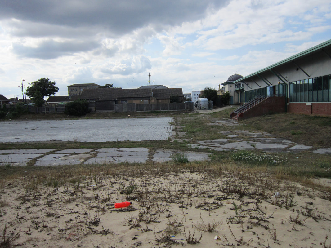
The old roller skating site
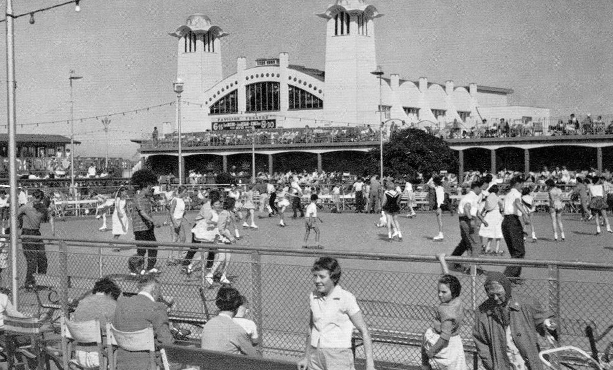
The roller skating rink at Wellington Pier, Great Yarmouth, pictured in the 1950s.