Sprowston History
  • Home
  • Road Index
    • Roads A >
      • Aiken Close
      • Allens Avenue
      • Amos Bacon Close
      • Aslake Close
      • Avian Way
      • Avocet Rise
    • Roads B >
      • Barkers Lane
      • Blackwell Avenue
      • Blenhiem Road
      • Blithemeadow Drive
      • Blue Boar Lane
      • Breck Road
    • Roads C >
      • Cannerby Lane
      • Cecil Gowing Court
      • Cere Road
      • Chartwell Road
      • Chenery Drive
      • Church Green
      • Colindeep Lane
      • Constitution Hill
      • Corbet Avenue
      • Cozens Hardy Road
      • Creance Road
      • Cromwell Road
    • Roads D >
      • Dixons Fold
      • Dovedales
    • Roads E >
      • Edwards Road
    • Roads F >
      • Falcoln Road West
    • Roads G >
      • Glenburn Avenue
      • Goshawk Mews
    • Roads H >
      • Hammond Way
      • Harrisons Drive
      • Holly Bank
      • Hornbeam Close
    • Roads L >
      • Lambert Road
      • Linacre Avenue
      • Lone Barn Road
      • Lusher's Loke
    • Roads M >
      • Merlin Avenue
      • Millwrights Way
      • Mousehold Lane
    • Roads N >
      • Neville Road
      • North Walsham Road
    • Roads P >
      • Parkland Road
      • Pinetrees Road
    • Roads R >
      • Recreation Ground Road
      • Rosemary Road
      • Roundtree Way
    • Roads S >
      • Salhouse Road
      • School Lane
      • Shipfield
      • Sparhawk Avenue
      • Sprowston Road
      • St Georges Loke
    • Roads T >
      • Tills Road
      • Tills Close
      • Tusting Close
    • Roads V >
      • Varvel Avenue
    • Roads W >
      • White Woman Lane
      • Wilks Farm Drive
      • Woodside Road
      • Wroxham Road
  • Timeline
  • Other Areas
    • Other Roads A >
      • Aylsham Road, Norwich
    • Other Roads B >
      • Beach Road, Hemsby
      • Boundary Road, Hellesdon
      • Burma Road, Old Catton
    • Other Roads C >
      • California Road, California
      • Castle Street, Norwich
      • Cromer Road, Hellesdon
    • Other Roads D >
      • Dereham Road, Norwich
      • Drayton High Street, Drayton
      • Drayton Road, Mile Cross
    • Other Roads E >
      • Earlham Road, Norwich
    • Other Roads F
    • Other Roads G
    • Other Roads H >
      • Havers Road
      • Haymarket, Norwich
      • Holt Road, Hellesdon
    • Other Roads I >
      • Ipswich Road
    • Other Roads J
    • Other Roads K
    • Other Roads L
    • Other Roads M
    • Other Roads N
    • Other Roads O
    • Other Roads P
    • Other Roads Q
    • Other Roads R
    • Other Roads S >
      • Salhouse Road, Rackheath
      • St Stephens Road
      • St Stephens Street
      • St Thomas Road, Hemsby
      • Station Road, Hoveton
    • Other Roads T >
      • The Paddocks, Old Catton
      • Thunder Lane, Thorpe St Andrew
    • Other Roads U
    • Other Roads V
    • Other Roads W >
      • Westlegate, Norwich
      • Whiffler Road
    • Other Roads X
    • Other Roads Y >
      • Yarrmouth Road, Thorpe St Andrew
    • Other Roads Z
  • Links & Local Books
  • Credits
  • Contact Me

Whiffler Road

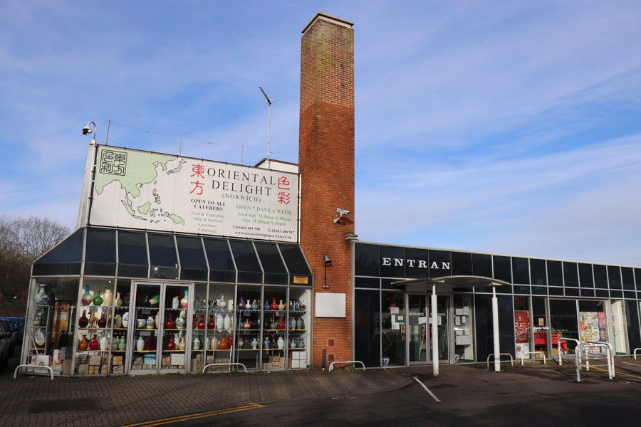
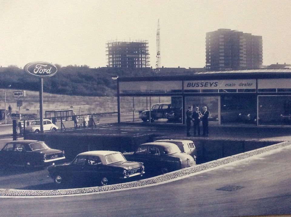
Busseys - Whiffler Road Industrial Estate 
Busseys where one of the first companies to move on there. In the background are the Mile Cross Towers.
The field opposite BUSSEYS is the one Stuart McPherson referred to in his recent blog.
Picture
Powered by Create your own unique website with customizable templates.