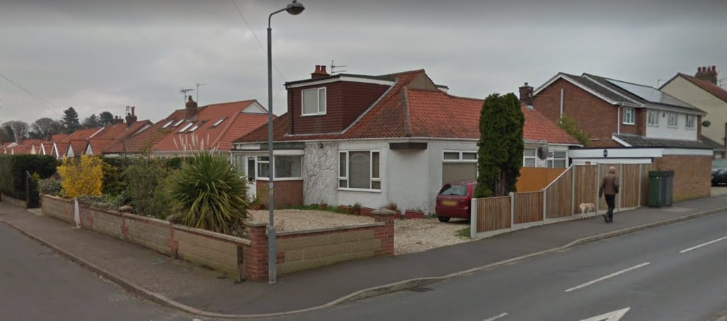
Sprowston History
  • Home
  • Road Index
    • Roads A >
      • Aiken Close
      • Alford Grove
      • Allens Avenue
      • Amos Bacon Close
      • Aslake Close
      • Avian Way
      • Avocet Rise
    • Roads B >
      • Barkers Lane
      • Blackwell Avenue
      • Blenhiem Road
      • Blithemeadow Drive
      • Blue Boar Lane
      • Breck Road
    • Roads C >
      • Cannerby Lane
      • Cecil Gowing Court
      • Cere Road
      • Chartwell Road
      • Chenery Drive
      • Church Green
      • Colindeep Lane
      • Constitution Hill
      • Corbet Avenue
      • Cozens Hardy Road
      • Creance Road
      • Cromwell Road
    • Roads D >
      • Dixons Fold
      • Dovedales
    • Roads E >
      • Edwards Road
    • Roads F >
      • Falcoln Road West
    • Roads G >
      • Glenburn Avenue
      • Goshawk Mews
    • Roads H >
      • Hammond Way
      • Harrisons Drive
      • Holly Bank
      • Hornbeam Close
    • Roads L >
      • Lambert Road
      • Linacre Avenue
      • Lone Barn Road
      • Lusher's Loke
    • Roads M >
      • Mallard Way
      • Merlin Avenue
      • Millwrights Way
      • Mousehold Lane
    • Roads N >
      • Neville Road
      • North Walsham Road
    • Roads P >
      • Parkland Road
      • Pinetrees Road
    • Roads R >
      • Recreation Ground Road
      • Rosemary Road
      • Roundtree Way
    • Roads S >
      • Salhouse Road
      • School Lane
      • Shipfield
      • Sparhawk Avenue
      • Sprowston Road
      • St Georges Loke
      • Stonehouse Road
    • Roads T >
      • Tills Road
      • Tills Close
      • Tusting Close
    • Roads V >
      • Varvel Avenue
    • Roads W >
      • White Woman Lane
      • Wilks Farm Drive
      • Woodside Road
      • Wroxham Road
  • Timeline
  • Other Areas
    • Other Roads A >
      • All Saints Green
      • Amsterdam Way, Hellesdon
      • Anglia Square
      • Aylsham Road, Norwich
    • Other Roads B >
      • Bacton Road, North Walsham >
        • Back Of The Inns, Norwich
        • Barrack Street, Norwich
      • Baxter Court, Norwich
      • Beach Road, Hemsby
      • Boundary Road, Hellesdon
      • Britannia Rd
      • Burma Road, Old Catton
    • Other Roads C >
      • California Road, California
      • Castle Meadow, Norwich
      • Castle Street, Norwich
      • Church Plain, Great Yarmouth
      • Clancy Road
      • Cozens Road
      • Cremorne Lane
      • Cromer Road, Hellesdon
    • Other Roads D >
      • Dales Loke, Thorpe St Andrew
      • Dereham Road, Norwich
      • Diamond Road, Norwich
      • Drayton High Street, Drayton
      • Drayton Road, Mile Cross
      • Dussindale Drive
    • Other Roads E >
      • Earlham Road, Norwich
      • Edwards Street, Norwich
    • Other Roads F >
      • Farmers Avenue
      • Fifers Lane
    • Other Roads G >
      • Gentlemen's Walk, Norwich
      • Golding Place
      • Guildhall Hill
      • Gurney Road
    • Other Roads H >
      • Havers Road
      • Haymarket, Norwich
      • Hemming Way, Norwich
      • Henby Way, Thorpe St Andrew
      • Hooker Road, Heartsease
      • Holt Road, Hellesdon
      • Holt Road, Horsford
      • Hurricane Way
    • Other Roads I >
      • Ipswich Road
    • Other Roads J
    • Other Roads K
    • Other Roads L >
      • Laundry Lane, Thorpe St Andrew
      • Lodge Lane, Old Catton
      • London Street, Norwich
    • Other Roads M >
      • Magdalen Road
      • Manor Road, Newton St Faith
      • Market Place, Great Yarmouth
      • Marine Parade, Great Yarmouth
      • Marryat Road
      • Mile Cross Lane
    • Other Roads N >
      • New Road, North Walsham
      • Newport Road, Newport
    • Other Roads O
    • Other Roads P >
      • Pound Lane, Thorpe St Andrew
      • Prince Of Wales Road, Norwich
      • Priory Plain, Great Yarmouth
    • Other Roads Q
    • Other Roads R >
      • Regent Road, Great Yarmouth
      • Reepham Road, Hellesdon
    • Other Roads S >
      • Salhouse Road, Rackheath
      • Sae View Road, Hemsby
      • St Nicholas Road, Great Yarmouth
      • St Stephens Road
      • St Stephens Street
      • St Thomas Road, Hemsby
      • Station Road, Hoveton
    • Other Roads T >
      • The Paddocks, Old Catton
      • Thorpe Avenue
      • Thorpe Road, Norwich
      • Thunder Lane, Thorpe St Andrew
    • Other Roads U
    • Other Roads V
    • Other Roads W >
      • Westlegate, Norwich
      • Whiffler Road
    • Other Roads X
    • Other Roads Y >
      • Yarmouth Road, Caister On Sea
      • Yarmouth Road, North Walsham
      • Yarrmouth Road, Thorpe St Andrew
      • South Hill Road, Thorpe St Andrew
    • Other Roads Z
  • Links & Local Books
  • Credits
  • Contact Me
  • Buses
  • Record Shops
  • Salhouse Road
  • New Page

Alford Grove

52 Alford Grove
Used to be Fairstead Stores until the 80's. Anyone know more? Did The Harvey's run it?

David Wyatt Fairstead Stores, used to go and get mums Mars Bar treat there in the 60,s for a threepenny Jamboree bag.
​
Chris Dack I believe it was Fairstead Stores, it was one of my first Saturday morning jobs there as a thirteen year old flattening all the cardboard boxes that they had used during the week
Picture
Powered by Create your own unique website with customizable templates.