Colindeep Lane
Memories of Colindeep Lane....
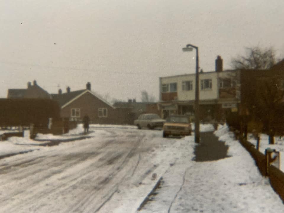
"I lived on the corner of Edwards road and what was then Gage road.( now Colindeep lane ) where the shops are was a field all the way to Allen’s lane , the first people in the general store were the Moore family , sons Chris and Andy about 1960.Gage road was only 50 yards long , then a tall hedge separated it from the field where the shop and all the other dwellings were built and they changed the longer road to COLINDEEP LANE"
Ron Sheldon
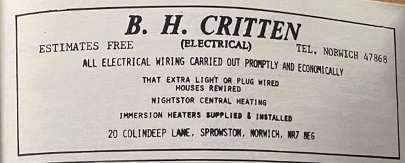
20 Colindeep Lane
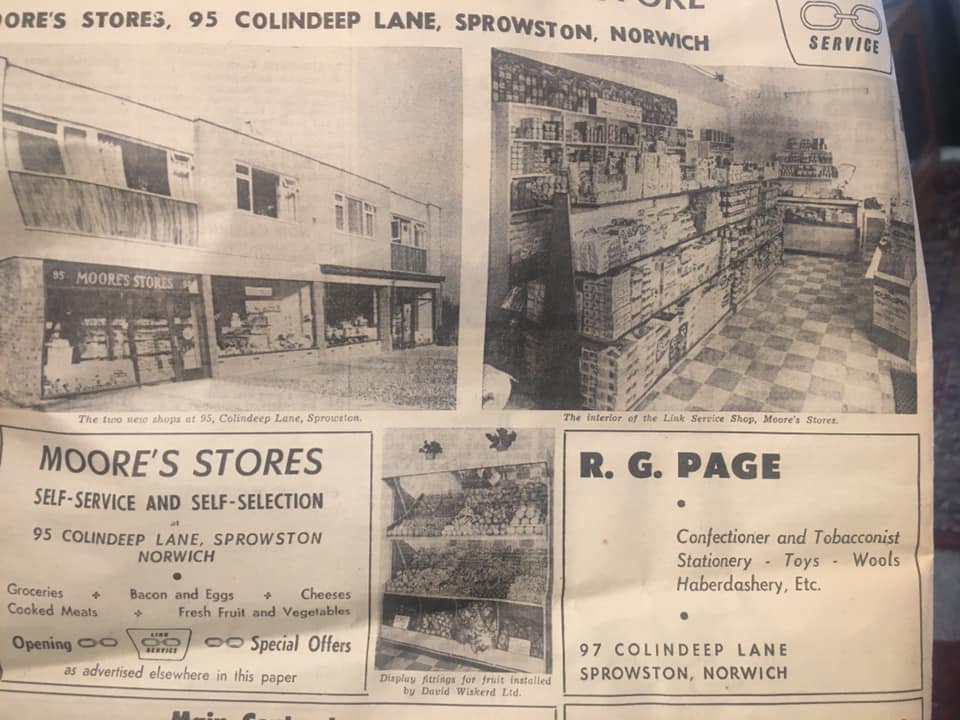
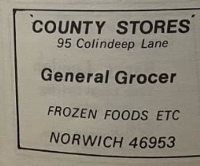
95 Colindeep Lane
To the left of Mistique Salon which is now bricked up used to be Moore's Stores run by Chris and Andy, Videostar video rental shop. Also once a clothes fashion shop run by Daphne Cooper. In 1977 it was County Stores.
To the left of Mistique Salon which is now bricked up used to be Moore's Stores run by Chris and Andy, Videostar video rental shop. Also once a clothes fashion shop run by Daphne Cooper. In 1977 it was County Stores.
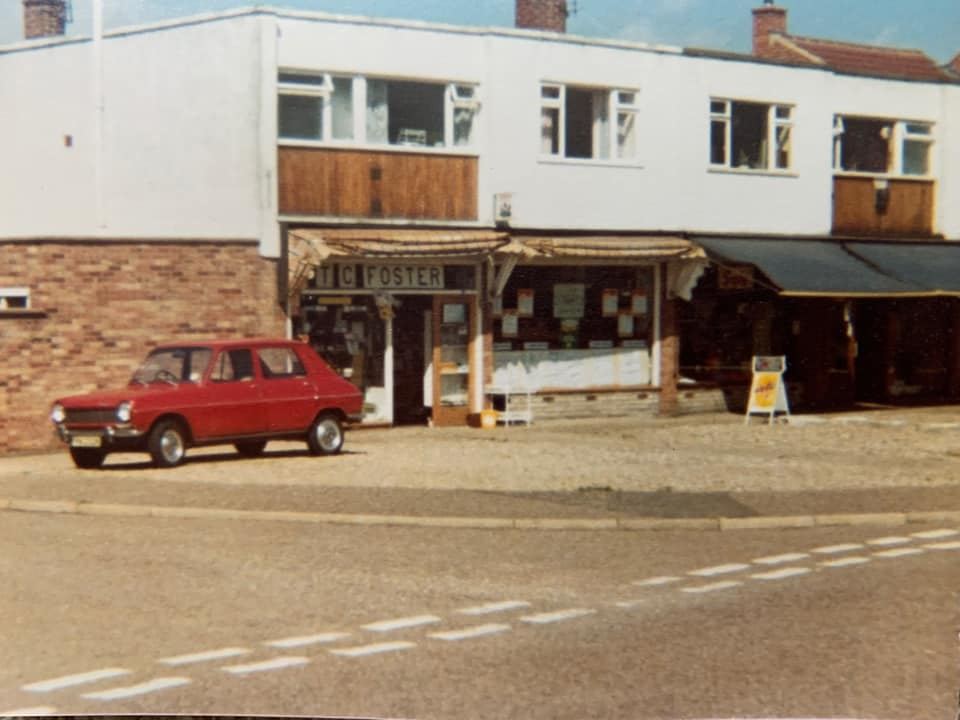
Thanks to Trevor Foster
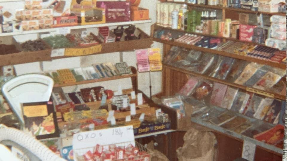
Thanks to Trevor Foster
Thanks to Trevor Foster
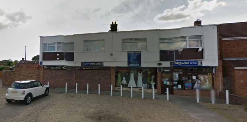
97 Colindeep Lane - Mistique Beaty Salon
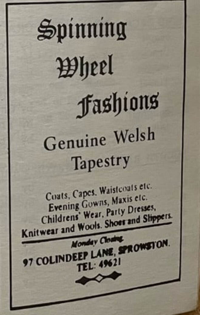
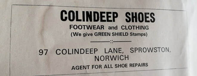
In the 60's this used to be a sweet shop run by Cherry and Bob. It was also a pet shop in 1983 run by Bill. Used to be Colindeep Shoes selling footwear and clothing. Was R.G Page confectioner and tobaconnist and Spinning Wheels Fashions and later it was Dreams Bridal.
In the 60's this used to be a sweet shop run by Cherry and Bob. It was also a pet shop in 1983 run by Bill. Used to be Colindeep Shoes selling footwear and clothing. Was R.G Page confectioner and tobaconnist and Spinning Wheels Fashions and later it was Dreams Bridal.