Aylsham Road, Norwich
2a Aylsham Road, Norwich
Used to be a florists in 1970. New building now.
Used to be a florists in 1970. New building now.
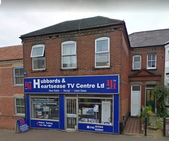
6 Aylsham Road, Norwich
Used to be Hubbards tv shop in 1970 until about 2009.
Used to be Hubbards tv shop in 1970 until about 2009.
8 Aylsham Road, Norwich
Used to be a Butchers shop in 1912 and Point 5 Windows And Doors and Hubbards tv shop.
Used to be a Butchers shop in 1912 and Point 5 Windows And Doors and Hubbards tv shop.
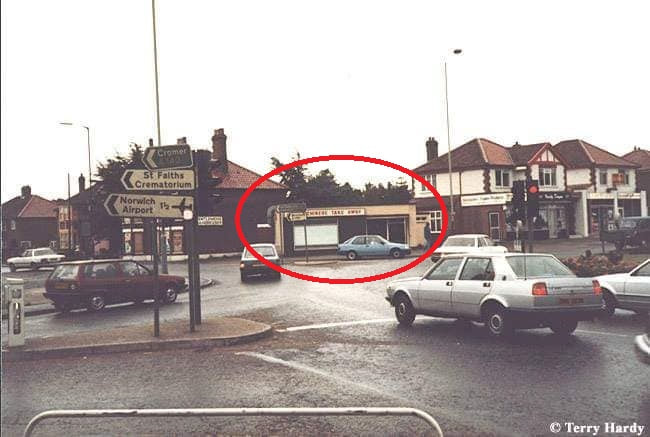
70 Aylsham Road
Used to be Black Arrow Filling Station in 1968
Used to be Black Arrow Filling Station in 1968
82 Aylsham Road, Norwich
Used to be Eastern Fixed Odds Turf Accountants in 1970.
Used to be Eastern Fixed Odds Turf Accountants in 1970.
84 Aylsham Road - Aylsham Road Car Sales
Used to be St Giles Motors in 1967
Used to be St Giles Motors in 1967
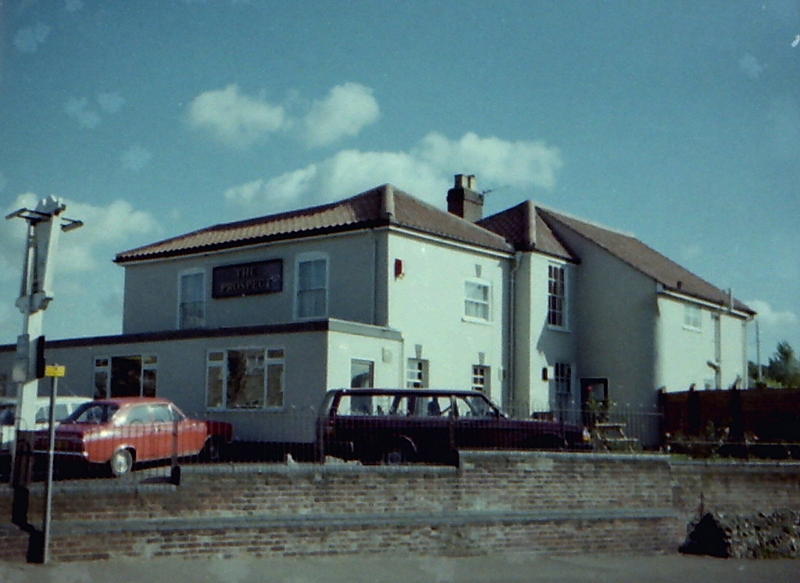
93 Aylsham Road - Prospect Medical Practice
Used to be Prospect House pub from 1939-1992. Photograph courtesy of Ken Chapman - taken c. 1984The pub entrance was hidden on the reverse of this elevation.
Despite the (post-WWII?) single-storey extension at the front,
the proportion of landlord accommodation - to public areas - seems to
have been very high. Note the private side-door and garden to the right.
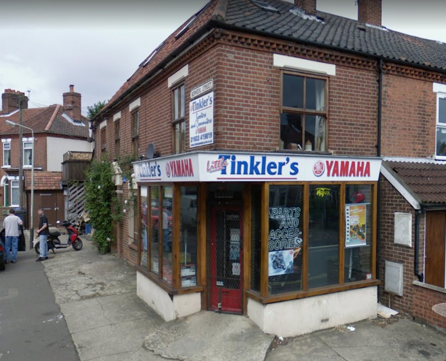
128 Aylsham Road
In 1928 it was a corner shop and was so for many years. In 1970 it was a grocers shop run by Mr Buck. Later it was Tinkler's motorbike shop and now has been converted to a normal house.
In 1928 it was a corner shop and was so for many years. In 1970 it was a grocers shop run by Mr Buck. Later it was Tinkler's motorbike shop and now has been converted to a normal house.
156 Aylsham Road, Norwich
Used to be Billy fruit shop in 1970. Now converted to a normal house.
Used to be Billy fruit shop in 1970. Now converted to a normal house.
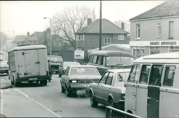
165-175 Aylsham Road - Wilco
I think this shop was 2 or 3 different shops years ago and now just one shop. Used to be Smarts Autoparts in 1982.
I think this shop was 2 or 3 different shops years ago and now just one shop. Used to be Smarts Autoparts in 1982.
167 Aylsham Road
Used to be Dunhams which sold fridges in 1952.
Used to be Dunhams which sold fridges in 1952.
From here - https://web.archive.org/web/20140813032331/http://www.norridge.me.uk/pubs/areasrch/north/pubs12/f123.htm#186
230 Aylsham Road, Norwich - Hamlin Court
Used to be Transcontinental Frozen Food Services Ltd in 1970.
Used to be Transcontinental Frozen Food Services Ltd in 1970.
226 Aylsham Road, Norwich
Used to be Claxtons Car Sales in 1967 and later it became R. Edmonds Car Sales & Service in 1991. The entrance was as you turn into Half Mile Close and it was demolished and now 2 new houses.
Used to be Claxtons Car Sales in 1967 and later it became R. Edmonds Car Sales & Service in 1991. The entrance was as you turn into Half Mile Close and it was demolished and now 2 new houses.
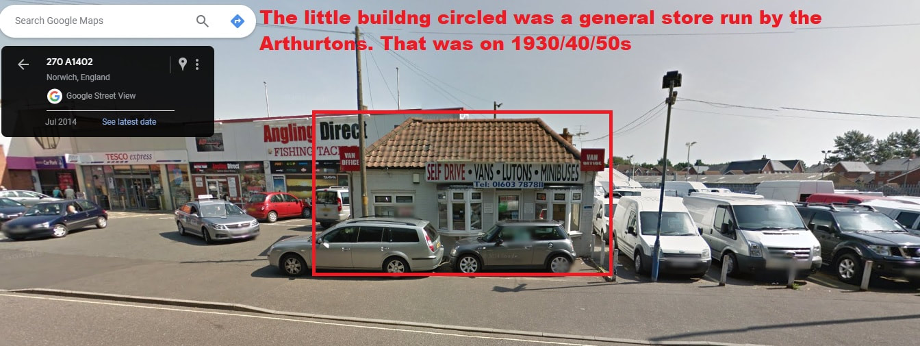
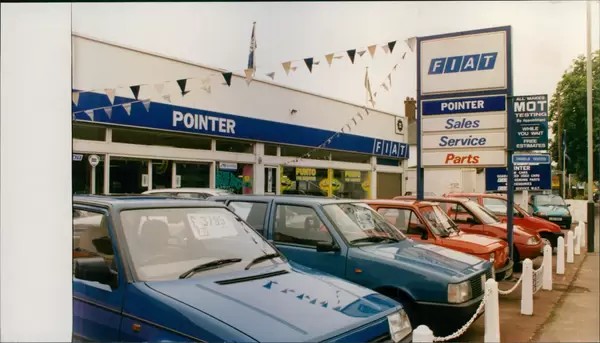
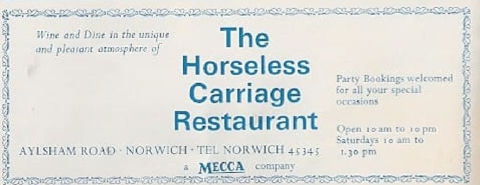
277 Aylsham Road, Norwich - Tesco Express
Used to be The Horseless Carriage Restaurant and Pointer Fiat garage. Little buildng at the front to the right of the forecort was a general store run by a Lady think it was Arthurtons. That was on 1930/40/50s
Used to be The Horseless Carriage Restaurant and Pointer Fiat garage. Little buildng at the front to the right of the forecort was a general store run by a Lady think it was Arthurtons. That was on 1930/40/50s
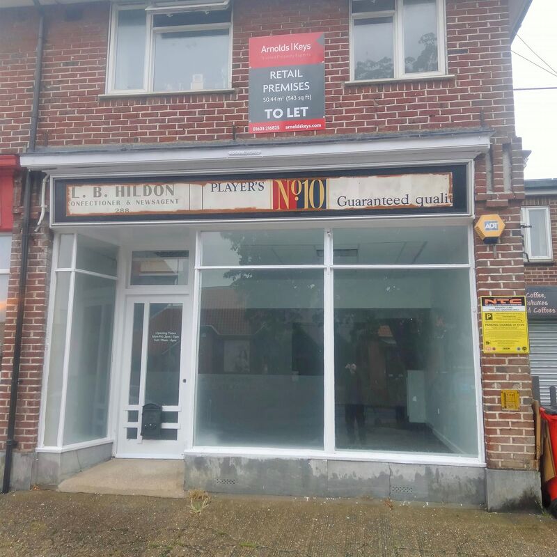
288 Aylsham Road, Norwich
Used to be L. B. Hildon newsagents and Swainsdons, paper shop and at some point it was John and Irene's paper shop. It also had a beechnut chewing gum machine outside and every 4th go you got a free packet.
Mr Uttings barbers was close by and across the road was Birds Bakery.
Used to be L. B. Hildon newsagents and Swainsdons, paper shop and at some point it was John and Irene's paper shop. It also had a beechnut chewing gum machine outside and every 4th go you got a free packet.
Mr Uttings barbers was close by and across the road was Birds Bakery.
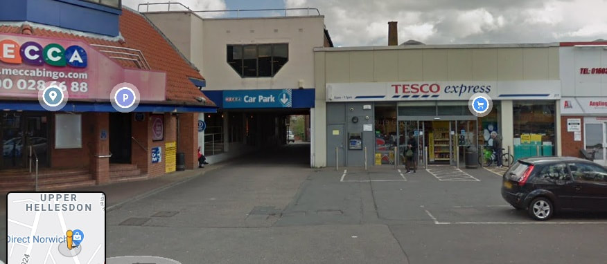
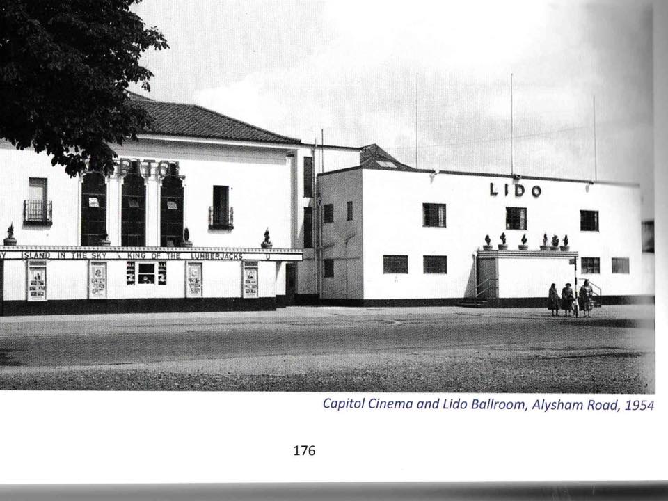
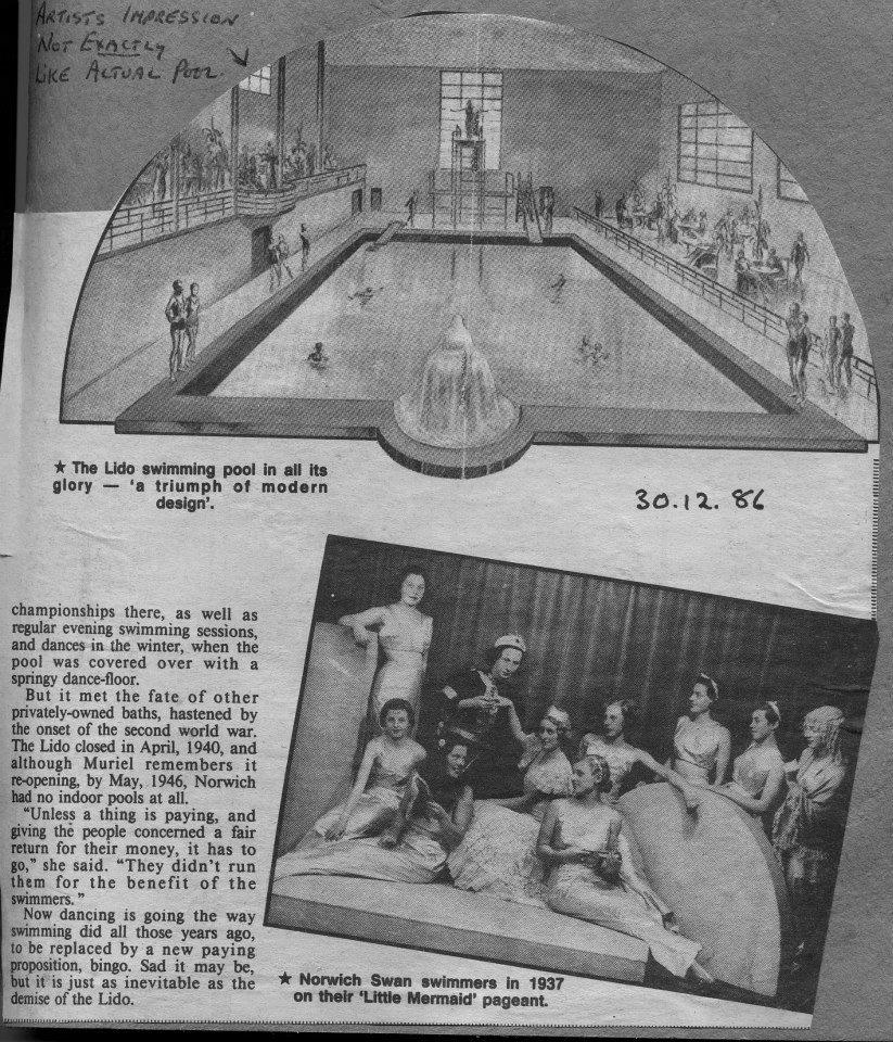
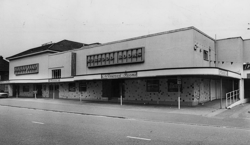
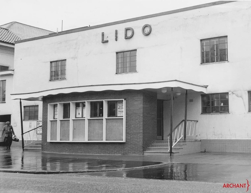
295 Aylsham Road, Norwich - Mecca Bingo
The Lido was a pool and dancehall. The pool was under the dancefloor. The pool was opened on 31st May 1934, with a display by a trio of young divers, Harry Amiss,Sid Day and Muriel Swain ( later Noller). The two men were founder members of the Penguin swimming club and Muriel of Norwich Swan became the First Lady President of the Norfolk Swimming Association. It closed in 1940 because of the war and reopend in 1946. Credit: Bridget Belson. It later became the Norwood Rooms and now Mecca Bingo. Capitol Cinema was next door to the left.
The Lido was a pool and dancehall. The pool was under the dancefloor. The pool was opened on 31st May 1934, with a display by a trio of young divers, Harry Amiss,Sid Day and Muriel Swain ( later Noller). The two men were founder members of the Penguin swimming club and Muriel of Norwich Swan became the First Lady President of the Norfolk Swimming Association. It closed in 1940 because of the war and reopend in 1946. Credit: Bridget Belson. It later became the Norwood Rooms and now Mecca Bingo. Capitol Cinema was next door to the left.
305 Aylsham Road, Norwich
Used to be City Wines in 1987.
Used to be City Wines in 1987.
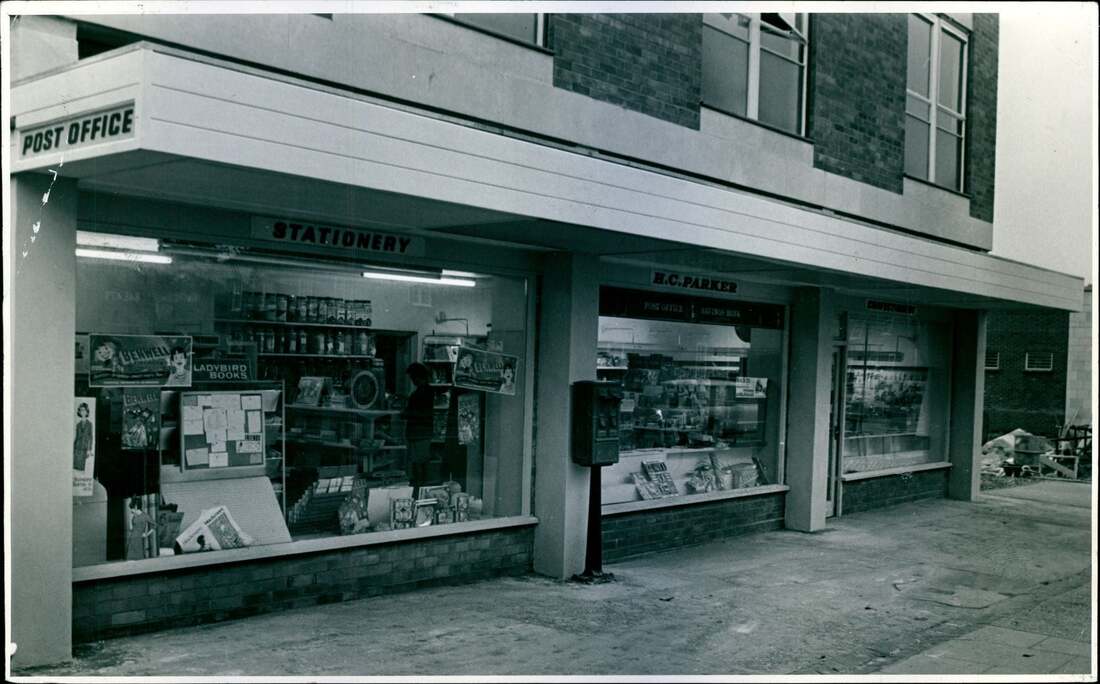
323 Aylsham Road, Norwich - Post Office
357 Aylsham Road, Norwich - Boundary Fish Bar
Used to be Barnes Butchers in 1952 up until at least 1968.
Used to be Barnes Butchers in 1952 up until at least 1968.
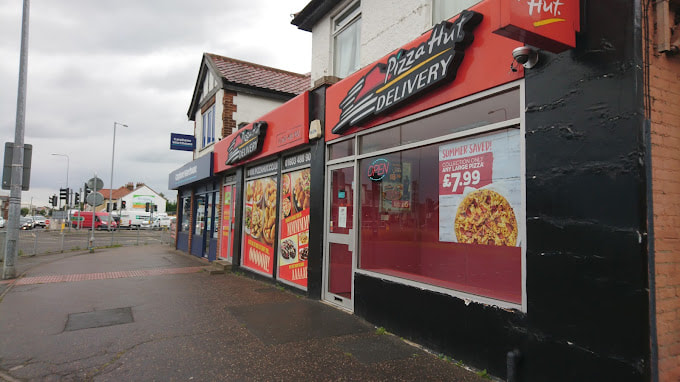
365 Aylsham Road, Norwich - Pizza Hut
Used to be Appleton's Fried Fish Shop in 1970.
Used to be Appleton's Fried Fish Shop in 1970.
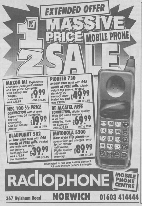
367 Aylsham Road, Norwich
In 2019 this old shop was empty and the last tenants removed the shop sign so it is now showing a very old sign of when it was a Chemists called Bingham. I think it was a chemist from during the 60's and 70's.. Annette tells me she worked there from 1970 - 1972. Later in 1987 it was a printer and photocopier shop called Copier Products Limited (Norwich) In 1995 it was Radiophone
In 2019 this old shop was empty and the last tenants removed the shop sign so it is now showing a very old sign of when it was a Chemists called Bingham. I think it was a chemist from during the 60's and 70's.. Annette tells me she worked there from 1970 - 1972. Later in 1987 it was a printer and photocopier shop called Copier Products Limited (Norwich) In 1995 it was Radiophone
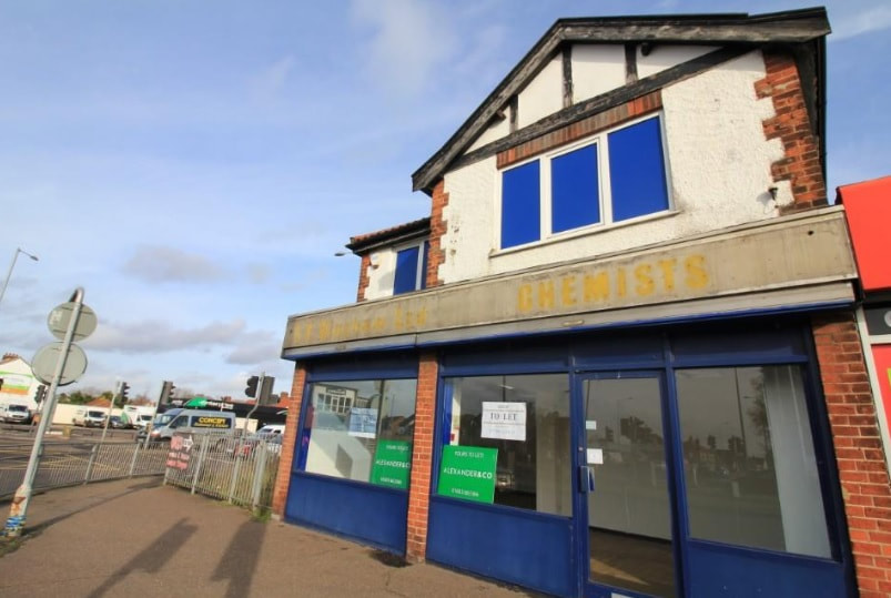
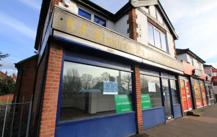
Copyright Archant & https://www.localrecall.co.uk/
369 Aylsham Road, Norwich - Now gone
Used to be Roundabout Cafe
Used to be Roundabout Cafe