Roundtree Way
2 Roundtree Way - HSS Hire Shop
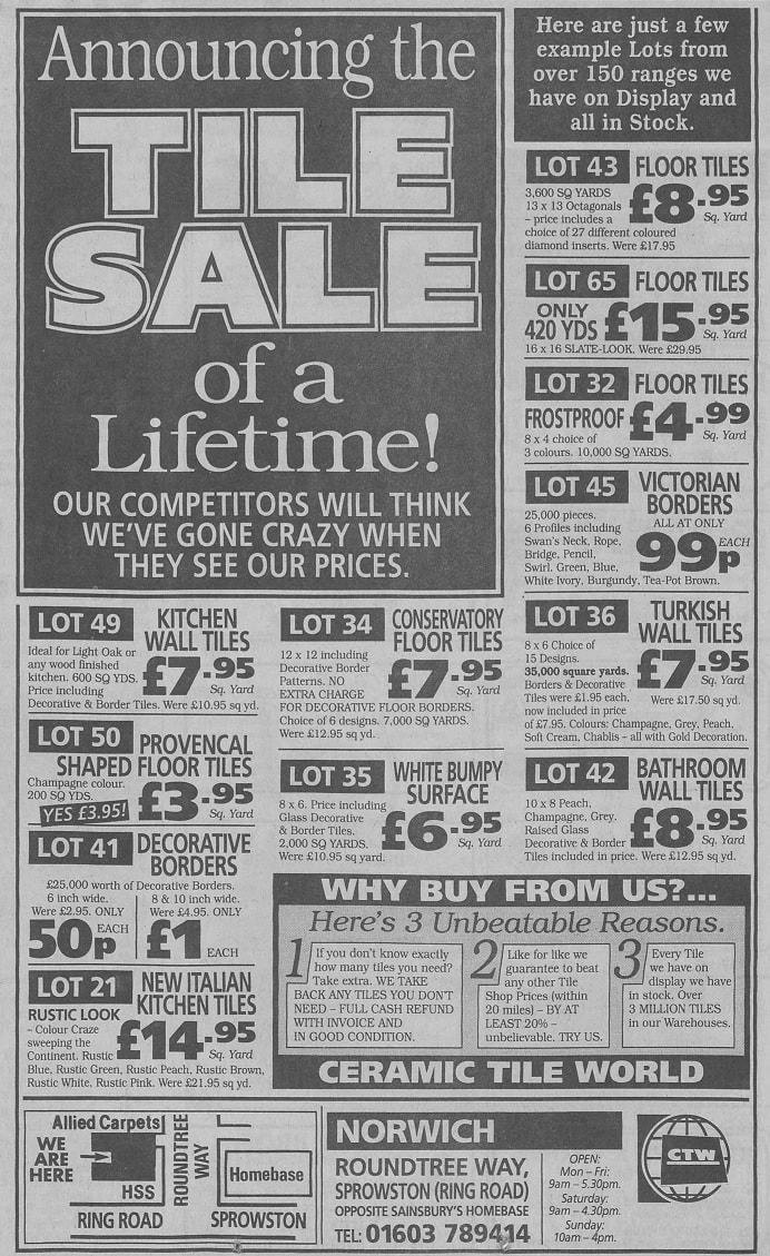
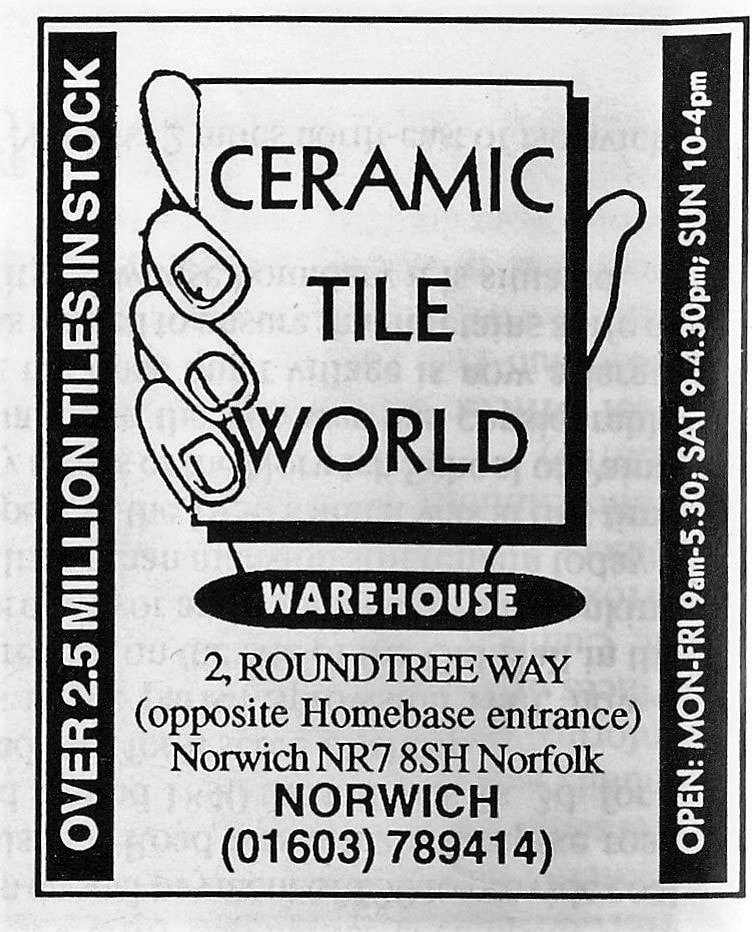
Used to be Ceramic Tile World
Used to be Ceramic Tile World
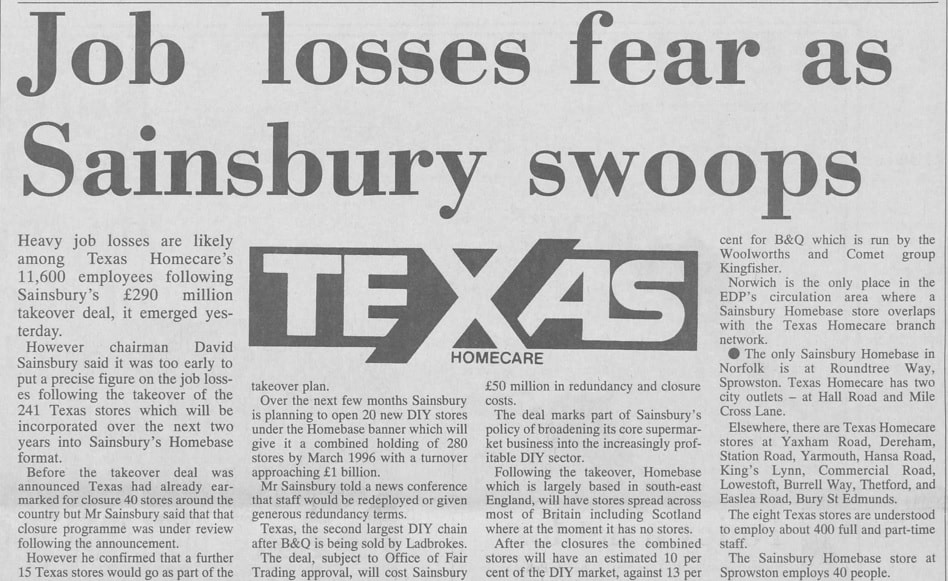
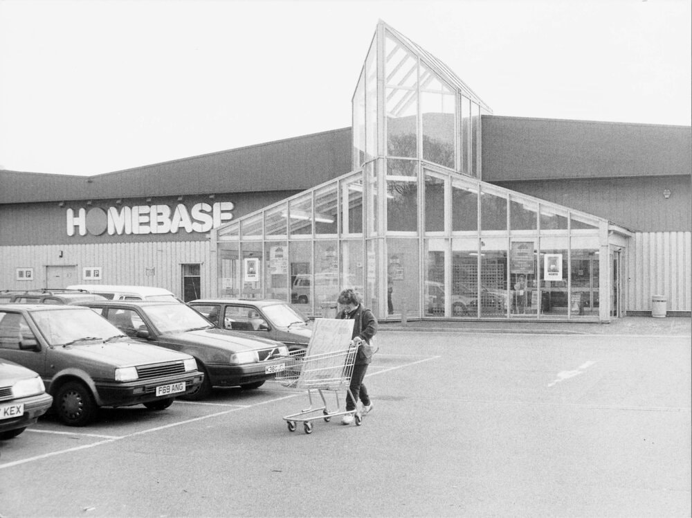
Homebase
This used to be the Florida Shoe Factory. The first incarnation of Homebase closed on January 22nd 2018. Homebase was taken over by Australian retail group Wesfarmers, which also owns Bunnings, in 2018 in a £340m deal. On January 22nd 2018 the Sprowston store closed and in March 2018 it reopened as Bunnings. It later went back to being Homebase again later in 2018.
This used to be the Florida Shoe Factory. The first incarnation of Homebase closed on January 22nd 2018. Homebase was taken over by Australian retail group Wesfarmers, which also owns Bunnings, in 2018 in a £340m deal. On January 22nd 2018 the Sprowston store closed and in March 2018 it reopened as Bunnings. It later went back to being Homebase again later in 2018.
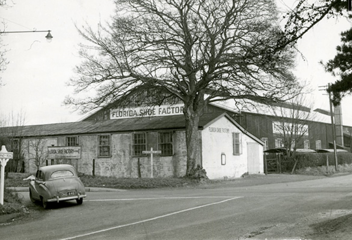
1974 - more at Picture Norfolk - https://www.norfolk.gov.uk/libraries-local-history-and-archives/libraries/local-history/norfolk-heritage-centre/picture-norfolk
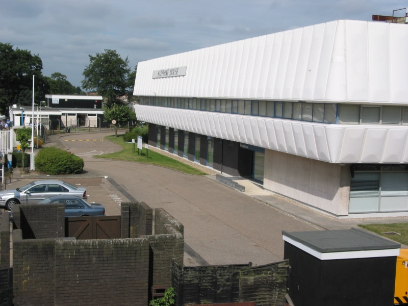
Sapphire Business Park
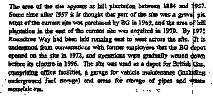
Used to be British Gas service centre and offices which opened in 1971 until 2001. Sapphire Park offers occupiers high quality office and industrial accommodation, either in established buildings or finished to a bespoke specification. From here
Used to be British Gas service centre and offices which opened in 1971 until 2001. Sapphire Park offers occupiers high quality office and industrial accommodation, either in established buildings or finished to a bespoke specification. From here
Sapphire Business Park with The Gas Club to the left.
The Gas Club
The club was originally the social club for British Gas and opened in the early 1970's. When they moved out of their Norwich premises the members decided to take on the running of the club as an independent social club.
Since then Jarrolds and the Post Office also closed their club premises and their members merged with the Gas Club.
We have now been joined by many from The British Legion Club on Aylsham Road in Norwich so despite the name the club is a wide mix of people from various walks of life. Taken from here
In October 2019 the social club function room hall had bad structural damage in the function room hall and the club closed its doors for the foreseeable future. On 24th November 2019 it is still closed.
The Space
This is now a church and a venue you can hire for meetings, events etc. I have been in there and it is an impressive place.
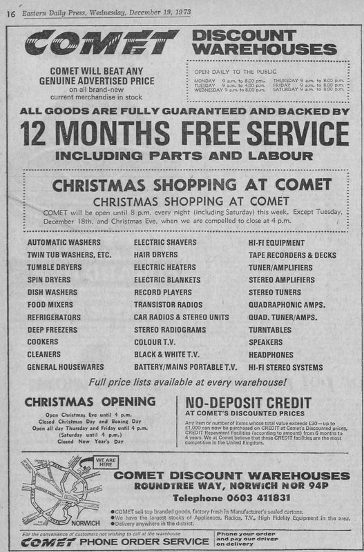
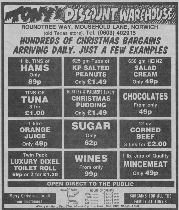
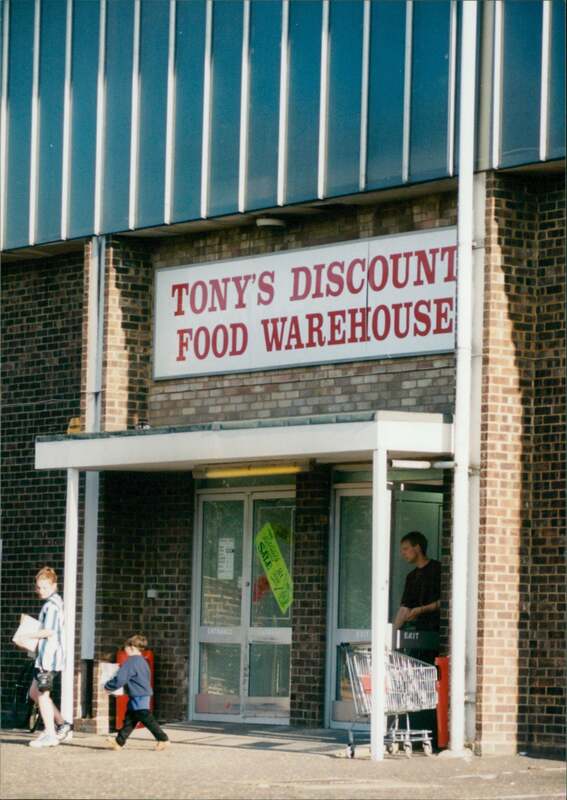
It has also been Texas DIY from around 1976 until around 1989, Tony's Discount Food Warehouse from around 1989 - 1997 and then Norfolk Fabric Warehouse.
This is now a church and a venue you can hire for meetings, events etc. I have been in there and it is an impressive place.
It has also been Texas DIY from around 1976 until around 1989, Tony's Discount Food Warehouse from around 1989 - 1997 and then Norfolk Fabric Warehouse.

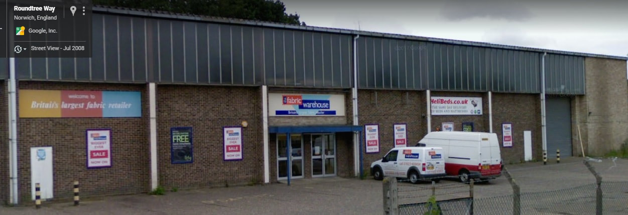
2008 - Norfolk Fabric Warehouse now The Space
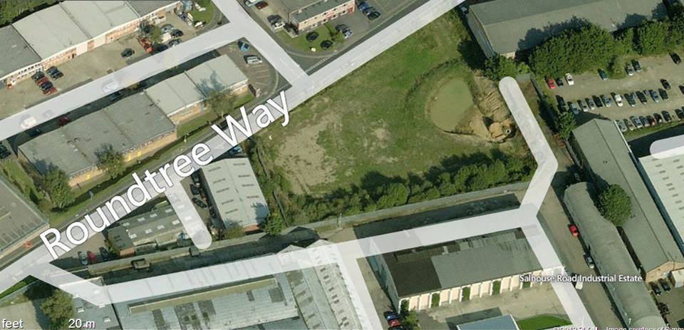
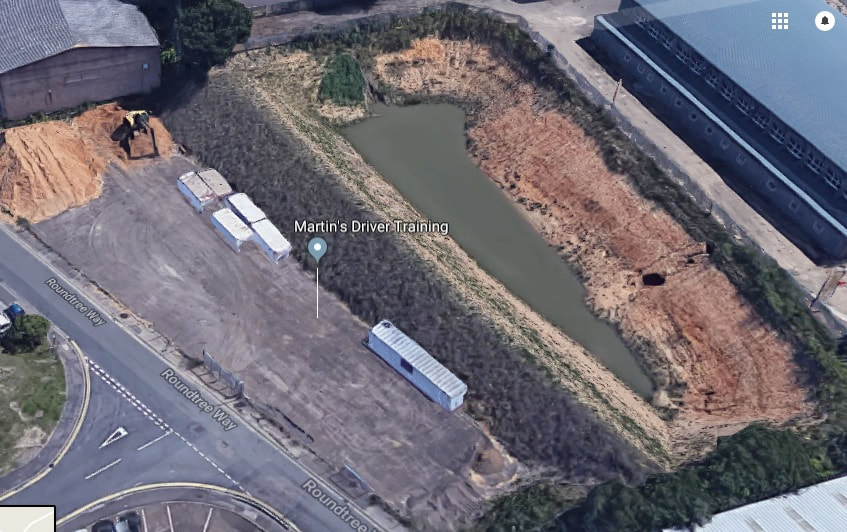
There used to be a big tank on the right hand side as you go down Roundtree Way just before you get to where The Space Is. It was used once as a pond for water in case of a fire with Mousehold Aerdrome being on Salhouse Road. The tank was about 12ft deep. I have looked at some old maps and Mousehold Plantation used to be on this site so I wonder if it got its named from the trees that used to be there?????