
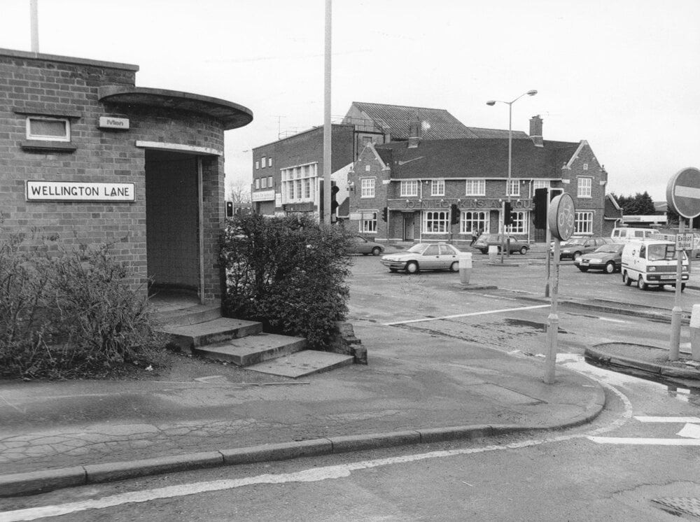
Dereham Road, Norwich NR2
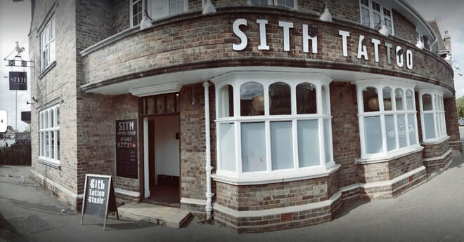
1 Dereham Road, Norwich - Sith Tattoo Studio
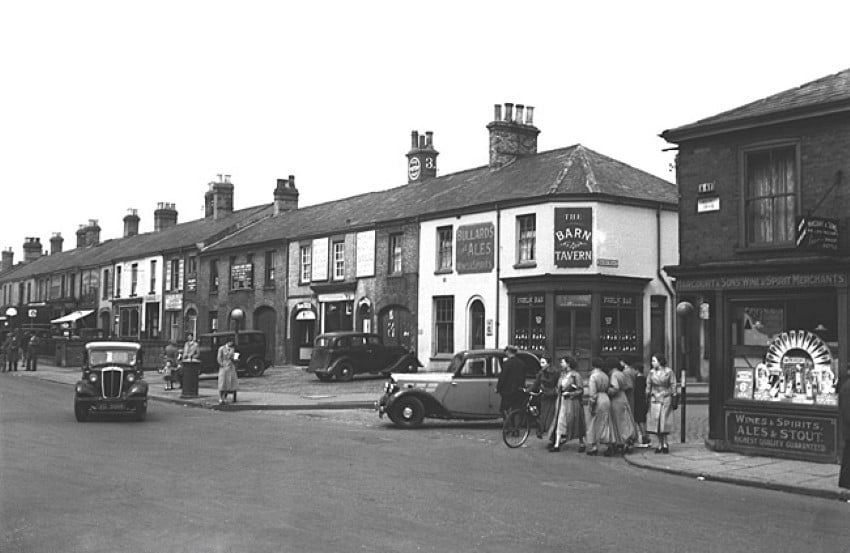
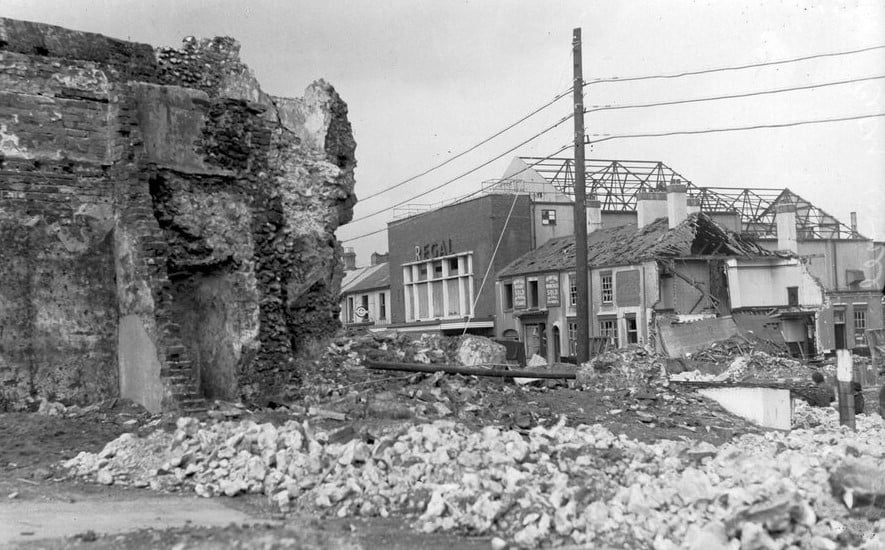
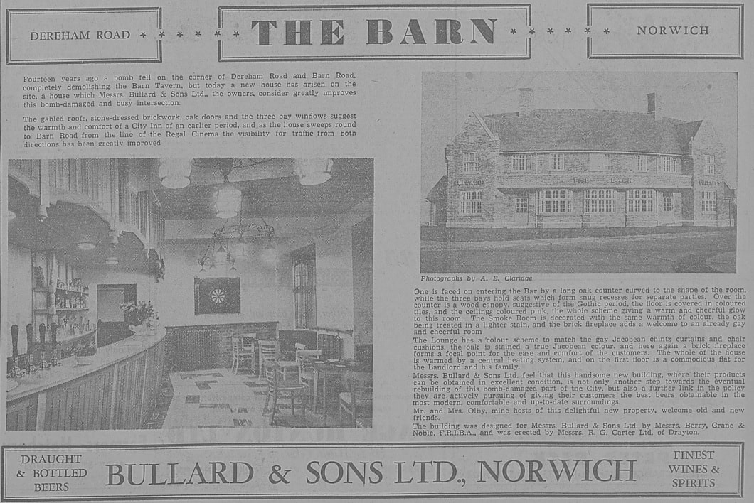
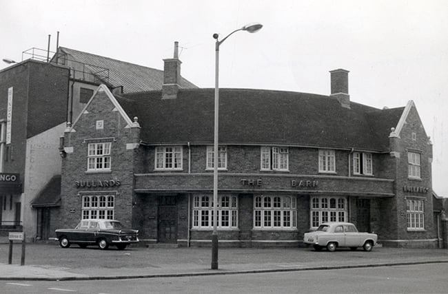
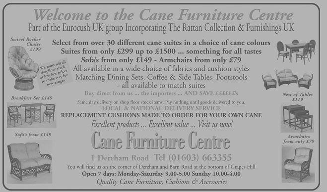
This building used to be a pub called The Barn. The original pub was totally destroyed in 1942. A newly built pub was opened in 1956. The pub closed by 1991. It then became an antiques shop. For the next 17 years it was a cane furniture shop but closed in 2019 due to rising postage costs. It is now a tattoo parlour. This would have been a popular pub as the cinema was next door.
This building used to be a pub called The Barn. The original pub was totally destroyed in 1942. A newly built pub was opened in 1956. The pub closed by 1991. It then became an antiques shop. For the next 17 years it was a cane furniture shop but closed in 2019 due to rising postage costs. It is now a tattoo parlour. This would have been a popular pub as the cinema was next door.
1956 Copyright Archant & https://www.localrecall.co.uk/
2005 Copyright Archant &https://www.localrecall.co.uk/
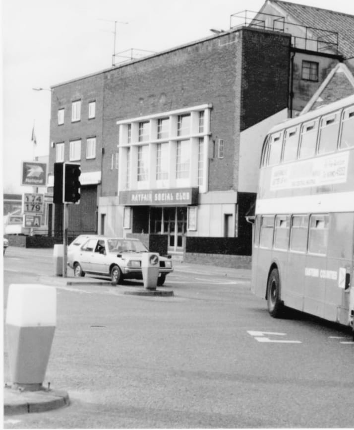
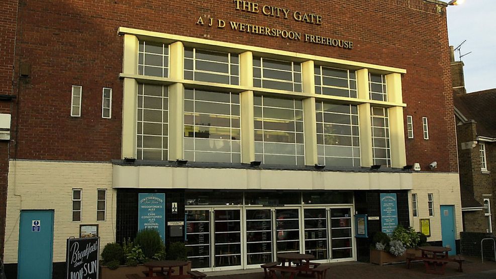
7 Dereham Road, Norwich - Bowling House
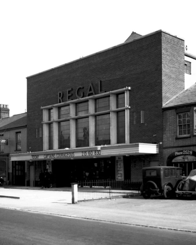
It has previously been a cinema, a bingo hall, casino, Mayfair Social Club, a Wetherspoons pub from 1999 - 2008 called City Gates then The Regal Pub, Merge buffet restuarant and now Bowling House.
It has previously been a cinema, a bingo hall, casino, Mayfair Social Club, a Wetherspoons pub from 1999 - 2008 called City Gates then The Regal Pub, Merge buffet restuarant and now Bowling House.


9 Dereham Road, Norwich
Used to be St Benedict's Garage in 1975.
Used to be St Benedict's Garage in 1975.
21a Dereham Road, Norwich
Used to be Scarlett George Ltd masonry contractors in 1969.
Used to be Scarlett George Ltd masonry contractors in 1969.
28 Dereham Road, Norwich - Golden City Chinese Takeaway
Used to be Valori Chip Shop. It had a fire in 1992.
Used to be Valori Chip Shop. It had a fire in 1992.

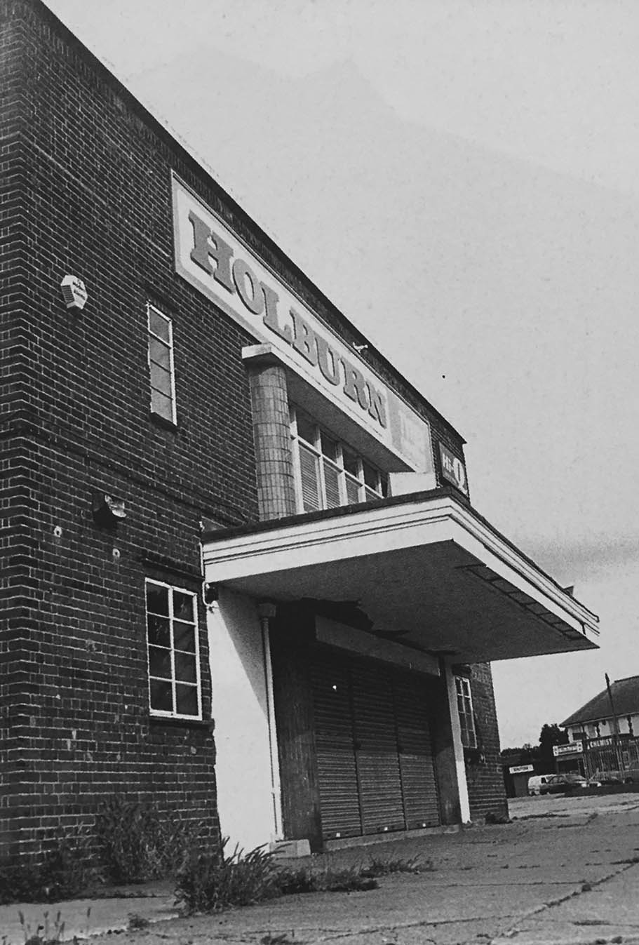
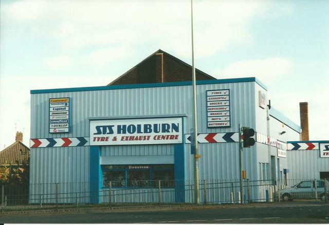
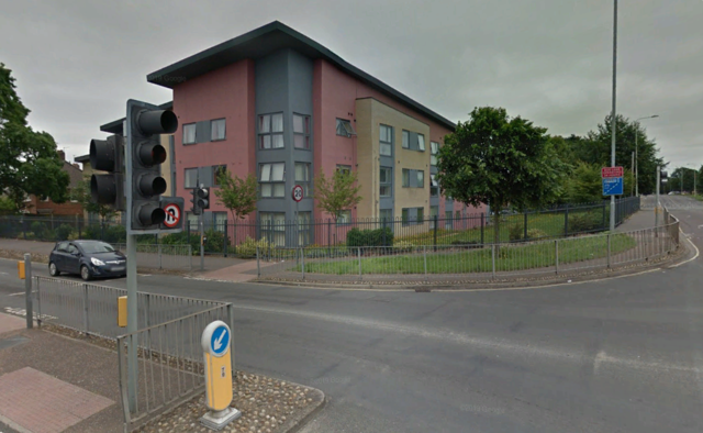
45 Dereham Road, Norwich - The Ritz
The Ritz Cinema opened on 10th September 1938 with Sabu in "Elephant Boy". It was a suburban ‘super’ cinema the 678 seats were all on one level. There were panels on the side walls of the auditorium which contained scenic murals. It was built for independent operator Victor E. Harrison and was independently operated throughout its cinematic life.
The Ritz Cinema closed on 10th July 1960 with Ted Ray in "Please Turn Over". The building lay unused for a while and in 1961, it became a motor tyre and exhaust centre. This use ended in 2006, and in 2007, the building was demolished for housing to be built on the site.
http://cinematreasures.org/theaters/25213
Dereham Road - Gatehouse pub approaching the Roundabout
40-48 Dereham Road - Wilco
Started out as K.J Shortis before the family name became Wilco. The original first Shortis branch was on Barn Road.
Started out as K.J Shortis before the family name became Wilco. The original first Shortis branch was on Barn Road.
61 Dereham Road - Medusa Juice
Used to be East Coast Clothing in 1988.
Used to be East Coast Clothing in 1988.
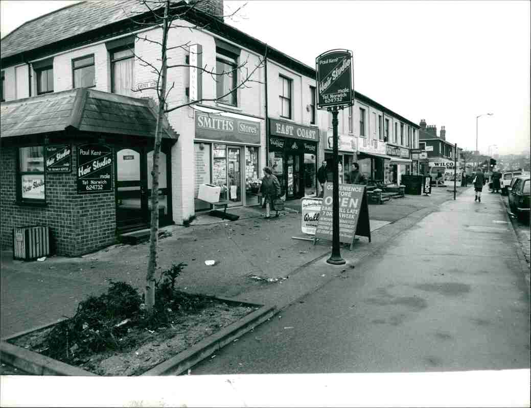
71 Dereham Road - Crown Pizza And Chicken
Used to be Smits Stores in 1988.
Used to be Smits Stores in 1988.
71B Dereham Road - Blessing Hair Studio.
In 1988 it used to be the original shop of Ex Norwich City player Paul Kent Hair Salon that is now on Ketts Hill.
In 1988 it used to be the original shop of Ex Norwich City player Paul Kent Hair Salon that is now on Ketts Hill.
106 Dereham Road - Randall's Footcare
Used to be Green Star Refreshment Bar and Petals Florists.
Used to be Green Star Refreshment Bar and Petals Florists.

131 Dereham Road, NR2 - Tesco Express
Used to be Dial House pub.
Used to be Dial House pub.


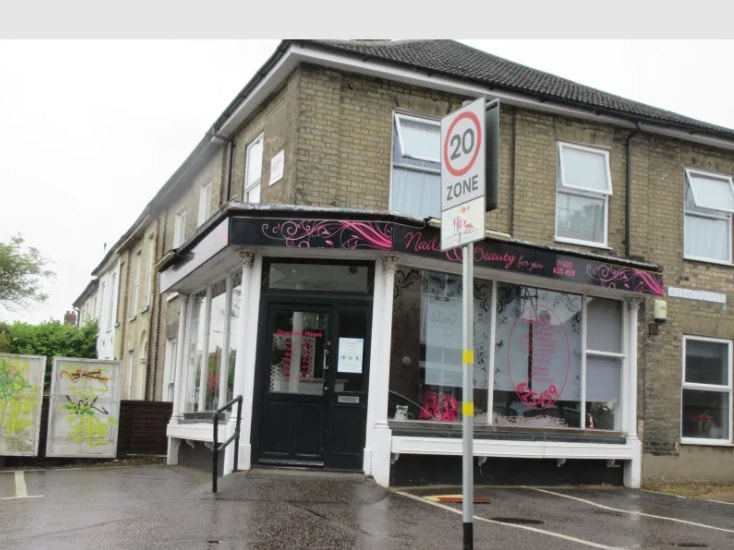
152 Dereham Road, NR2 - Nails, Beauty & You
Used to be a Post Office in the 1970's.
Used to be a Post Office in the 1970's.
154 - 156 Dereham Road
Used to be Midland Bank. In 1984 Roy Heatley became branch Manager. and then HSBC.
Used to be Midland Bank. In 1984 Roy Heatley became branch Manager. and then HSBC.
160 Dereham Road, NR2
Used to be Prentices Stores selling fruit.
Used to be Prentices Stores selling fruit.
228 Dereham Road, NR2
Used to be Tommy Momument Newsagents.
Used to be Tommy Momument Newsagents.
240-258 Dereham Road - Harvard Court
Used to be Enterprise Garage and later Texaco and a Fishmongers until they demolished it all and the pub.
Used to be Enterprise Garage and later Texaco and a Fishmongers until they demolished it all and the pub.


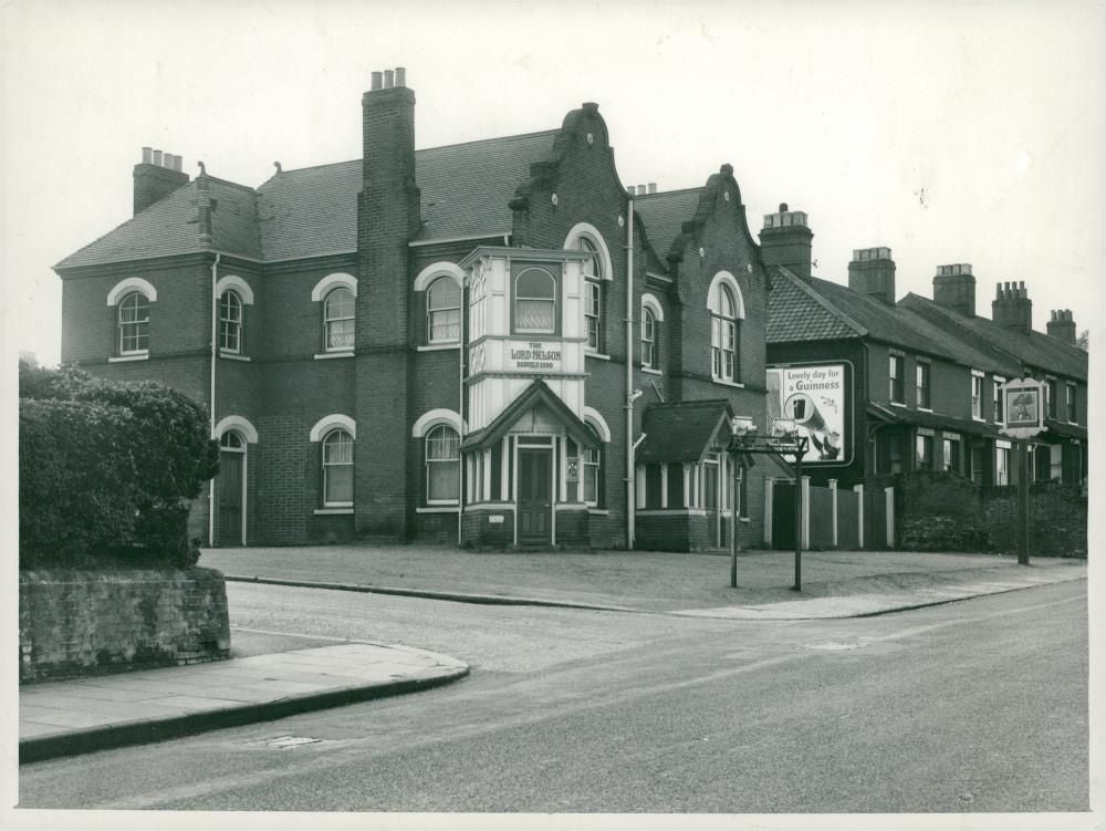
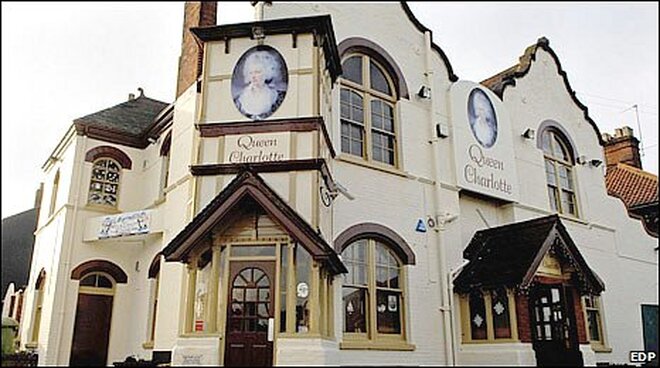
286 Dereham Road - The Norwich and Norfolk Muslim Association
The pub dates back to 1839 and was originally called The Lord Nelson and was based at a site nearby before it was moved to its present site in the early 1900s before being rebuilt after bomb damage in April 1942. In 1989 its name was changed to the Artful Dodger, in 2001 it became Dodger's Karaoke Cafe and Bar and in 2006 it became the Queen Charlotte which was a live music pub and closed in 2008. It became The Norwich and Norfolk Muslim Association in 2011.
The pub dates back to 1839 and was originally called The Lord Nelson and was based at a site nearby before it was moved to its present site in the early 1900s before being rebuilt after bomb damage in April 1942. In 1989 its name was changed to the Artful Dodger, in 2001 it became Dodger's Karaoke Cafe and Bar and in 2006 it became the Queen Charlotte which was a live music pub and closed in 2008. It became The Norwich and Norfolk Muslim Association in 2011.
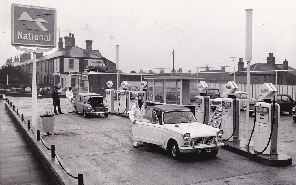
420 Dereham Road - Now Whistlefish Court
Used to be Keyway Motors a car sales showroom and a petrol station in 1964. In 1981 it was Duff Morgan and Esso petrol station. It is now Whistlefish Court. Anyone know what the whistlefish connection is? There was also a Keyway Motors in Hockering back in 1961.
Used to be Keyway Motors a car sales showroom and a petrol station in 1964. In 1981 it was Duff Morgan and Esso petrol station. It is now Whistlefish Court. Anyone know what the whistlefish connection is? There was also a Keyway Motors in Hockering back in 1961.
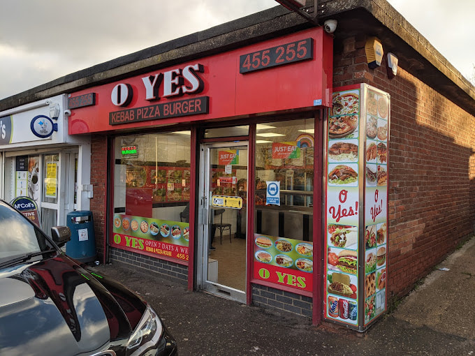
560b Dereham Road - Oh Yes Kebab
Used to be Scrutton C. J & Sons Newsagents and toy shop in 1969.
Used to be Scrutton C. J & Sons Newsagents and toy shop in 1969.
562A Dereham Road - Boots
Used to be Rees T Coghlan Chemist in 1993.
Used to be Rees T Coghlan Chemist in 1993.
564 Dereham Road - Betfred
Used to be Hales Fruit
Used to be Hales Fruit
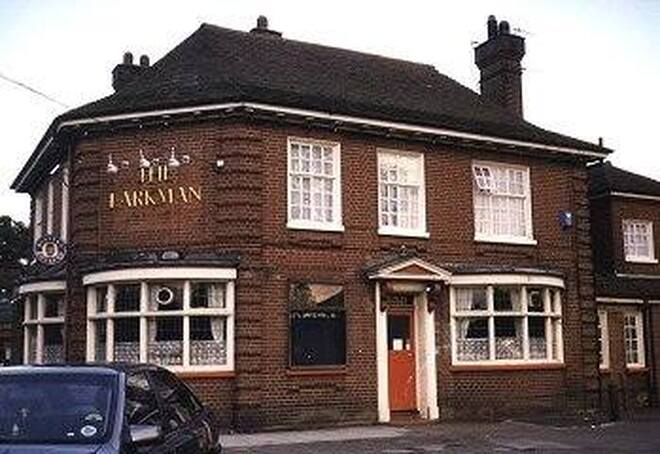
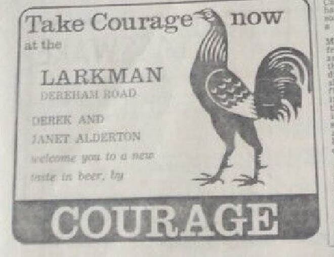
566 Dereham Road
Used to be Larkman Pub.
Used to be Larkman Pub.
First licensed 1932.
Purchased by supermarket chain Aldi who announced plans to demolish April 2000. Closed during the autumn of 2000.
Gutted by fire 23.02.2001
Demolished November 2001
Credit - https://norfolkpubs.co.uk/norwich/lnorwich/nclar.htm
Purchased by supermarket chain Aldi who announced plans to demolish April 2000. Closed during the autumn of 2000.
Gutted by fire 23.02.2001
Demolished November 2001
Credit - https://norfolkpubs.co.uk/norwich/lnorwich/nclar.htm
1972
